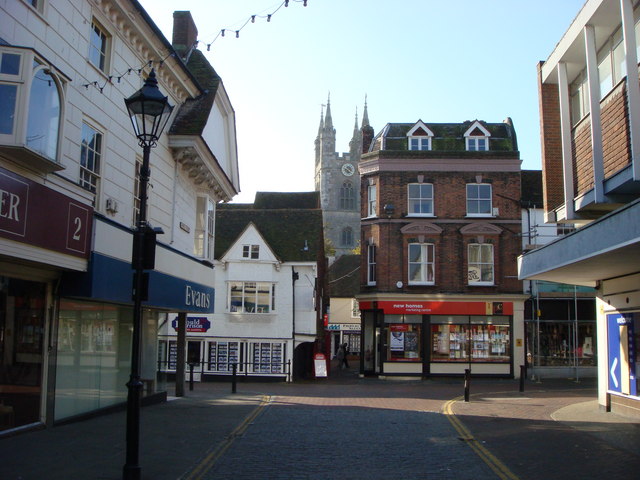
Borough of Ashford

This page is the City map of Ashford, a non-metropolitan district in Kent, England, showing streets, paths and places across the region. Ashford covers approximately 580.6 square kilometres and had about 129,281 residents in 2018. The population increased from 120,100 in 2012 to 135,610 in 2022. The district is divided into 44 subregions, including towns, villages, hamlets and civil parishes.

City map Ashford
Iain Crump, CC BY-SA 2.0 – Wikimedia Commons

Egerton

Egerton is a village and civil parish in Kent within Ashford district. It has 1,054 residents and covers approximately 12.38 square kilometres. The settlement lies in the rural Kent landscape between Charing and Pluckley. Its administrative level is 10.

Charing

Charing is a village and civil parish in Kent within the Ashford area. It has 3,184 residents and an area of approximately 24.9 square kilometres. The village lies near the North Downs and the A20 corridor between Ashford and Maidstone. Charing’s administrative level is 10.

Smarden

Smarden is a village in Kent and forms one of Ashford’s administrative subregions. It has 1,455 residents and covers approximately 21.8 square kilometres. The settlement is located in the Weald of Kent, north-west of Tenterden. Smarden has administrative level 10.

Biddenden

Biddenden is a village and civil parish in Kent. Its population is 2,661, and its area is approximately 29.12 square kilometres. The parish lies in the Weald of Kent between Ashford and Cranbrook. Biddenden is recorded at administrative level 10.

Challock

Challock is a village in Kent within the Ashford district. It has 1,089 residents and covers approximately 14.07 square kilometres. The village is situated near the North Downs and the Pilgrims’ Way. Challock has administrative level 10.

Molash

Molash is a village in Kent and an administrative subregion of Ashford. It has 243 residents and an area of approximately 6.38 square kilometres. The village lies near the North Downs, west of Chilham and north-west of Ashford town. Molash is recorded at administrative level 10.

Chilham

Chilham is a village in Kent within the Ashford district. Its population is 1,774, and its area is approximately 13.85 square kilometres. Chilham lies in the Stour valley near the River Great Stour, between Canterbury and Ashford. The subregion has administrative level 10.

High Halden

High Halden is a village and civil parish in Kent. It has 2,092 residents and covers approximately 15.18 square kilometres. The parish lies south-west of Ashford and north of Tenterden in the Weald of Kent. High Halden is an administrative level 10 subregion.

Tenterden

Tenterden is a town and civil parish in Ashford district, Kent. It has 8,198 residents and an area of approximately 36.19 square kilometres. The town lies in the Weald of Kent and is associated with the Kent and East Sussex Railway. Tenterden is recorded at administrative level 10.

Rolvenden

Rolvenden is a village and civil parish in Ashford district, Kent. Its population is 1,591, and its area is approximately 23.28 square kilometres. The parish lies in the Weald of Kent near Tenterden and the Kent and East Sussex Railway. Rolvenden has administrative level 10.

Newenden

Newenden is a village and civil parish in Kent within Ashford district. It has 224 residents and covers approximately 4.23 square kilometres. The village lies near the River Rother and the boundary between Kent and East Sussex. Newenden is recorded at administrative level 10.

Bethersden

Bethersden is a village and civil parish in Ashford, Kent. It has 1,669 residents and an area of approximately 26.1 square kilometres. The village lies north-west of Ashford between Great Chart and Smarden. Bethersden has administrative level 10.

Pluckley

Pluckley is a village in Kent and an administrative subregion of Ashford. Its population is 1,080, and its area is approximately 12.63 square kilometres. The village is located between Ashford and Charing in the Kent countryside. Pluckley has administrative level 10.

Little Chart

Little Chart is a civil parish and small village in Ashford, Kent. It has 263 residents and covers approximately 6.0107 square kilometres. The parish lies south-west of Ashford near the River Stour and Great Chart. Little Chart is recorded at administrative level 10.

Godmersham

Godmersham is a village in Kent within Ashford district. Its population is 362, and its area is approximately 15.7 square kilometres. The village lies in the Great Stour valley near Chilham and Wye. Godmersham has administrative level 10.

Crundale

Crundale is a village and civil parish in Kent. It has 201 residents and covers approximately 6.39 square kilometres. The parish lies in the North Downs north-west of Wye and east of Canterbury. Crundale is recorded at administrative level 10.

Wye with Hinxhill

Wye with Hinxhill is a civil parish in Kent within Ashford district. It has 2,454 residents and is recorded at administrative level 10. The parish includes Wye, which lies near the River Stour and the North Downs. Hinxhill is situated to the south-east of Wye.

Hothfield

Hothfield is a village in Kent within the Ashford district. It has 815 residents and covers approximately 9.59 square kilometres. The village lies north-west of Ashford near the Great Stour valley. Hothfield has administrative level 10.

Westwell

Westwell is a village and civil parish in Kent. Its population is 1,073, and its area is approximately 12.57 square kilometres. The parish lies on the southern edge of the North Downs, north-west of Ashford. Westwell is recorded at administrative level 10.

Eastwell

Eastwell is a hamlet and civil parish in Kent within Ashford district. It has 91 residents and covers approximately 3.62 square kilometres. The parish lies near the North Downs between Ashford and Charing. Eastwell has administrative level 10.

Boughton Aluph

Boughton Aluph is a village in Kent and an Ashford subregion. Its population is 2,578, and its area is approximately 9.93 square kilometres. The village lies near the River Great Stour, west of Wye and north of Ashford. Boughton Aluph has administrative level 10.

Brook

Brook is a village and civil parish in the Ashford borough of Kent. It has 329 residents and covers approximately 4.01 square kilometres. The village is located on the North Downs west of Wye. Brook is recorded at administrative level 10.

Hastingleigh

Hastingleigh is a village and civil parish in Kent. Its population is 241, and its area is approximately 6.33 square kilometres. The parish lies on the North Downs north-west of Ashford and near the villages of Brook and Brabourne. Hastingleigh has administrative level 10.

Brabourne

Brabourne is a village and civil parish in Kent within Ashford district. It has 1,306 residents and covers approximately 14.77 square kilometres. The parish lies between the North Downs and the village of Smeeth, east of Ashford. Brabourne is recorded at administrative level 10.

Shadoxhurst

Shadoxhurst is a village and civil parish in Kent. Its population is 1,353, and its area is approximately 8.03 square kilometres. The parish lies west of Ashford near the edge of the Weald of Kent. Shadoxhurst has administrative level 10.

Woodchurch

Woodchurch is a village and civil parish in Kent. It has 2,061 residents and covers approximately 27.95 square kilometres. The village lies in the Weald of Kent south of Ashford and north of the Romney Marsh. Woodchurch is recorded at administrative level 10.

Wittersham

Wittersham is a village in Kent within the Ashford district. Its population is 1,174, and its area is approximately 14.66 square kilometres. The village lies near the River Rother and the Kent border with East Sussex. Wittersham has administrative level 10.

Appledore

Appledore is a village and civil parish in Ashford district, Kent. It has 832 residents and covers approximately 12.46 square kilometres. The village lies near the edge of Romney Marsh and the Royal Military Canal. Appledore is recorded at administrative level 10.

Orlestone

Orlestone is a village and civil parish in Kent. Its population is 1,649, and its area is approximately 7.91 square kilometres. The parish lies south of Ashford near the Romney Marsh and the Royal Military Canal. Orlestone has administrative level 10.

Warehorne

Warehorne is a village in Kent within Ashford district. It has 337 residents and covers approximately 10.66 square kilometres. The village lies beside the Royal Military Canal near Romney Marsh. Warehorne is recorded at administrative level 10.

Kenardington

Kenardington is a village and civil parish in Kent. Its population is 283, and its area is approximately 7.47 square kilometres. The parish lies between Appledore and the Royal Military Canal, close to Romney Marsh. Kenardington has administrative level 10.

Stone-cum-Ebony

Stone-cum-Ebony is a civil parish in Kent within Ashford district. It has 438 residents and covers approximately 19.18 square kilometres. The parish lies near the River Rother and the Kent border with East Sussex. Stone-cum-Ebony is recorded at administrative level 10.

Great Chart with Singleton

Great Chart with Singleton is a civil parish in Kent. Its population is 7,410, and it forms a substantial subregion west of Ashford town. Great Chart lies near the River Stour, while Singleton is a developed area adjoining Ashford. The parish has administrative level 10.

Stanhope

Stanhope is a civil parish in Ashford, Kent. It has 4,390 residents and an area of approximately 0.58 square kilometres. The parish lies within the urban area of Ashford, south of the town centre. Stanhope is recorded at administrative level 10.

Kingsnorth

Kingsnorth is a village and civil parish in Ashford, Kent. Its population is 12,024, and its area is approximately 12.46 square kilometres. The parish lies south-east of Ashford and includes settlements near the River Stour. Kingsnorth has administrative level 10.

Mersham

Mersham is a village in Kent within Ashford district. It has 1,479 residents and covers approximately 13.85 square kilometres. The village lies south-east of Ashford near the North Downs and the Kent countryside. Mersham is recorded at administrative level 10.

Smeeth

Smeeth is a village in Kent and an administrative subregion of Ashford. Its population is 931, and its area is approximately 8.29 square kilometres. The village lies east of Brabourne and north-east of Ashford. Smeeth has administrative level 10.

Sevington with Finberry

Sevington with Finberry is a village subregion in Ashford, Kent. It has 1,522 residents and is recorded at administrative level 10. Sevington lies east of Ashford, while Finberry is a nearby residential settlement south-east of the town. The subregion forms part of the urban and rural transition around Ashford.

Aldington

Aldington is a village and civil parish in Ashford district, Kent. Its population is 1,456, and its area is approximately 13.4745 square kilometres. The parish lies south-east of Ashford near the Royal Military Canal and Romney Marsh. Aldington has administrative level 10.

Ruckinge

Ruckinge is a village and civil parish in Kent. It has 767 residents and covers approximately 13.91 square kilometres. The parish lies south-east of Ashford near the Royal Military Canal and the northern edge of Romney Marsh. Ruckinge is recorded at administrative level 10.

Bilsington

Bilsington is a village and civil parish in Kent within Ashford district. Its population is 302, and its area is approximately 11.12 square kilometres. The parish lies near Romney Marsh and the Royal Military Canal, south-east of Ashford. Bilsington has administrative level 10.

Bonnington

Bonnington is a village and civil parish in Kent. It has 116 residents and is recorded at administrative level 10. The parish lies south-east of Ashford near the Royal Military Canal and the Romney Marsh landscape. Bonnington is one of the smaller subregions by population in the district.

Kennington

Kennington is a suburb and civil parish in Ashford, Kent. Its population is 11,040, making it one of the largest subregions in Ashford. The parish lies immediately north of Ashford town near the River Great Stour. Kennington is recorded at administrative level 10.

South Willesborough and Newtown

South Willesborough and Newtown is a civil parish in Ashford, Kent. It has 4,713 residents and is recorded at administrative level 10. The parish lies within the urban area south and east of Ashford town. Its location connects residential districts with the wider road and settlement network of Ashford.

Data sources: OpenStreetMap (ODbL), Wikidata (CC0) · Image: Wikimedia Commons

Ashford – Facts

Inhabitants 129281
Area 580.6 km²
Subregions 44
Located in Kent
Country United Kingdom
Official name Ashford
Website https://www.ashford.gov.uk/

Data source: Wikidata (CC0)

Roads in Borough of Ashford