Blaby

This City map of Blaby shows the roads, paths and places of the non-metropolitan district in Leicestershire, England. Blaby covers approximately 130.5 square kilometres and had about 104,182 residents in 2022. The population increased from 94,600 in 2012 to 104,182 in 2022. Established as a district in 1894, Blaby is divided into 24 subregions, including villages, hamlets and civil parishes near Leicester.

City map Blaby
Kev747 at en.wikipedia, Public domain – Wikimedia Commons
City map Blaby
Chemical Engineer, CC0 – Wikimedia Commons

Blaby

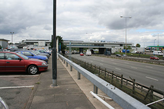
Blaby is a village and civil parish in Leicestershire and gives its name to the district. The subregion had a population of 6,831 and is located south of Leicester.

As an administrative level 10 area, Blaby forms one of the 24 subregions shown on the district map. Its streets and local roads connect the village with neighbouring settlements in central Leicestershire.

City map Glen Parva
Tammy Winand, CC BY-SA 2.0 – Wikimedia Commons

Glen Parva

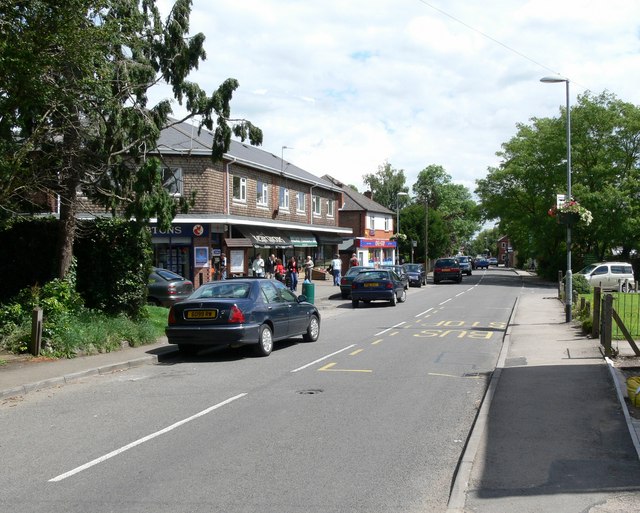
Glen Parva is a village in Leicestershire, England, within the Blaby district. It had a recorded population of 5,706.

The village lies close to Leicester and is represented as an administrative level 10 subregion. The City map records Glen Parva together with its residential streets and connections to nearby communities.

City map Enderby
Chemical Engineer, CC BY-SA 3.0 – Wikimedia Commons

Enderby

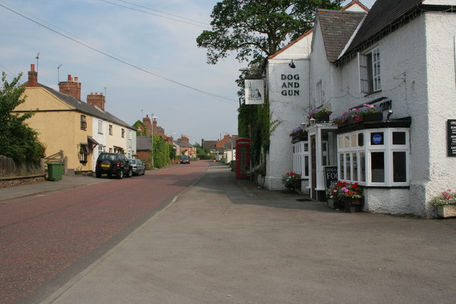
Enderby is a village and parish in Blaby, Leicestershire, with a population of 6,418. It is situated west of Leicester in the central part of the county.

Enderby is mapped as an administrative level 10 subregion. The local road network links the parish with Leicester and neighbouring villages in Blaby.

Braunstone

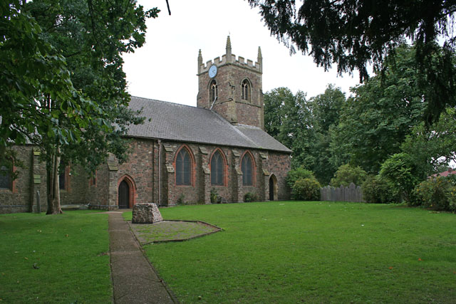
Braunstone is a civil parish in Blaby, Leicestershire, and had a population of 17,506. It lies immediately west of Leicester and is the most populous subregion listed for the district.

The parish forms an administrative level 10 area with extensive residential development close to the city boundary. Its roads provide direct connections between Braunstone, Leicester and other settlements in Blaby.

City map Leicester Forest East
Kate Jewell, CC BY-SA 2.0 – Wikimedia Commons

Leicester Forest East

Leicester Forest East is a village and civil parish in Leicestershire with 7,427 residents. The settlement is located west of Leicester within the Blaby district.

Its position beside the Leicester urban area makes Leicester Forest East a clearly defined subregion on the City map. The parish is recorded at administrative level 10 and contains local streets linking it with neighbouring parts of Leicestershire.

Glenfields

Glenfields is a civil parish in Blaby, Leicestershire, with a population of 10,818. It is located west of Leicester and forms one of the larger communities in the district.

The subregion is classified as administrative level 10. Its mapped roads and paths connect Glenfields with Leicester Forest East, Kirby Muxloe and other settlements in western Blaby.

City map Kirby Muxloe
Mat Fascione, CC BY-SA 2.0 – Wikimedia Commons

Kirby Muxloe

Kirby Muxloe is a village in Leicestershire with a recorded population of 4,793. It lies west of Leicester and north of several central Blaby settlements.

The village is an administrative level 10 subregion in the district. Kirby Muxloe’s local roads connect it with Glenfields, Leicester Forest East and the wider Leicester area.

City map Leicester Forest West
Mat Fascione, CC BY-SA 2.0 – Wikimedia Commons

Leicester Forest West

Leicester Forest West is a village and civil parish in Leicestershire. Its recorded population is 35, making it the smallest population among the 24 listed Blaby subregions.

The parish is mapped at administrative level 10 west of Leicester. Its roads and paths serve a small settlement within the rural and suburban surroundings of western Blaby.

City map Lubbesthorpe
Kate Jewell, CC BY-SA 2.0 – Wikimedia Commons

Lubbesthorpe

Lubbesthorpe is a hamlet and civil parish in Blaby, Leicestershire, with a population of 1,326. It is located west of Leicester within the district.

As an administrative level 10 subregion, Lubbesthorpe appears on the map alongside nearby parishes and villages. The local road network connects the hamlet with Leicester Forest East, Enderby and other parts of Blaby.

City map Thurlaston
Jonathan Billinger, CC BY-SA 2.0 – Wikimedia Commons

Thurlaston

Thurlaston is a village and civil parish in Leicestershire with a population of 727. It lies in the western part of Blaby, near larger settlements around Leicester.

The parish is recorded as an administrative level 10 area. Its local streets and paths connect Thurlaston with neighbouring villages in the district.

City map Huncote
Kate Jewell, CC BY-SA 2.0 – Wikimedia Commons

Huncote

Huncote is a village and civil parish in Leicestershire with a recorded population of 2,169. The subregion has a mapped area of 388,000 square metres.

Huncote is an administrative level 10 area in Blaby, south-west of Leicester. Its roads connect the village with neighbouring communities such as Narborough, Enderby and Whetstone.

City map Narborough
Kev747 at en.wikipedia, Public domain – Wikimedia Commons

Narborough

Narborough is a village and civil parish in Leicestershire with 8,680 residents. It is located west of Leicester and is one of the larger settlements in Blaby.

The parish is classified as administrative level 10. Narborough’s streets and paths connect it with Huncote, Enderby, Whetstone and other parts of the district.

City map Whetstone
Kate Jewell, CC BY-SA 2.0 – Wikimedia Commons

Whetstone

Whetstone is a village and civil parish in Blaby, Leicestershire, with a population of 7,248. It lies south-west of Leicester and near the central settlements of Blaby.

Whetstone is recorded as an administrative level 10 subregion. The village road network links it with Narborough, Countesthorpe, Cosby and neighbouring parts of Leicestershire.

City map Kilby
Kate Jewell, CC BY-SA 2.0 – Wikimedia Commons

Kilby

Kilby is a village and civil parish in Leicestershire with a population of 294. It is a small settlement in the south-western part of the Blaby district.

The subregion is mapped at administrative level 10. Kilby’s local roads connect the village with Countesthorpe, Whetstone and other rural communities in Leicestershire.

City map Countesthorpe
Kate Jewell, CC BY-SA 2.0 – Wikimedia Commons

Countesthorpe

Countesthorpe is a village and civil parish in Leicestershire with a population of 7,672. It is situated south of Leicester within the Blaby district.

The parish is an administrative level 10 subregion with road connections to Kilby, Whetstone, Cosby and other nearby villages. Countesthorpe is one of the larger settlements in the southern part of Blaby.

City map Cosby
Mat Fascione, CC BY-SA 2.0 – Wikimedia Commons

Cosby

Cosby is a village and civil parish in Leicestershire with a population of 3,517. It lies south-west of Leicester and near Countesthorpe and Croft.

Cosby is recorded as an administrative level 10 area in Blaby. Its local roads connect the village with Whetstone, Countesthorpe and settlements farther west in the district.

Croft

Croft is a civil parish in Blaby, Leicestershire, with a population of 1,714. The settlement is located in the south-western part of the district.

The parish is classified as administrative level 10. Croft is connected by local roads with Cosby, Huncote, Sapcote and other villages in central Leicestershire.

City map Potters Marston
Mat Fascione, CC BY-SA 2.0 – Wikimedia Commons

Potters Marston

Potters Marston is a village in Leicestershire with a recorded population of 31. It is the smallest settlement by population among the rural villages listed in the Blaby subregions.

The village is mapped as an administrative level 10 area in the western part of the district. Its local roads connect Potters Marston with Croft, Elmesthorpe and nearby Leicestershire communities.

City map Stoney Stanton
Poliphilo, CC0 – Wikimedia Commons

Stoney Stanton

Stoney Stanton is a village in Leicestershire with a population of 4,492. It lies in the western part of Blaby, close to Sapcote and Elmesthorpe.

The settlement is an administrative level 10 subregion. Its roads and paths connect Stoney Stanton with nearby villages and with the wider network of western Leicestershire.

City map Elmesthorpe
John Salmon, CC BY-SA 2.0 – Wikimedia Commons

Elmesthorpe

Elmesthorpe is a village in Leicestershire with a recorded population of 762. It is situated in the western part of the Blaby district.

Elmesthorpe is classified as an administrative level 10 area. Local roads link the village with Stoney Stanton, Sapcote, Potters Marston and other settlements in Leicestershire.

City map Sapcote
Poliphilo, CC0 – Wikimedia Commons

Sapcote

Sapcote is a village and civil parish in Leicestershire with a population of 3,381. It lies west of Leicester and near Stoney Stanton and Elmesthorpe.

The parish is recorded as an administrative level 10 subregion. Sapcote’s local streets and paths connect it with Croft, Sharnford and other villages in western Blaby.

City map Aston Flamville
Oosoom, CC BY-SA 3.0 – Wikimedia Commons

Aston Flamville

Aston Flamville is a rural village in Leicestershire with a population of 272. It is located in the western part of the Blaby district.

The village is mapped as an administrative level 10 subregion. Local roads connect Aston Flamville with Sapcote, Sharnford and nearby rural settlements in Leicestershire.

City map Sharnford
Mat Fascione, CC BY-SA 2.0 – Wikimedia Commons

Sharnford

Sharnford is a village in Leicestershire with a recorded population of 1,066. It lies in western Blaby, close to Sapcote and Aston Flamville.

Sharnford is classified as an administrative level 10 area. Its roads and paths connect the village with surrounding communities in the western part of the district.

City map Wigston Parva
Mat Fascione, CC BY-SA 2.0 – Wikimedia Commons

Wigston Parva

Wigston Parva is a village in Leicestershire with a population of 38. It is one of the smallest settlements included among Blaby’s 24 administrative level 10 subregions.

The village is located in the southern part of the district and is shown with its local roads and paths. Wigston Parva connects to the surrounding rural settlements of Blaby and wider Leicestershire.

Data sources: OpenStreetMap (ODbL), Wikidata (CC0) · Image: Wikimedia Commons

Blaby – Facts

Inhabitants 104182
Area 130.5 km²
Subregions 24
Inception 1894
Located in Leicestershire
Country United Kingdom
Website https://www.blaby.gov.uk/

Data source: Wikidata (CC0)