
Sussex Place in Brighton and Hove
Sussex Place in Brighton and Hove is a service road and it runs in a north-south direction starting from Richmond Place and ends in a cul-de-sac. Sussex Place also exists in Slough, Portsmouth, Luton and Stoke-on-Trent.
- Road Type
- service road
- Route
- north-south
Image
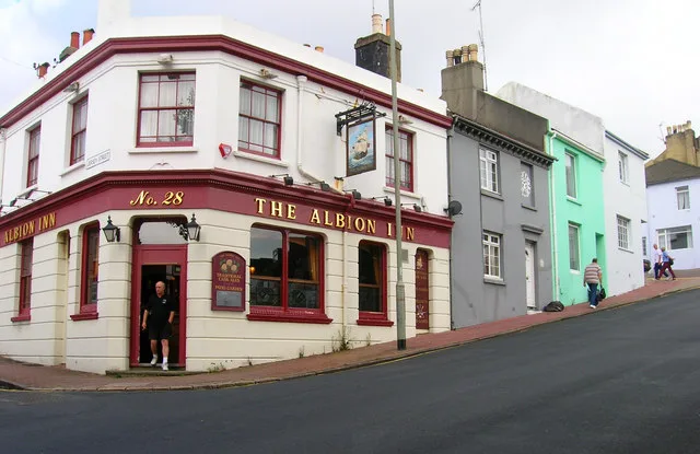
Roads nearby
Ivory PlaceIvory Place (Zone C)
50 m
Richmond ParadeNisa
100 m
St. George's PlaceSt Peter's Church (Stop L), Regency House Dental Surgery, L'Atelier du Vin
150 m
Morley StreetMorley Street (Zone C), Oui Crêperie
150 m
Ashton Rise150 m
Nelson Row150 m
Gloucester PlaceValley Gardens, Gloucester Place, Jacob's Bakery+ Cafe, Richmond Place
150 m
Blenheim Place150 m
Gloucester Passage200 m
Gloucester RoadThe Basketmakers Arms, Mr Bongo Records, Films and Publishing, Ju*Ju, Cubitts, Gloucester Newsagents, Trawlerman Fish & Chips, Black Mocha, Aesop, LOAM, La Choza, The Blue Man, Brighton Birdcage, Diplocks, The Brighton Tavern, Gloucester Road Barber, Michael Bloomstein, Cuttlefish Eco Salon, Tidy Street General Store, ease, Gallery40, Vine Street Vintage, Julian Stephens Goldsmith, Jeremy Hoye Jewellery, Galeed Strict Baptists Chapel, The Pond, Baby Bao At The Pond, The Botanist Coffee Co., Beyond Retro, Brighton Dental Care, Across the Tracks, Brighton Sausage Co., Dormitory, Cool Hand Luke
200 m
Gloucester StreetTiger Bites Pig, The Flour Pot Bakery, Clippers Barbers, The Bomb, iO Gallery, DANDY, North Laine Brewhouse, Gloucester Street
200 m
Circus StreetCircus Street (Zone C)
200 m
Market SquareA spring in your step, White Cloud Coffee Co.
200 m
Cheltenham PlaceThe Archives
250 m
North RoadThe Heart & Hand, Starbucks, North Laine, DIGS, Infinity Foods, Painting Pottery Cafe, Brighton Sewing Centre, Leo Frames, John Edward Hairdressing, Little Beach Boutique, Olea, Cappadocia Guest House, Petit Pays Vintage, Garden Café Brighton, Yummy Kũrtõs, Socktopus, Brighthelm Church and Community Centre, Rolyn's News, Love fit cafe, Brighton Delivery Office, Afrori, All Bikes Electric, Burger Brothers, Food Fountain, Popstacular, Magic Tattoo, Prontaprint
250 m
Marlborough PlaceMarlborough Place, Tutto, King & Queen, The Wine Cellar, King and Queen (Stop R2)
250 m
Kingswood StreetSallis Benney Theatre, Grand Parade, Kingswood Street (Zone C), Circus Totem
300 m
North Place300 m
Barrack Yard300 m
Grand Parade Mews350 m
William StreetWilliam Street (Zone C)
400 m
Apartment buildings nearby
Nelson Place150 m
The Courtyard Building B200 m
The Courtyard, Building C200 m
The Dance Space200 m
Pavilion Court400 m
Buildings nearby
Ashton Lodge100 m
ROX Brighton150 m
Gloucester Yard250 m
Cafés nearby
The Market Diner200 m
Commercial buildings nearby
Yachtwerks100 m
InCrowd Sports200 m
The Office at Circus Street250 m
Constructions nearby
Valley Gardens Phase 3400 m
Gardens nearby
Circus Square250 m
Hairdresser's nearby
Barber King50 m
Hostel nearby
Kipp's Hostel400 m
Off-licences nearby
Budgens50 m
Paint shops nearby
Dulux Decorator Centre50 m
Parks nearby
Grand Parade Gardens200 m
Victoria GardensChurch notice board
250 m
Places of worship nearby
One Church Gloucester Place150 m
Pubs nearby
The Eagle200 m
The Fountain Head300 m
Residential buildings nearby
Kaplan Living Brighton200 m
Restaurants nearby
Bill's300 m
Second-hand shops nearby
Junk300 m
Terraced houses nearby
Milner Flats250 m
University buildings nearby
Grand ParadeThe Blackhouse Club, The Fat Pizza, Costa Express
300 m
Public transport map Brighton and Hove Legend
| Railway | |
| Bus | |
| Tram |
Cycling map Brighton and Hove Legend
| Cycle path | |
| Cycle lane on road | |
| Cycling on bus lane | |
| Bicycle street | |
| Cyclists allowed | |
| Cyclists allowed, good surface | |
| No cycling | |
| Cobblestones |
| Long-distance cycle route | (depending on scale) | |
| Long-distance cycle route |
Walking map Brighton and Hove Legend
| Path |
| Long-distance hiking trail | (depending on scale) | |
| Long-distance hiking trail | ||
| No pedestrians |