
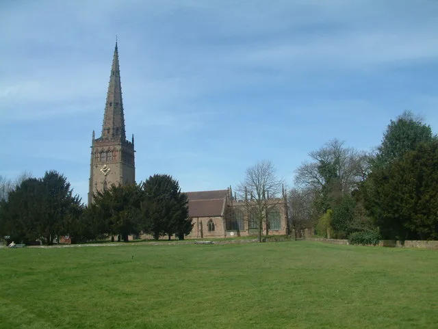
All Saints in Coleshill, Buckinghamshire
All Saints in Buckinghamshire, Coleshill is a Anglicana church. It is near Village Road and is also known as All Saints Church, Coleshill, Buckinghamshire. The church belongs to the Diocese of Oxford and is dedicated to All Saints' Day. It is a listed building.
- Amenity
- place of worship
- Building Type
- church
- Website
- https://coleshill.org/village-life/all-saints-church.html
Image
Tourist information offices
Roads nearby
Manor Way100 m
Meadowcot LaneColeshill
100 m
Barracks HillColeshill Parish Council
250 m
Village Road300 m
Windmill Hill350 m
Chalk Hill450 m
Hill Meadow650 m
Sampsons Hill700 m
New Road850 m
Magpie Lane900 m
Chase Close950 m
Whielden Gate1000 m
Tower Road1000 m
Coleshill Lane1,1 km
Whielden Lane1,2 km
Fagnall Lane1,2 km
Amersham Road1,4 km
Bottrells Lane1,4 km
Long Meadow Close1,4 km
Pond CloseWinchmore Hill
1,4 km
The Hill1,4 km
Gore Hill1,5 km
The CommonPenn Parish Council, Winchmore Hill
1,5 km
Whielden StreetZaza, Jewellery Workshop, Bridgman, Martin Moore, The Saracens Head, Spice Society, Old Amersham
1,6 km
Cherry Lane1,6 km
Whielden Heights1,8 km
Buildings nearby
The Plough1,4 km
HS2 Works Portacabin1,7 km
Community centres nearby
Coleshill Village Hall50 m
Winchmore Hill Memorial Hall1,5 km
Constructions nearby
HS2 Amersham Vent Shaft1,6 km
HS2 Amersham Vent Shaft - Office Compound1,7 km
Farmyards nearby
Cherry Tree Farm800 m
Rushymead farm900 m
Luckings Farm950 m
Pavilions nearby
Coleshill Cricket Club1000 m
Places of worship nearby
Winchmore Hill Methodist Church1,4 km
Pubs nearby
Red Lion150 m
Harte and Magpies1,3 km
The Potters Arms1,4 km
Recreation grounds nearby
Coleshill Tennis Club1,1 km
Sports pitches nearby
Jack Adams Field1,1 km
Woodlands nearby
Herts Wood250 m
Coleshill Larches600 m
West Wood600 m
Turner's Wood1,1 km
Brentford Wood1,5 km
David's Wood1,7 km
Other nearby
HS2 Amersham Ventilation Shaft1,7 km
| Dedicated to | All Saints' Day |
|---|---|
| Diocese | Diocese of Oxford |
| Heritage designation | Grade II* listed building |
| Located in | Coleshill |
| Country | United Kingdom |
Public transport map Coleshill Legend
| Railway | |
| Bus | |
| Tram |
Cycling map Coleshill Legend
| Cycle path | |
| Cycle lane on road | |
| Cycling on bus lane | |
| Bicycle street | |
| Cyclists allowed | |
| Cyclists allowed, good surface | |
| No cycling | |
| Cobblestones |
| Long-distance cycle route | (depending on scale) | |
| Long-distance cycle route |
Walking map Coleshill Legend
| Path |
| Long-distance hiking trail | (depending on scale) | |
| Long-distance hiking trail | ||
| No pedestrians |