
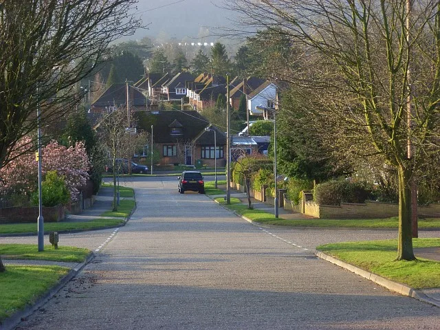
Sandygate Close in Marlow, Buckinghamshire
Sandygate Close in Buckinghamshire, Marlow is a asphalted residential street.
- Road Type
- residential street
Image
Convenience stores
Post offices
Tyre shops
Guest house
Fast food restaurants
Café
Car repair shops
Tourist information
Jeweller's
Funeral directors
Restaurants
Kindergarten
Bicycle parkings
Furniture shops
Dentist
Veterinary clinic
Roads nearby
Sandygate Road100 m
Seymour Park Road200 m
Seymour Court Road250 m
Berwick Lane300 m
Primrose Lea300 m
Berwick Close300 m
Deanfield Close300 m
Manor Court350 m
Marefield Road350 m
Verney Close350 m
Pinecroft400 m
Queen's Road400 m
Creswell Row400 m
Prospect Road450 m
Oram Court450 m
Berwick Road450 m
Cambridge Road450 m
York Road500 m
Crown RoadPoppies Day Nursery, Mr Edward Riley F.I.C, Salvation Army Citadel in Crown Road, The Environment
500 m
Eton Place500 m
Chiltern Road550 m
Tilecotes Close550 m
Quoitings Gardens550 m
Amenities nearby
Sir Aubrey Ward House450 m
Allotment gardens nearby
Hanging Hill Allotments450 m
Apartment buildings nearby
Peel Lodge400 m
Buildings nearby
35 - 38100 m
34100 m
33150 m
29150 m
28150 m
22200 m
21200 m
20200 m
30200 m
13200 m
26200 m
11200 m
35200 m
31200 m
27250 m
18250 m
23250 m
19250 m
10250 m
Florella300 m
Parks nearby
Seymour Park350 m
Police stations nearby
Marlow Neighbourhood Police Team400 m
Pubs nearby
Duke of Cambridge500 m
 Public transport map Marlow Legend
 | Railway | |
| Bus | |
| Tram |
 Cycling map Marlow Legend
 | Cycle path | |
| Cycle lane on road | |
| Cycling on bus lane | |
| Bicycle street | |
| Cyclists allowed | |
| Cyclists allowed, good surface | |
| No cycling | |
| Cobblestones |
| Long-distance cycle route | (depending on scale) | |
| Long-distance cycle route |
 Walking map Marlow Legend
 | Path |
| Long-distance hiking trail | (depending on scale) | |
| Long-distance hiking trail | ||
| No pedestrians |