City of Peterborough

This page is the City map of the City of Peterborough, showing streets, paths and places across the unitary authority area in Cambridgeshire, England. The region covers approximately 343.4 square kilometres and uses the PE postal area and the 01733 dialling code. City of Peterborough was established in 1974 and is part of the combined Cambridgeshire and Peterborough area. Population figures recorded for the region include about 201,041 residents in 2018 and 217,705 residents in 2022, compared with 186,400 in 2012. The map area is divided into 29 subregions, including Peterborough suburbs, rural villages and civil parishes.

City map City of Peterborough
Hynek Moravec, CC BY 3.0 – Wikimedia Commons
City map Eye
Kev747 at en.wikipedia, Public domain – Wikimedia Commons

Eye

Eye is a village and civil parish in Cambridgeshire within the City of Peterborough. The subregion has admin_level 10 and a recorded population of 5,409.

Its position is in the eastern part of the Peterborough authority area, among the low-lying fen landscapes of Cambridgeshire. Eye is one of the larger rural settlements represented on the City of Peterborough map.

City map Newborough
Uksignpix, CC BY-SA 3.0 – Wikimedia Commons

Newborough

Newborough is a village and civil parish in the Peterborough district of Cambridgeshire. It is recorded at admin_level 10 with a population of 1,859.

The settlement lies in the northern part of the City of Peterborough area, within the agricultural landscape of the Cambridgeshire fens. Newborough is shown as a separate civil parish on the regional map.

City map Borough Fen
Jay Haywood, CC BY-SA 2.0 – Wikimedia Commons

Borough Fen

Borough Fen is a civil parish in Cambridgeshire, England, within the City of Peterborough. The admin_level 10 subregion has a recorded population of 124.

The parish occupies a rural fenland setting north of the built-up Peterborough area. Its small population distinguishes Borough Fen from larger neighbouring settlements such as Eye and Newborough.

City map Peakirk
John Salmon, CC BY-SA 2.0 – Wikimedia Commons

Peakirk

Peakirk is a village and civil parish in Cambridgeshire within the City of Peterborough. It has admin_level 10 and a recorded population of 490.

The village lies north of Peterborough in the flat fenland landscape. Peakirk forms one of the distinct northern settlements included in the City of Peterborough map.

City map Northborough
Jay Haywood, CC BY-SA 2.0 – Wikimedia Commons

Northborough

Northborough is a village and civil parish in Cambridgeshire, England. The admin_level 10 subregion has a recorded population of 1,339.

It is located in the northern part of the City of Peterborough authority area, near the fenland countryside. Northborough is larger than nearby Peakirk, which has a recorded population of 490.

City map Deeping Gate
craig putterill, CC BY-SA 2.0 – Wikimedia Commons

Deeping Gate

Deeping Gate is a village and civil parish in Cambridgeshire within the Peterborough district. It is classified at admin_level 10 and has a population of 534.

The settlement stands in the northern rural part of the authority area, close to the wider Deepings landscape. Deeping Gate is represented separately from Northborough and Peakirk on the regional map.

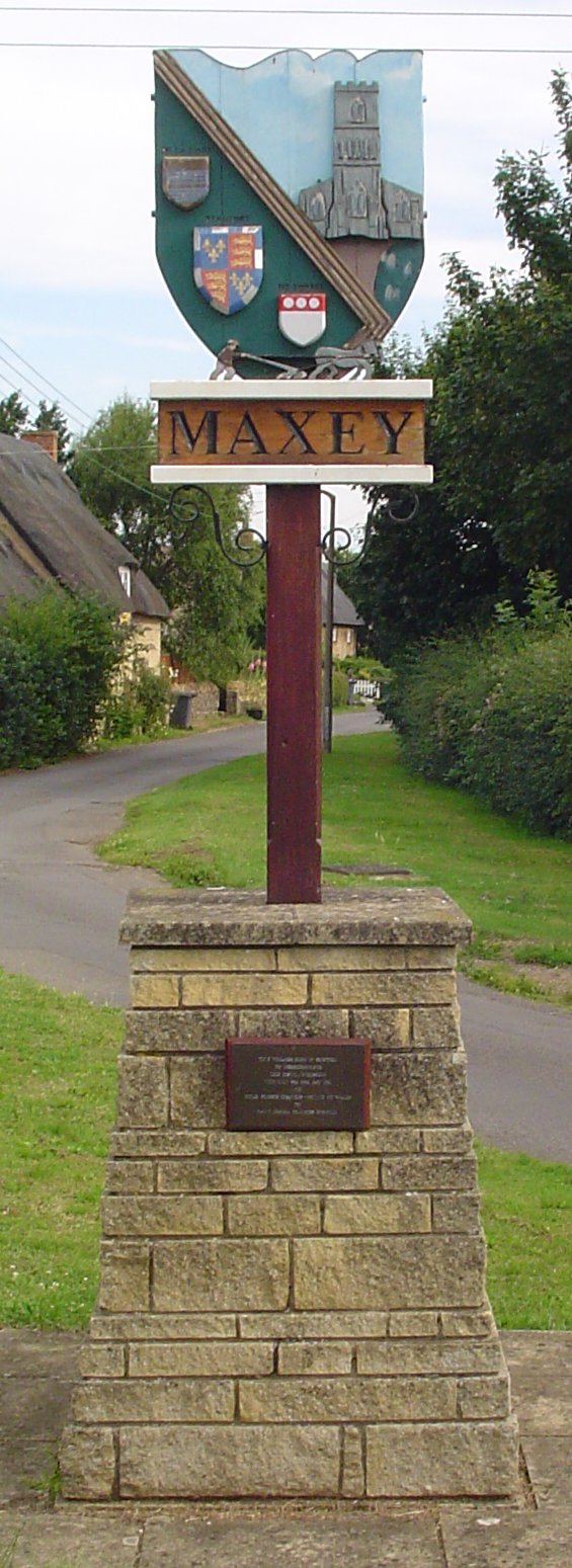
City map Maxey
Uksignpix, CC BY-SA 3.0 – Wikimedia Commons

Maxey

Maxey is a village and civil parish in Cambridgeshire, England. The subregion has admin_level 10 and a recorded population of 692.

Maxey lies north of Peterborough in an area where fenland lowlands meet the slightly higher ground of eastern England. Its separate parish boundary is included among the 29 subregions of the authority.

City map Bainton
Richard Croft, CC BY-SA 2.0 – Wikimedia Commons

Bainton

Bainton is a village and civil parish in Cambridgeshire within the City of Peterborough. The admin_level 10 area has a recorded population of 333.

The village is situated in the rural northern part of the authority, near Maxey and Helpston. Bainton remains a small settlement compared with the Peterborough suburbs of Bretton and Orton Waterville.

City map Helpston
Ian Simons, CC BY-SA 2.0 – Wikimedia Commons

Helpston

Helpston is a village in the City of Peterborough, England, with a recorded population of 1,249. It is mapped as an admin_level 10 subregion.

The village lies north-west of Peterborough near the edge of the limestone countryside of the Peterborough area. Helpston is associated with the rural landscape between the fenland settlements and the villages west of the city.

City map Ufford
Geoff Pick, CC BY-SA 2.0 – Wikimedia Commons

Ufford

Ufford is a village and civil parish in Peterborough, Cambridgeshire. The admin_level 10 subregion has a recorded population of 272.

It lies in the western rural part of the City of Peterborough area, close to the villages of Barnack and Bainton. Ufford is a small parish set within the transition from fenland to the higher limestone landscape.

City map Barnack
Uksignpix, CC BY-SA 3.0 – Wikimedia Commons

Barnack

Barnack is a village in Cambridgeshire, England, within the City of Peterborough. The subregion has admin_level 10 and a recorded population of 1,144.

Barnack lies west of the Peterborough urban area in the limestone landscape near the Lincolnshire and Northamptonshire borderlands. The village is close to Ufford and Wothorpe, which are separate subregions on the map.

City map St. Martin's Without
Richard Croft, CC BY-SA 2.0 – Wikimedia Commons

St. Martin's Without

St. Martin's Without is a civil parish in Cambridgeshire within the City of Peterborough. It is recorded at admin_level 10 and has a population of 53.

The parish is one of the smallest subregions in the authority by population. Its location belongs to the rural western area near the historic settlement of Stamford and the villages of Wothorpe and Barnack.

City map Wothorpe
Tim Heaton, CC BY-SA 2.0 – Wikimedia Commons

Wothorpe

Wothorpe is a village in Cambridgeshire, England, within the City of Peterborough. The admin_level 10 subregion has a recorded population of 314.

It lies on the western side of the authority area, close to Stamford and the village of Barnack. Wothorpe forms a separate rural unit from St. Martin's Without and Ufford.

City map Wittering
John Salmon, CC BY-SA 2.0 – Wikimedia Commons

Wittering

Wittering is a village and civil parish in Cambridgeshire within the City of Peterborough. It has admin_level 10 and a recorded population of 2,676.

The settlement lies in the western part of the authority area, close to RAF Wittering and the boundary with Northamptonshire. Wittering is one of the larger villages outside the Peterborough urban centre.

City map Thornhaugh
Chris Allen, CC BY-SA 2.0 – Wikimedia Commons

Thornhaugh

Thornhaugh is a village and civil parish in Cambridgeshire, England. The admin_level 10 subregion has a recorded population of 177.

It is situated west of Peterborough near Wansford and the River Nene corridor. Thornhaugh belongs to the wooded and gently undulating western landscape rather than the flat fenland north and east of the city.

City map Wansford
Uksignpix, CC BY-SA 3.0 – Wikimedia Commons

Wansford

Wansford is a village and civil parish in Cambridgeshire within the City of Peterborough. It is recorded at admin_level 10 with a population of 506.

The village is located on the River Nene west of Peterborough and near the historic market town of Stamford. Wansford is connected with the stone-built villages and limestone landscapes of the western side of the authority.

City map Southorpe
JThomas, CC BY-SA 2.0 – Wikimedia Commons

Southorpe

Southorpe is a village and civil parish in Peterborough, Cambridgeshire. The subregion has admin_level 10 and a recorded population of 145.

It lies in the western rural area near Barnack, Ufford and Wansford. Southorpe is a small parish within the limestone countryside south-west of the Peterborough urban centre.

City map Sutton
Chris Stafford, CC BY-SA 2.0 – Wikimedia Commons

Sutton

Sutton is a village and civil parish in the City of Peterborough, Cambridgeshire. It has admin_level 10 and a recorded population of 132.

The village is located in the rural western part of the authority near Southorpe and Upton. Sutton is one of the smaller civil parishes represented on the regional map.

City map Upton
Terry Butcher, CC BY-SA 2.0 – Wikimedia Commons

Upton

Upton is a village and civil parish in Peterborough, Cambridgeshire, England. The admin_level 10 subregion has a recorded population of 57.

It is among the smallest settlements in the City of Peterborough area and lies west of the main urban centre. Upton is located near Sutton and the rural villages around the River Nene corridor.

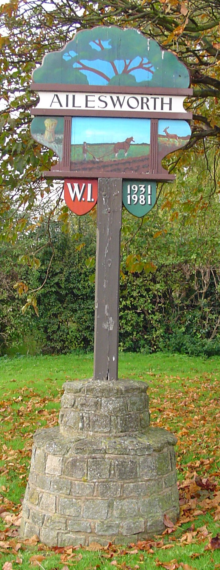
City map Ailsworth
Uksignpix, CC BY-SA 3.0 – Wikimedia Commons

Ailsworth

Ailsworth is a village in Cambridgeshire within the City of Peterborough. It has admin_level 10 and a recorded population of 604.

The village lies west of Peterborough near Castor and the River Nene. Ailsworth forms part of the rural settlement belt between the city’s western suburbs and the villages near Wansford.

City map Marholm
Uksignpix, CC BY-SA 3.0 – Wikimedia Commons

Marholm

Marholm is a village and civil parish in Cambridgeshire, England. The subregion is classified at admin_level 10 and has a recorded population of 146.

It is located north-west of Peterborough near the urban districts of Bretton and the rural villages of Ailsworth and Castor. Marholm is a small parish within the western side of the authority.

City map Glinton
Uksignpix, CC BY-SA 3.0 – Wikimedia Commons

Glinton

Glinton is a village and civil parish in Cambridgeshire within the City of Peterborough. It has admin_level 10 and a recorded population of 1,745.

The village lies north of Peterborough, close to Peakirk and Northborough in the fenland landscape. Glinton is one of the larger rural settlements in the northern part of the authority area.

City map Etton
Uksignpix, CC BY-SA 3.0 – Wikimedia Commons

Etton

Etton is a village and civil parish in Cambridgeshire, England. The admin_level 10 subregion has a recorded population of 137.

It lies north of Peterborough near Maxey and Helpston, where the flat fenland landscape meets higher ground. Etton is a small rural parish separate from the larger village of Glinton.

City map Bretton
Mike Bardill, CC BY-SA 2.0 – Wikimedia Commons

Bretton

Bretton is a suburb and civil parish in Peterborough, Cambridgeshire. The subregion has admin_level 10 and a recorded population of 13,734.

It forms part of the built-up Peterborough urban area west of the city centre. Bretton is substantially larger than the surrounding rural parishes, including Marholm, Ailsworth and Castor.

City map Castor
Uksignpix, CC BY-SA 3.0 – Wikimedia Commons

Castor

Castor is a village and civil parish in Peterborough, Cambridgeshire. It is recorded at admin_level 10 with a population of 859.

The village stands west of Peterborough near the River Nene and Ailsworth. Castor is known for its historic parish church and Roman archaeological remains in the surrounding area.

City map Orton Waterville
Chris Stafford, CC BY-SA 2.0 – Wikimedia Commons

Orton Waterville

Orton Waterville is a civil parish in Peterborough, Cambridgeshire, with a recorded population of 11,028. It is mapped as an admin_level 10 subregion.

The parish lies south-west of Peterborough and includes built-up areas around the River Nene and Ferry Meadows. Orton Waterville is one of the largest subregions in the authority by population.

City map Hampton Hargate
Colin Westley, CC BY-SA 2.0 – Wikimedia Commons

Hampton Hargate

Hampton Hargate is a civil parish in Peterborough, Cambridgeshire. The admin_level 10 subregion has a recorded population of 13,087.

It is a major residential area south-west of Peterborough city centre and lies near the wider Hampton development. Hampton Hargate has a population comparable to Bretton, which has 13,734 recorded residents.

City map Orton Longueville
Chris Stafford, CC BY-SA 2.0 – Wikimedia Commons

Orton Longueville

Orton Longueville is a suburb and civil parish in Peterborough, Cambridgeshire. It has admin_level 10 and a recorded population of 11,641.

The parish lies south-west of the central Peterborough area near the River Nene and Orton Waterville. Orton Longueville is one of the authority’s largest suburban subregions, alongside Hampton Hargate and Bretton.

City map Thorney
Uksignpix, CC BY-SA 3.0 – Wikimedia Commons

Thorney

Thorney is a village and civil parish in Cambridgeshire within the City of Peterborough. The admin_level 10 subregion has a recorded population of 2,774.

It lies east of Peterborough in the fenland landscape near the Cambridgeshire and Lincolnshire border. Thorney has a notable historic connection with Thorney Abbey, whose surviving church is dedicated to Saint Andrew.

Data sources: OpenStreetMap (ODbL), Wikidata (CC0) · Image: Wikimedia Commons

City of Peterborough – Facts

Inhabitants 201041
Area 343.4 km²
Subregions 29
Inception 1974
Located in Cambridgeshire
Postal code PE
Country United Kingdom
Website https://www.peterborough.gov.uk/

Data source: Wikidata (CC0)

Roads in City of Peterborough

Roads

Lincoln Road
Brotherhood Retail Park, M&S Café, rdv furniture, Creams, Eastern Delight, Apex Tyres, Cock Inn, Mr Clutch, Chaayé Paani, Norfolk Street, HSS Hire, Azadi Charcoal Grill, Staverton Road, Paul Pry, Greggs, Morrisons, Chaii Wala, Cambridge Avenue, Iceland, Food Plus, InPost Locker, Londis, Paddy Power, Burmer Road, The Spinney, Mill, Loxley Centre Opposite Staverton Road, Loxley Centre, Julia, Shanghai Garden, Malcolm & Sue's Print Shop, Occupation Road, The Water Zoo, a Tasca, Walton Park, Headmasters, SF Food and Wine, Triangle, Las Vegas, Bus Depot, Express Burger
West Mall
Queensgate Bus Station 6, Queensgate Bus Station 7, Queensgate Bus Station 8, Queensgate Bus Station 16, Peterborough, Adjacent Queensgate Bus Station, Queensgate Bus Station 9, Queensgate Bus Station 5, Queensgate Bus Station 2, Queensgate Bus Station 1, Queensgate Bus Station 3, Queensgate Bus Station 4, Queensgate Bus Station 11, Queensgate Bus Station 12, Queensgate Bus Station 13, Queensgate Bus Station 14, Queensgate Bus Station 17, Queensgate Bus Station 15, Queensgate Bus Station 18, Photo-Me, Coca-Cola, H&M, Superdrug
Oundle Road
Woodston, Adjacent Earl Spencer Court, Earl Spencer Court, Oundle Road, Adjacent Bakers Lane, Opposite Esso, Private Shop, Anglia Ruskin University, Opposite Swain Court, Ironing Plus, Palmerston Arms, Ming Garden, Hassan's Grill, Stop & Shop, Woodston Cycles, Coral, Yard Of Ale, Woodston Chippy, Nisa Local, Baan Thai, Zebedee Shoes, Cotton TV Rentals, The Barber's Lounge, Moonlight, InPost Locker, Elton Cars, The Cherry Tree, Town Bridge Corner
Long Causeway
Starbucks, Optical Express, Halifax, Boots, Regis, Mallards Jewellery, BBs Coffee, Sports Direct, Nationwide, Toni & Guy, Americano Vape Store, Burger King, Richardsons Cycles, Metro Bank, Wagamama, Caffè Nero, FonePlus, Paddy Power, Costa, PhoneXperts, Greggs, CeX, Nail Design, Town Shop, Photo by Fujifilm, Shout, Chopstix, Morleys, TSB, The Salvation Army, Wood Green, Supercuts
Westgate
Snappy Snaps, Shrives the Chemist, Beauty & Brows, City News, Smartfone, H&T Pawnbrokers, Subway, Wimpy, Lloyds Bank, doMuk, Cancer Research UK, Age UK, Scrivens, Megabite, Black Cabs, A2B Euro Cars, Peterborough Christian Bookshop, Queensgate Bus Station 19, Queensgate Bus Station 20, Queensgate Bus Station 1A, Bumble Inn, Momoz & More, Westgate Newagent & Stationers, Westgate Stop Y, Layla's Lengths, Furniture Warehouse, The Brewery Tap
Thorpe Road
Thorpe Meadows, Peterborough High School, Thorpe Road Surgery, Thorpe Wood Police Station, Quaker Meeting House, Peterborough, Kirkwood Close, Fox & Hounds, Fox and Hounds, Woburn Close, TWG Sport, Thorpe Hall
Bourges Boulevard
Tawheed Foundation, Bourges Boulevard, Mattressman, Nectar, Queen Bee, Afro-Bean, Paddy Power, Zig Zag, webuyanycar, Rivergate Stop A, Rivergate Stop B, Rivergate Stop F, Rivergate Stop E, Peterborough Cultural Centre, Kwik Fit, National Tyres and Autocare, Triangle, Triangle Market, Real Food, Turkish Restaurant
Bridge Street
Melanie Richard's Hair & Beauty, B&M Bargains, Yours Clothing, The Works, Cross Keys Homes Customer Central, Moss Bros, The Entertainer, Vape Shop Outlet, Ladbrokes, Timpson, The Dice Box, Peterborough City Council, Peterborough Visitor Information Centre, Bewiched Coffee, NatWest, Argo Lounge, Kaspa's, Greggs, British Heart Foundation, Bijou, Specsavers, Ex Peacocks, Betfred, Food Hall, ex Grizzlers, Janson Hong Supermarket
Station Road
Adjacent Peterborough Railway Station, Starbucks, Cafe Local, Peterborough, Customer Service, The Bike Barista, Café Local, Station Express Cafe, Adams Taxis, Photo-Me, Waitrose Café, Brompton Bike Hire, Black cabs, Crescent Junction, Pumpkin, The Pasty Shop
Broadway
John Clare Theatre, Broadway Cinema, Oriental Grill, Katana, New Theatre, O'Neills, Red Room, Broadway Smart, JenningsBet, Ladbrokes, The Salvation Army, Tesco Stop T, Tesco Stop H, Tesco stop G
Church Street
Golden Lion, HSBC UK, The Stoneworks, Nando's, PizzaExpress, Barclays, Virgin Money, Wildwood, KOKORO, Yorkshire Building Society, Bill's, Five Guys, Côte Brasserie, Burystead, Village Hall, Werrington Village
Rivergate
Robb-Iris, Asda, Asda Opticians, Asda Café, ojay, Helping hands, Lena Yip, Rico, Subway, Bargain Buys, Dubble Bubble Tea House, British Heart Foundation, Domino's, Town Bridge, Foundry Walk
Midgate
NATA Lisboa, Peri-Peri, Poundland, Peterborough NHS Dental Access Centre, Step up, Scope, Morleys, William Hill, Parrotts, Ladbrokes, Lucie Marie, Hidden Hearing, The Tanning Shop, Hereward Cross
Hampton Court
Hampton Court, Well Pharmacy, Spar, Westwood Convenience Store, Hot Junction, Premier, The Coldroom, Ria, Westraven Cross Keys Community Cafe, Oriental Eats, Coral, mydentist, www.velashineaesthetics.co.uk, Sue Ryder
Shrewsbury Avenue
Shrewsbury Avenue, Adjacent Wainman Road, Opposite Christian Salvesan, Shrewsbury Avenue, Christian Salvesan, Shrewsbury Avenue, Opposite Newcastle Drive, Shrewsbury Avenue, Adjacent Lansdown Walk, Shrewsbury Avenue, Adjacent Oakleigh Drive
Mayors Walk
West Town, Juicy Vibes, Europe Plus, Easy Times Cafe & Bar, Hope For The Nations, West Town Chemist, Mayors Walk, adj. Almoners Lane, Ummah Halal Meats, West Town Barbers, Stop & Shop, Zam Zam, Hong Kong Chef, InPost Locker
Cowgate
CFO Activity Hub, The Good Stuff, The Pizza Parlour, Subway, Cowgate Local, Leeds Building Society, Pizza House, Magic Tattoo, Heavenly Desserts, The Ladz Flame Grilled and Peri Peri
Dogsthorpe Road
Exeter Road, Brownlow Road, Grange Avenue, Bluebell Inn, The Pantry, Barbers Station, Cafe Yu
Park Road
Park Road Corner, King's School, Stars Day Nurseries, Central Park, Queen's Drive, Pengelly & Mizen
Fletton Avenue
The Peacock, Carlton House, Fellowes Road, Recreation Ground, The Coffee Hive, Heritage, D-Tech
London Road
InPost Locker, Phorpres Houses, Aragon House Hotel, London Road Park Street, Drill Hall, London Road Dental Practice, The Peacock, Dial-a-Pizza!, Town Bridge Corner
Central Square
Tesco Express, Sue Ryder Cafe, Papa John's, Nectar, Rainbow City, Sue Ryder, New Look, TK Maxx, Skechers
Cavell Close
Costa, Body, Mind & Spirit, Friends of Peterborough Hospitals, Haematology And Oncology Unit, Delimarché, WHSmith, Haemodialysis Unit, Ambulatory Care Unit, PALS
Church Street Werrington
Three Horseshoes, Werrington Green Post Office and Stores, Village
Russell Street
Asia Mini Market, Zamzam Sweets, Bismillah Butchers, Muslim Butchers, Aro Restaurant, El Hoot, Cromwell, Halal Food Store
Fengate
Screwfix, Trains4U, Plumbase, InPost Locker, Squirrels Cafe, Hereward Stationers & Printers Ltd, Topps Tiles, Polbud Home & Furniture
Cobden Street
Roshni, Travel Direct, Hasan Food Store, Meat Shop, Faizan-e-Madina Food Store, islamforever, Hassan Eastern Fashions, Mubarak Fashion
Eastfield Road
Head Star, Paradise, European & Asian Foodstore, Snappy Pizza, Europe Shop, InPost Locker, Peterborough Orthodontic Centre
Aldermans Drive
ABC Kids Nursery, St Margaret's Residential Home, The Maltings Care Home, Skin Sistas, Phatty’z, Toppings & Fries, Curry Masala
High Street
White Hart, The Glen, Fletton Fish & Chips, Top Chef, Jinja Express, InPost Locker
Lawson Avenue
Denton Road, Lawson Avenue Shops, St George Avenue, Coneygree Road
Arundel Road
Dover Road, Conway Avenue
Mountsteven Avenue
Voyager School, Arundel Road
Sugar Way
Budgens, Domino's, Barnardo's, Betfred, kiddi caru, Botolph Bridge NHS
Hodgson Avenue
Abbotts Grove, Somerville, Hodgson Centre
Amberley Slope
Amberley Slope, The Curry Masala, The Frothblowers
Exchange Street
Peterborough, Santander, Franco Manca, Tap & Tandoor, Turtle Bay, Ben & Jerry's, Henry Smith + Hamilton
Burghley Road
Burghley Road, Da Rosalia Hotel, TeeFee
Whittlesey Road
Aldi, Shell, Southfield School, Central Square, The Fenman
Skaters Way
J'Re Hair Design, Jade Garden, Layla's Lengths, Head 2 Head, The Tanning Booth
Midland Road
District Hospital, Mebs Motors, Motor Giant Ltd, Midland Road Hand Car Wash, Accident Assistance Peterborough Limited
Werrington Parkway
Werrington Parkway, Hurn Road, Dukesmead
Searjeant Street
Millfield Community Fridge, Najib's Food Store, Al Noor, Lahori Cafe
Gravel Walk
1525, 1245, 1270, 1222, 1500
Paston Ridings
Witham Way, Rainbow Court, Chadburn, Ridings School, Pittneys
Crescent Bridge Roundabout
Queensgate Bus Station 9, Queensgate Bus Station 10, Queensgate Bus Station 10A
St. John's Street
Luv Cod, Uni Express, Trim Yard, Bal's General Store, The Sun General Grocery
Hartwell Way
Westwood, Winwick Place, Hartwell Court, Dingley Court
Queen Street
Queens Head, John Lionel Hair Design, Pinky's Nails, Kiko
Ledbury Road
Netherton Fisheries, Spices World, Martin's, Jannat Food Store
Newark Road
Sri Guru Singh Sabha Gurdwara, Control Components Anglia, Lucion Ground Engineering, Car Cologne
Mallory Road
Marshall Jaguar, Marshall Volvo, Marshall Land Rover, Toyota
Embankment Road
Arne-Lily, Fawn-Yves, Lily-Elle, Lagoon
Storrington Way
Launderama, Chow Chu Chin, Storrington News, Seven
Twelvetree Avenue
Twelvetrees Avenue, Wainwright
Walton Park
Marholm Road, Shell Northmead LPG, InPost Locker, Revolution Laundry
Bramhall Court
Netherton Pharmacy, Netherton Store, Pierogarnia, Nirvana Hair Studio
Fulbridge Road
Shakespeare Avenue, Tennyson Road
Gunthorpe Ridings
The Harrier, Gunthorpe Road Crossing, Mealsgate- Citi 2, Wasdale Gardens, Whitwell
Padholme Road East
Subway, Halfords Autocentre, Electric Centre, BEW Electrical Distributors Ltd
Maskew Avenue
Kwik Fit, Mr Clutch, Uncle Jeff's, HiQ Tyres & Autocare
Wellingtonia Cycleway
Peterborough (NVR), Nene Valley Railway
Atherstone Avenue
Wilton Drive, The Halcyon
Gladstone Street
Stylish Barber, Steps Cafe, Bismillah Cloth House, Madani Supermarket
North Street
Bee'z, Fused, Special Eyes, The Woolpack
Fitzwilliam Street
Ali's, Asia, Peterborough Central Library, The Co-operative Funeralcare
Wentworth Street
Oodles Wok, Mountain Warehouse, Waterstones, German Donner Kebabs (GDK)
Corfe Avenue
Corfe Avenue
Coniston Road
Windermere Way, Ambleside Gardens, Coniston Road, Norwood School- Citi 2
Goodwin Walk
The Pastures, Welbourne
Padholme Road
Price Cutter, Premier, Food Plus Express
Saville Road
Evri Parcelshop, Party Place, Global Go!
Welland Road
RBS, Spar, Subway
Paston Lane
The Lime Tree, Spar Store Paston Lane
Cross Street
BBC Cambridgeshire, Yorkshire Bank, Prezzo
Harvester Way
Howdens Joinery, Johnstone's Decorating Centre, Crown Decorating Centre
Westfield Road
Prison, Baker Park
Coneygree Road
Coneygree Lodge, Mary Walsham Close
Brook Street
Solstice, Jena's Tandoori
The Green
The Green, Blue Bell