
Cornish Main Line in St Stephen-in-Brannel
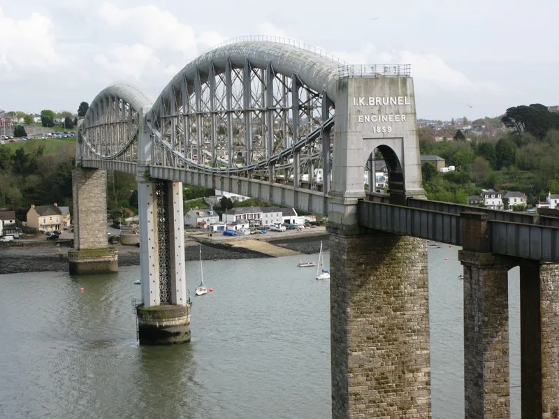
Cornish Main Line in Cornwall, St. Stephen-in-Brannel is a railway line (Network Rail, 1435 mm, main line). The train route 135 (GW) runs along this road. Cornish Main Line also exists in Saltash, Truro, St. Clement, St. Austell Bay and St. Austell. Ⓦ.
- Speed Limit
- 65 mph
- Operator
- Network Rail
Image
Bus stops
Roads nearby
Burngullow LaneBurngullow Junction
400 m
Brookfield Close850 m
School HillLanjeth The Old School
950 m
Coombe RoadCoombe Junction, Langerth Farm, Lanjeth, Hall's Car Centre
1,2 km
Hornick Hill1,2 km
Carne HillPath to St. Mewan Beacon
1,3 km
Pyramid Close1,3 km
Tremewan1,3 km
Hembal Lane1,3 km
Park View1,4 km
Hembal Close1,4 km
Peters HillPeters Hill
1,4 km
Hembal Road1,4 km
Badgers Watch1,5 km
Westbridge RoadTrewoon Stores (SE-bound), Tremewan, Trewoon Stores (NW-bound)
1,5 km
St Anne's Road1,5 km
Long LaneLong Lane
1,5 km
The Green1,6 km
Coliza HillColiza Hill
1,7 km
Rose HillLittle Trelower Park
1,8 km
Trebullan1,8 km
St Stephens Road1,8 km
Southdown Close1,9 km
Cotswold Avenue1,9 km
Cotswold Close1,9 km
Chapel Green2,0 km
Southdown Road2,0 km
Buildings nearby
Manor Farm 33kv Solar Pk850 m
1st Sticker Scouts1,9 km
Churches nearby
Trewoon Methodist Church1,4 km
Commons nearby
Burngullow Common1,6 km
Community centres nearby
Lanjeth & High Street Memorial Hall700 m
Trewoon Village Hall1,4 km
Convenience stores nearby
Premier1,5 km
Farmyards nearby
Manor Farm500 m
Langerth Farm900 m
Gardens nearby
Lanjeth Nursery & Water Gardens500 m
Hairdresser's nearby
ELVIE Hair & Beauty1,5 km
Industrial areas nearby
Imerys Tehidy Centre1000 m
Blackpool Substation1,2 km
Industrial buildings nearby
Blackpool Driers950 m
Parks nearby
Queen Elizabeth II Memorial Garden1,4 km
Places of worship nearby
Kingdom Hall of Jehovah's Witnesses1,4 km
Playgrounds nearby
Trewoon Playground1,3 km
Pubs nearby
The White Pyramid1,2 km
Quarries nearby
Blackpool Pit1,3 km
Railway lines nearby
Crugwallins Siding250 m
The Drinnick Mill Line800 m
Other nearby
Manor Farm Solar Farm800 m
| Opening | 1867 |
|---|---|
| Length | 79.5 |
| Located in | Cornwall |
| Country | United Kingdom |
| Has part | Saltash to St Germans Line, Cornwall Loop, Main Line (Paddington to Penzance via Bath), Cornwall Loop Junction to St Germans, Main Line (Paddington to Penzance via Bath), St Germans to mileage change point east of Chacewater, Main Line (Paddington to Penzance via Bath), Mileage change point east of Chacewater to Penzance |
| Part of | National Rail |
 Public transport map St. Stephen-in-Brannel Legend
 | Railway | |
| Bus | |
| Tram |
 Cycling map St. Stephen-in-Brannel Legend
 | Cycle path | |
| Cycle lane on road | |
| Cycling on bus lane | |
| Bicycle street | |
| Cyclists allowed | |
| Cyclists allowed, good surface | |
| No cycling | |
| Cobblestones |
| Long-distance cycle route | (depending on scale) | |
| Long-distance cycle route |
 Walking map St. Stephen-in-Brannel Legend
 | Path |
| Long-distance hiking trail | (depending on scale) | |
| Long-distance hiking trail | ||
| No pedestrians |