
Cornish Main Line in Tywardreath and Par
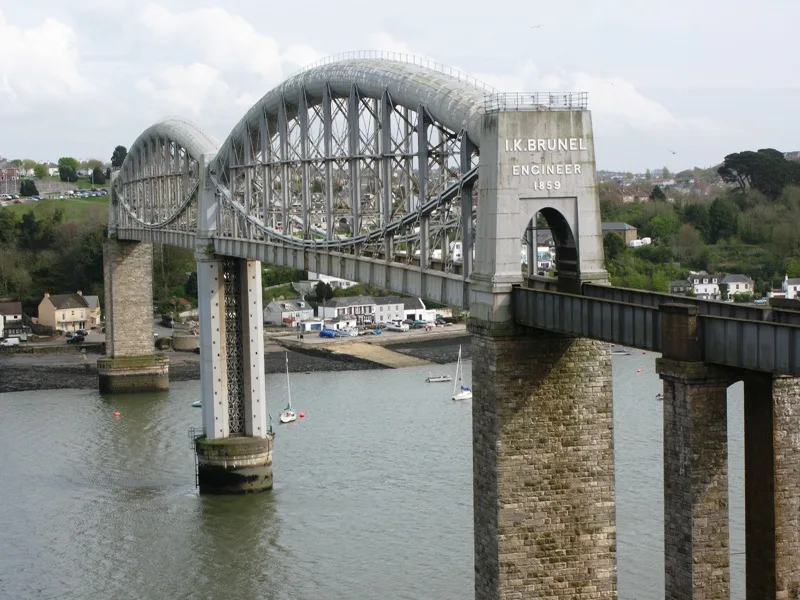
Cornish Main Line in Cornwall, Tywardreath and Par is a railway line (Network Rail, 1435 mm, main line). The train route 135 (GW) runs along this road. Cornish Main Line also exists in Saltash, Truro, St. Clement, St. Austell Bay and St. Austell. Ⓦ.
- Speed Limit
- 65 mph
- Operator
- Network Rail
Image
Stations
- train routes 135 (GW)
Convenience stores
Bus stops
Artwork
Butcher's
Platforms
- train routes 135 (GW)
Fast food restaurants
Social facility
Roads nearby
Wood Lane300 m
Woodland AvenueTywardreath Hall, Woodland Avenue
350 m
Trevance Park400 m
Southpark Road400 m
Swallowfield Close450 m
Anjardyn Place450 m
North Street450 m
Church StreetTywardreath Butchers, ArtBox, St Andrews Church
500 m
Driving Lane500 m
St Benedicts Close500 m
Vicarage Road500 m
Nursery Close500 m
Priory Close500 m
Eastcliffe RoadTehidy Road, Par Library, Par Library (SE-bound), Par Railway Station (SE-bound), Par Railway Station (NW-bound)
550 m
Tehidy RoadSt Benedicts Close, Tehidy Road Church
550 m
Kilhallon Woodlands550 m
Elderfield Close550 m
Vine Place600 m
Glen View600 m
Belmont Street650 m
Fore StreetThe Catch, Tywardreath Village Shop
700 m
Well StreetTywardreath
700 m
Legion Lane700 m
Mount Bennett RoadBelmont Street, Belmount Street, Poldrea
750 m
St Sampsons Close750 m
Moorland RoadMoorland Rd & Par Green Jctn, Moorland Road
850 m
St Andrew's Road950 m
St Blazey RoadPar Community Church, Single Line Junction, Middleway Garage
950 m
Porcupine RoadNear Four Corners
950 m
Valley ViewGrove Parc
1000 m
Grove Park1000 m
Blackberry Way1,1 km
Body of waters nearby
St. Andrews Pond500 m
Buildings nearby
Tywardreath Masonic Centre350 m
Cafés nearby
Sweet's Grill750 m
Canals nearby
Par Canal1,0 km
Clinics nearby
Par Medical Centre650 m
Community centres nearby
Fourways1000 m
Farmyards nearby
Barn Park Farm700 m
Gardens nearby
Glencliffe Community Garden800 m
Guest house nearby
The Royal Inn550 m
Nature reserves nearby
Tywardreath Marsh Nature Reserve200 m
Places of worship nearby
St Andrew's Church, Tywardreath650 m
Well Street Chapel700 m
Pubs nearby
New Inn700 m
Railway lines nearby
Par Loop800 m
The Atlantic Coast Line850 m
Railway stations nearby
Par Railway Station650 m
Sports centres nearby
Par Sports Club800 m
| Opening | 1867 |
|---|---|
| Length | 79.5 |
| Located in | Cornwall |
| Country | United Kingdom |
| Has part | Saltash to St Germans Line, Cornwall Loop, Main Line (Paddington to Penzance via Bath), Cornwall Loop Junction to St Germans, Main Line (Paddington to Penzance via Bath), St Germans to mileage change point east of Chacewater, Main Line (Paddington to Penzance via Bath), Mileage change point east of Chacewater to Penzance |
| Part of | National Rail |
 Public transport map Tywardreath and Par Legend
 | Railway | |
| Bus | |
| Tram |
 Cycling map Tywardreath and Par Legend
 | Cycle path | |
| Cycle lane on road | |
| Cycling on bus lane | |
| Bicycle street | |
| Cyclists allowed | |
| Cyclists allowed, good surface | |
| No cycling | |
| Cobblestones |
| Long-distance cycle route | (depending on scale) | |
| Long-distance cycle route |
 Walking map Tywardreath and Par Legend
 | Path |
| Long-distance hiking trail | (depending on scale) | |
| Long-distance hiking trail | ||
| No pedestrians |