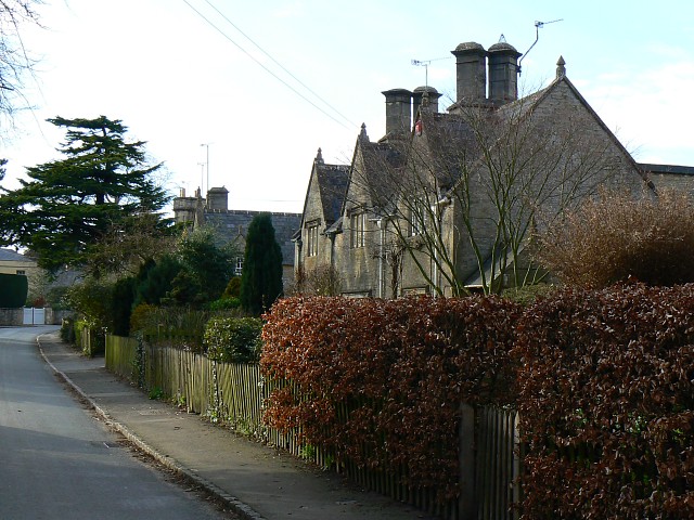
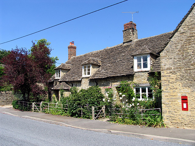
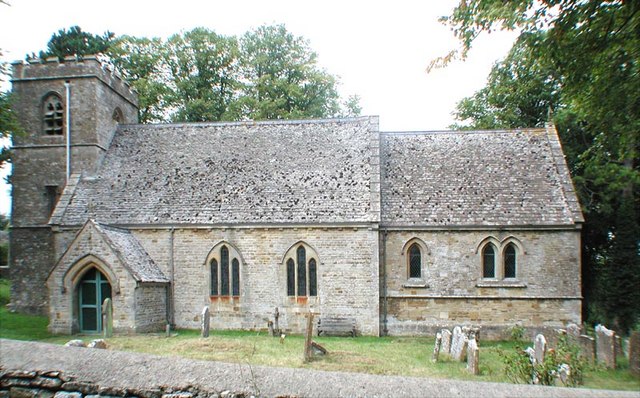
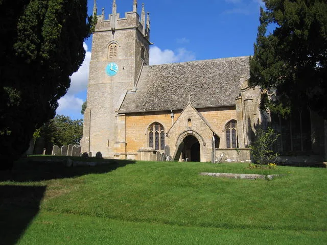
This page is the City map of Cotswold, a local government district in Gloucestershire, England, showing streets, paths and places. The district covers approximately 1,164.5 square kilometres and had about 91,563 residents, compared with 85,200 in 2015. Cotswold was established in 1974 and is divided into 116 subregions. Cirencester is the district’s largest settlement in the listed data, while the River Thames and the Cotswold landscape extend across the eastern and southern parts of the area.
Dowdeswell is a civil parish in Gloucestershire with 150 residents. It lies in the Cotswold District, west of Cheltenham and close to the A436. The parish is associated with the Dowdeswell Reservoir and the valley of the River Coln. Its administrative level is 10.
Whittington is a village and civil parish in Gloucestershire with 128 residents. It is located south of Cheltenham near the River Coln and the A40 corridor. The parish forms part of the rural Cotswold area. It is mapped at administrative level 10.
Cowley is a village and civil parish in Cotswold District with 406 residents. It lies south of Cheltenham in the upper Coln area. Cowley is connected with the Cotswold escarpment and nearby settlements such as Elkstone and Coberley. Its administrative level is 10.
Coberley is a village and civil parish in Gloucestershire with 373 residents. It stands south of Cheltenham in a valley below the Cotswold escarpment. The village is near the River Churn’s headwaters and the A435 route. Coberley is an administrative level 10 subdivision.
Elkstone is a village in Gloucestershire with 216 residents. It lies on the Cotswold uplands between Cheltenham and Cirencester. The parish is close to the A417 and the source area of the River Churn. Elkstone is recorded at administrative level 10.
Didmarton is a village and civil parish in Gloucestershire with 381 residents. It lies in the southern Cotswolds near the A433 between Tetbury and Badminton. The parish is close to Westonbirt Arboretum and the valley of the Little Avon River. Its administrative level is 10.
Westonbirt with Lasborough is a civil parish in Cotswold District with 268 residents. Westonbirt is known for the National Arboretum, one of the United Kingdom’s major collections of trees. The parish lies near Tetbury and the A433 in southern Gloucestershire. It is mapped at administrative level 10.
Boxwell with Leighterton is a civil parish in Gloucestershire with 241 residents. It lies east of Tetbury on the limestone plateau of the southern Cotswolds. The parish is near the A4135 and the valleys leading towards Wotton-under-Edge. Its administrative level is 10.
Ozleworth is a village in Gloucestershire with 45 residents. It lies near Wotton-under-Edge on the western edge of the Cotswolds. The settlement is close to Ozleworth Park and the valleys of the Little Avon catchment. Ozleworth is an administrative level 10 subdivision.
Kingscote is a village and civil parish in Cotswold District with 306 residents. It is situated west of Tetbury near the valley of the Ozleworth Brook. The parish occupies farmland and wooded limestone country close to the Gloucestershire–South Gloucestershire boundary. Its administrative level is 10.
Beverston is a village and civil parish in Gloucestershire with 125 residents. Its principal historic feature is Beverston Castle, a medieval fortified house near the A4135. The village lies west of Tetbury in the southern Cotswolds. Beverston is mapped at administrative level 10.
Shipton Moyne is a village in Gloucestershire with 288 residents. It lies south of Tetbury near the county boundary with Wiltshire. The settlement is close to the River Avon’s upper catchment and the A433. Shipton Moyne is recorded at administrative level 10.
Tetbury Upton is a village and civil parish in Gloucestershire with 289 residents. The parish was established in 1894 and lies around the northern and western outskirts of Tetbury. It is connected with the A433 and the upper valley of the River Avon. Tetbury Upton has administrative level 10 status.
Tetbury is a town and civil parish in Cotswold District with 6,455 residents. It lies in southern Gloucestershire near the A433 and the headwaters of the River Avon. The town has a historic market centre and is close to Westonbirt Arboretum. Tetbury is an administrative level 10 subdivision.
Avening is a village in Gloucestershire with 1,121 residents. It lies south of Stroud in the valley of the River Aven, a tributary of the River Frome. The village is near Minchinhampton and the Cotswold escarpment. Avening is mapped at administrative level 10.
Long Newnton is a village and civil parish in Gloucestershire with 211 residents. It lies west of Tetbury near the upper River Avon and the Wiltshire boundary. The parish is connected by local roads with Tetbury and Malmesbury. Its administrative level is 10.
Ashley is a village in Gloucestershire with 104 residents. It lies south of Tetbury near the county boundary with Wiltshire. The settlement is close to the upper River Avon and the road between Tetbury and Malmesbury. Ashley is recorded at administrative level 10.
Cherington is a village and civil parish in Cotswold District with 137 residents. It lies east of Tetbury in the valley of the River Churn’s southern tributaries. The parish is near the A429 and the village of Cotswold. Cherington is an administrative level 10 subdivision.
Rodmarton is a village in Gloucestershire with 352 residents. It lies north-east of Tetbury on the Cotswold limestone plateau. Rodmarton Manor, an Arts and Crafts house built in the early 20th century, is located near the village. The settlement is mapped at administrative level 10.
Sapperton is a village and civil parish in Gloucestershire with 425 residents. It lies in the valley of the River Frome west of Cirencester. Sapperton is associated with the Cotswold Arts and Crafts movement and the nearby Sapperton Valley. Its administrative level is 10.
Kemble is a village in Gloucestershire with 940 residents. It lies south-west of Cirencester and is known as the source area of the River Thames. Kemble railway station provides a rail connection on the Swindon–Gloucester line. The village is recorded at administrative level 10.
Poole Keynes is a village and civil parish in Cotswold District with 172 residents. It lies in the Upper Thames Valley near the Cotswold Water Park. The parish is south of Cirencester and close to the River Thames. Poole Keynes has administrative level 10 status.
Somerford Keynes is a village in Gloucestershire with 479 residents. It lies beside the River Thames and forms part of the Cotswold Water Park, an area of more than 150 lakes created from gravel extraction. The village is south of Cirencester near the A429. Somerford Keynes is mapped at administrative level 10.
South Cerney is a village in Gloucestershire with 3,998 residents. It lies south of Cirencester beside the River Churn and within the Cotswold Water Park. The settlement has direct road connections to the A419 and the wider Thames Valley. South Cerney is an administrative level 10 subdivision.
Driffield is a village and civil parish in Cotswold District with 173 residents. It lies east of Cirencester near the River Churn. The parish is located on the limestone landscape between Cirencester and the villages of Barnsley and Ampney. Its administrative level is 10.
Down Ampney is a village in Gloucestershire with 572 residents. It lies east of Cirencester near the River Churn and the A417. The village is the birthplace of composer Ralph Vaughan Williams, who was born there in 1872. Down Ampney is mapped at administrative level 10.
Maiseyhampton is a civil parish in Cotswold District with 546 residents. It lies south-east of Cirencester near the River Coln and the Cotswold Water Park. The parish is connected with the A417 and the route towards Fairford. Maiseyhampton is an administrative level 10 subdivision.
Fairford is a town in Gloucestershire with 3,236 residents and a recorded area of 16,240,000 square metres. It lies on the River Coln in the eastern Cotswolds, near the A417. Fairford is known for its medieval church of St Mary and its annual air tattoo at RAF Fairford. The town is mapped at administrative level 10.
Kempsford is a village and civil parish in Gloucestershire with 1,176 residents. It lies near the River Thames and the county boundary with Wiltshire. The village is south of Fairford and close to the former RAF Fairford area. Kempsford is recorded at administrative level 10.
Lechlade is a civil parish in Cotswold District with 3,138 residents. It lies at the upper navigable end of the River Thames, near its confluence with the River Leach. The town is close to the borders of Gloucestershire, Oxfordshire and Wiltshire. Lechlade is an administrative level 10 subdivision.
Eastleach is a civil parish in Gloucestershire with 307 residents. It consists of settlements in the valley of the River Leach east of Fairford. The parish lies near the A417 and the boundary with Oxfordshire. Eastleach is mapped at administrative level 10.
Southrop is a village in Gloucestershire with 277 residents. It lies near the River Leach between Fairford and Lechlade. The village is close to the Cotswold Water Park and the Oxfordshire boundary. Southrop is recorded at administrative level 10.
Hatherop is a village and civil parish in Gloucestershire with 172 residents. It lies north of Fairford in the valley of the River Coln. Hatherop Castle is a notable local building near the village. The parish is an administrative level 10 subdivision.
Siddington is a village and civil parish in Gloucestershire with 1,349 residents. It lies south-east of Cirencester near the River Churn and the A417. The parish is close to the Roman town of Cirencester and the Cotswold Water Park. Siddington is mapped at administrative level 10.
Coates is a village and civil parish in Gloucestershire with 458 residents. It lies south of Cirencester near the River Churn and the Cotswold Water Park. The parish is close to the A419 and the Gloucestershire–Wiltshire boundary. Coates is recorded at administrative level 10.
Cirencester is a market town in eastern Gloucestershire with 19,076 residents. It stands near the River Churn and occupies the site of the Roman town Corinium Dobunnorum, one of Roman Britain’s largest settlements. The town contains the Corinium Museum and lies at the centre of the Cotswold District. Cirencester is an administrative level 10 subdivision.
Preston is a village and civil parish in Cotswold District with 356 residents. It lies north-east of Cirencester near the River Coln and the A429. The parish is situated between the Cotswold uplands and the Coln valley. Preston is mapped at administrative level 10.
Barrington is a civil parish in Gloucestershire with 181 residents. It lies beside the River Coln near the A417 and the town of Burford. The parish includes the Cotswold village of Great Barrington and lies close to the Oxfordshire boundary. Its administrative level is 10.
Great Rissington is a village and civil parish in Gloucestershire with 355 residents. It lies in the Windrush valley in the northern Cotswolds. The parish is near Bourton-on-the-Water and the boundary with Oxfordshire. Great Rissington is an administrative level 10 subdivision.
Westcote is a civil parish in Cotswold District with 207 residents. It lies north of Stow-on-the-Wold near the valley of the River Evenlode. The parish is close to the Gloucestershire–Oxfordshire boundary and the A44. Westcote is mapped at administrative level 10.
Bledington is a village and civil parish in Gloucestershire with 459 residents. It lies near the River Evenlode on the northern Cotswold plateau. The village is close to Stow-on-the-Wold and the Oxfordshire boundary. Bledington is recorded at administrative level 10.
Adlestrop is a village in Gloucestershire with 129 residents. It lies beside the River Evenlode near Moreton-in-Marsh and the Oxfordshire boundary. The village became known through Edward Thomas’s poem “Adlestrop”, written after a railway stop there in 1914. Adlestrop is an administrative level 10 subdivision.
Evenlode is a village and civil parish in Cotswold District with 147 residents. It lies in the valley of the River Evenlode west of Moreton-in-Marsh. The settlement is near Adlestrop and the railway line between Oxford and Hereford. Evenlode is mapped at administrative level 10.
Moreton-in-Marsh is a town in Gloucestershire with 5,010 residents. It lies on the upper River Evenlode and has a railway station on the Cotswold Line between Oxford and Hereford. The town is located near the A44 and serves as a transport centre for the northern Cotswolds. Moreton-in-Marsh is an administrative level 10 subdivision.
Todenham is a village and civil parish in Cotswold District with 239 residents. It lies north of Moreton-in-Marsh near the River Stour and the Warwickshire boundary. The parish is close to Chipping Campden and the northern Cotswold hills. Todenham is recorded at administrative level 10.
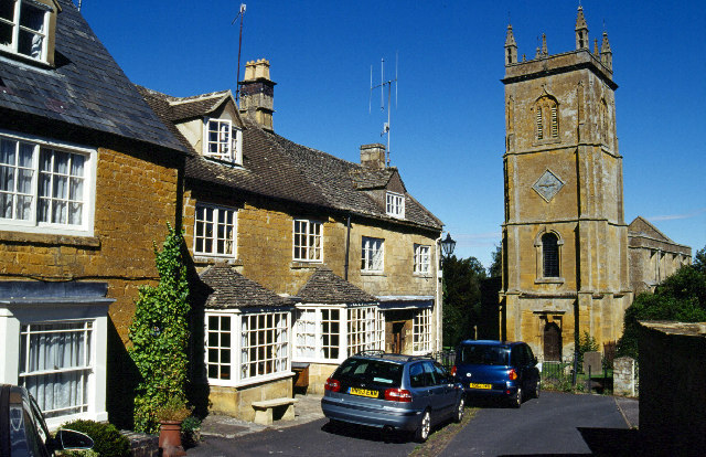
Blockley is a village and civil parish in Gloucestershire with 1,960 residents. It lies between Moreton-in-Marsh and Chipping Campden in a valley of the northern Cotswolds. The village is known for its stone houses and was used as a filming location for the television series “Father Brown”. Blockley is mapped at administrative level 10.
Ebrington is a village and civil parish in Gloucestershire with 570 residents. It lies east of Chipping Campden near the Warwickshire boundary. The village is associated with Ebrington Manor and the upper valley of the Dene. Ebrington is an administrative level 10 subdivision.
Mickleton is a civil parish in Cotswold District with 2,217 residents. It lies in the Vale of Evesham at the northern edge of the Cotswolds, close to the River Stour. The village is known for its spring daffodil displays and proximity to Hidcote Manor Garden. Mickleton is mapped at administrative level 10.
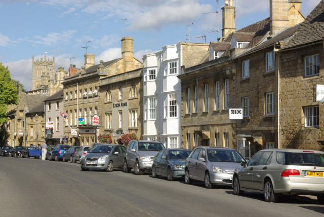
Chipping Campden is a town in Gloucestershire with 2,377 residents. Its long High Street contains limestone buildings from the medieval wool trade, including the Market Hall built in 1627. The town was an important centre of the Arts and Crafts movement through C. R. Ashbee’s Guild of Handicraft. Chipping Campden is an administrative level 10 subdivision.
Weston Subedge is a civil parish in Cotswold District with 411 residents. It lies south of Chipping Campden below Dovers Hill, the traditional starting point of the Cotswold Olimpicks. The parish is near the Gloucestershire–Worcestershire boundary. Weston Subedge is mapped at administrative level 10.
Aston Subedge is a village in Gloucestershire with 52 residents. It lies near Chipping Campden and the northern escarpment of the Cotswolds. The settlement is close to Weston Subedge and the road towards Broadway in Worcestershire. Aston Subedge is recorded at administrative level 10.
Willersey is a village in Gloucestershire with 991 residents. It lies north of Broadway and east of Chipping Campden near the A44. The parish is situated at the northern edge of the Cotswold escarpment and close to the Vale of Evesham. Willersey is an administrative level 10 subdivision.
Saintbury is a village and civil parish in Cotswold District with 79 residents. It lies near Broadway and the Cotswold escarpment in northern Gloucestershire. Saintbury is close to Broadway Tower and the Gloucestershire–Worcestershire boundary. The parish is mapped at administrative level 10.
Batsford is a village in Gloucestershire with 106 residents. It lies east of Moreton-in-Marsh in the valley of the River Evenlode. Batsford Arboretum, known for its collection of Japanese maples, is located near the village. Batsford is recorded at administrative level 10.
Bourton-on-the-Hill is a village and civil parish in Gloucestershire with 302 residents. It lies on a steep Cotswold hillside above the valley of the River Evenlode. The village is situated between Moreton-in-Marsh and Stow-on-the-Wold near the A44. Bourton-on-the-Hill is an administrative level 10 subdivision.
Cutsdean is a village in Gloucestershire with 56 residents. It lies on the high ground between Bourton-on-the-Water and Stow-on-the-Wold. The settlement is close to the headwaters of the River Windrush and the northern Cotswold escarpment. Cutsdean is mapped at administrative level 10.
Temple Guiting is a village and civil parish in Cotswold District with 392 residents. It lies in the valley of the River Windrush between Stow-on-the-Wold and Bourton-on-the-Water. The parish contains Temple Guiting Manor, a historic country house. Temple Guiting is an administrative level 10 subdivision.
Guiting Power is a village in Gloucestershire with 296 residents. It lies in the valley of the River Windrush in the northern Cotswolds. The village is near Temple Guiting and the route between Stow-on-the-Wold and Winchcombe. Guiting Power is recorded at administrative level 10.
Sevenhampton is a village and civil parish in Gloucestershire with 300 residents. It lies north-east of Cheltenham on the Cotswold escarpment. The parish is near the River Coln’s upper catchment and the A436. Sevenhampton is mapped at administrative level 10.
Longborough is a village in Gloucestershire with 489 residents. It lies north-east of Stow-on-the-Wold near the valley of the River Evenlode. The village is known for Longborough Festival Opera, located in the surrounding Cotswold countryside. Longborough is an administrative level 10 subdivision.
Data sources: OpenStreetMap (ODbL), Wikidata (CC0) · Image: Wikimedia Commons