
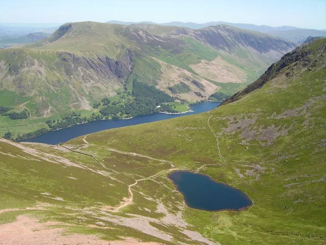
Bleaberry Tarn in Buttermere, Cumbria, Cumberland
Bleaberry Tarn in Cumberland, Buttermere is a body of water. Bleaberry Tarn also exists in Westmorland and Furness. Ⓦ.
- Nature
- body of water
Image
Pubs
Tourist information offices
Bus stops
Attraction
Artwork
Cafés
Roads nearby
Scale Bridge1,1 km
Newlands PassMountain Road junction
1,8 km
Newlands Hause1,9 km
Hasness TunnelDalegarth
1,9 km
Nature nearby
Chockstone Ridge900 m
Bare rocks nearby
Oxford & Cambridge Buttress850 m
Grey Wall900 m
The Slabs900 m
Mitre Buttress900 m
Harrow Buttress950 m
Buildings nearby
Holiday Cottages1,7 km
Syke Farm1,8 km
Buttermere Telephone Exchange1,8 km
Refuge1,9 km
Cafés nearby
Croft House Farm Café1,7 km
Syke Farm Tea Room1,8 km
Campsite nearby
Syke Farm Campsite1,7 km
Cliffs nearby
Chapel Crags600 m
Grey Crag850 m
The Knors1000 m
Lingcomb Edge1000 m
Raven Cragg1,0 km
Eagle Crag1,2 km
Comb Crag1,3 km
High Crag Butress1,8 km
Low Crag1,9 km
Community centres nearby
Church Hall1,8 km
Farmyards nearby
Croft House Farm1,7 km
Wilkinsyke Farm1,7 km
Guest house nearby
Wood House Buttermere2,0 km
Hotels nearby
The Buttermere Court Hotel1,6 km
Bridge Hotel1,7 km
Buttermere Youth Hostel1,8 km
Places of worship nearby
St James1,8 km
Quarries nearby
Buttermere Quarry1,9 km
Rivers nearby
Buttermere Dubs1,2 km
Streams nearby
Sourmilk Gill350 m
Near Ruddy Beck950 m
Far Ruddy Beck1,2 km
Bowder Beck1,5 km
Comb Beck1,6 km
Gillflinter Beck1,8 km
Hagg Sike1,9 km
Dodsgill Beck2,1 km
Scale Beck2,2 km
Low Beck2,3 km
Valleies nearby
Ennerdale1,9 km
Woodlands nearby
Holme Island1,7 km
Scale Island2,0 km
| Length | 0.2 |
|---|---|
| Elevation | 497 m |
| Protected area | Lake District National Park |
| Located in | Buttermere |
| Country | United Kingdom |
 Public transport map Buttermere Legend
| Railway | |
| Bus | |
| Tram |
 Cycling map Buttermere Legend
| Cycle path | |
| Cycle lane on road | |
| Cycling on bus lane | |
| Bicycle street | |
| Cyclists allowed | |
| Cyclists allowed, good surface | |
| No cycling | |
| Cobblestones |
| Long-distance cycle route | (depending on scale) | |
| Long-distance cycle route |
 Walking map Buttermere Legend
| Path |
| Long-distance hiking trail | (depending on scale) | |
| Long-distance hiking trail | ||
| No pedestrians |