
All Saints in Newton Abbot
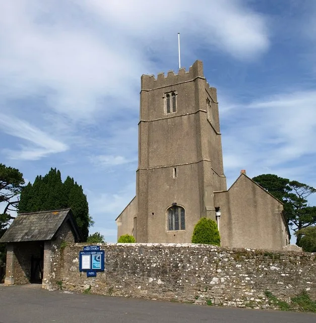
All Saints in Newton Abbot in Teignbridge is a Anglicana church. It is near The Churchills and is also known as All Saints, Highweek. The church belongs to the Diocese of Exeter and is dedicated to All Saints' Day. It was built in 1428 and is a listed building. All Saints also exists in Kenton.
- Amenity
- place of worship
- Building Type
- church
Image
Petrol station
Car dealerships
Café
Library
Bus stops
Pub
Town hall
Pharmacy
Fast food restaurants
Roads nearby
The Churchills200 m
Kite Close250 m
Blenheim Close250 m
Pitt Hill Road250 m
Foxwell Lane250 m
Horseshoe Drive300 m
Ringslade RoadHeltor,Highweek Garage
300 m
Ringslade Close300 m
Randolph Court350 m
Stoneleigh Close350 m
Whitehill Road350 m
Osprey Avenue350 m
Harrier Place350 m
Marlborough Place350 m
Chartwell Drive400 m
Coombeshead Road400 m
Noelle Drive400 m
Badger Lane400 m
Hawk Avenue400 m
Neville Road450 m
Noctule Avenue450 m
Roberts Way450 m
Tawny Road450 m
Greenaway Road500 m
Ashburton RoadCoombeshead School, Manor Road, Broadlands Avenue, Greenaway Road, Howton Lane, Mile End Road, Ashburton Road, Barton Drive, Co-op Food, Hele Park
500 m
Churchills500 m
Exeter RoadWain Lane, College, Eden Motor Group MG
500 m
Wain Lane500 m
Eagle Crescent500 m
Jetty Marsh RoadSandford View, Teign Vehicle Rentals
500 m
Mapleton Close500 m
Dyrons500 m
Western Drive550 m
Pipistrelle Road550 m
Sandford View550 m
Trafalgar Close550 m
Gaze Hill550 m
Whitehill Close550 m
Bushel Road550 m
Hill Park Road550 m
Serotine Close550 m
Highweek VillageHighweek, Highweek Village Inn
550 m
Orleigh Avenue600 m
Heather Close600 m
Bovey Road600 m
Rosemary Avenue600 m
Orleigh Cross600 m
Bovey Tracey Road600 m
Sports centres nearby
Newton Abbot Leisure Centre550 m
| Inception | 1428 |
|---|---|
| Dedicated to | All Saints' Day |
| Diocese | Diocese of Exeter |
| Heritage designation | Grade I listed building |
| Located in | Newton Abbot |
| Country | United Kingdom |
| Location | Highweek |
 Public transport map Newton Abbot Legend
 | Railway | |
| Bus | |
| Tram |
 Cycling map Newton Abbot Legend
 | Cycle path | |
| Cycle lane on road | |
| Cycling on bus lane | |
| Bicycle street | |
| Cyclists allowed | |
| Cyclists allowed, good surface | |
| No cycling | |
| Cobblestones |
| Long-distance cycle route | (depending on scale) | |
| Long-distance cycle route |
 Walking map Newton Abbot Legend
 | Path |
| Long-distance hiking trail | (depending on scale) | |
| Long-distance hiking trail | ||
| No pedestrians |