
St Mary in Tarrant Crawford
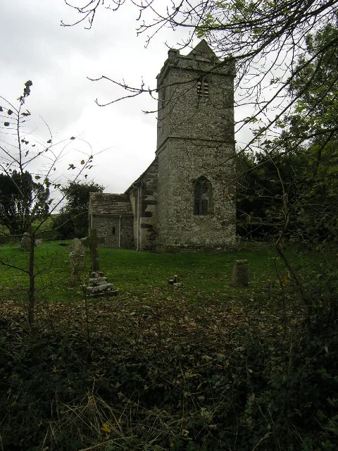
St Mary in Dorset, Tarrant Crawford is a Anglicana church. It is near St Richards Close and was built in 1101. The church is a listed building. St Mary also exists in West Stour, Motcombe, Iwerne Courtney or Shroton, Sturminster Newton and Stalbridge. Ⓦ.
- Building Type
- church
- Operator
- The Churches Conservation Trust
Image
Roads nearby
St Richards Close850 m
Beech Close1,4 km
Wimborne Road1,4 km
Slopers Mead1,4 km
Riversdene1,4 km
Bournemouth RoadSpetisbury First School
1,5 km
Priory Gardens1,5 km
Crawford Bridge1,5 km
Abbey View1,5 km
Crawford Park1,6 km
Louse LaneCrawford Bridge Crossroads
1,8 km
May Grove1,9 km
Meadow RoadMeadow Road
1,9 km
West StreetThe Anchor
2,0 km
Kathryn Court2,0 km
Green Close2,1 km
Greenfield Road2,1 km
River Lane2,1 km
Hopegood Close2,2 km
Palmers Lane2,2 km
Stour Valley Way2,3 km
Swan Way2,3 km
Church StreetResidents of Shapwick January 1st 2000
2,3 km
Ram Lane2,4 km
Stewards Lane2,4 km
High StreetShapwick, Shapwick Cross
2,4 km
New Road2,5 km
Piccadilly Lane2,7 km
Park Lane2,7 km
Abandoned railways nearby
Broadstone Junction to Templecombe Lower Line2,0 km
Buildings nearby
Brook Field Farm900 m
The Anne Biddlecombe Hall1,2 km
Rushton Hall2,7 km
Campsite nearby
Crawford Farm Camping Field400 m
Little Hundreds Campsite650 m
Community centres nearby
Charlton Marshall Village Hall2,0 km
Farmyards nearby
Preston Farm2,1 km
Forests nearby
New Barn Plantation2,3 km
Golf courses nearby
Ashley Wood Golf Club1,9 km
Industrial areas nearby
Tarrant Crawford WwTW900 m
Meadows nearby
Charlton Marshall Water Meadows1,7 km
Places of worship nearby
All Saints650 m
St John the Baptist1,5 km
St Bartholomew2,3 km
Pubs nearby
The True Lovers Knot1,5 km
Charlton Inn2,1 km
Rivers nearby
River Stour1,1 km
Streams nearby
The Tarrant500 m
Village greens nearby
The Charles Bennett Village Green2,4 km
| Inception | 1101 |
|---|---|
| Heritage designation | Grade I listed building |
| Located in | Tarrant Crawford |
| Country | United Kingdom |
 Public transport map Tarrant Crawford Legend
| Railway | |
| Bus | |
| Tram |
 Cycling map Tarrant Crawford Legend
| Cycle path | |
| Cycle lane on road | |
| Cycling on bus lane | |
| Bicycle street | |
| Cyclists allowed | |
| Cyclists allowed, good surface | |
| No cycling | |
| Cobblestones |
| Long-distance cycle route | (depending on scale) | |
| Long-distance cycle route |
 Walking map Tarrant Crawford Legend
| Path |
| Long-distance hiking trail | (depending on scale) | |
| Long-distance hiking trail | ||
| No pedestrians |