
St. Johns in Borough of Gedling
St. Johns in Gedling is a Anglicana church (NG4 1BP). It is near Onchan Avenue and belongs to the Diocese of Southwell and Nottingham. The church is dedicated to John the Baptist.
- Postal Code
- NG4 1BP
- Amenity
- place of worship
- Building Type
- church
- Website
- http://stjohnscarlton.org.uk/
Image
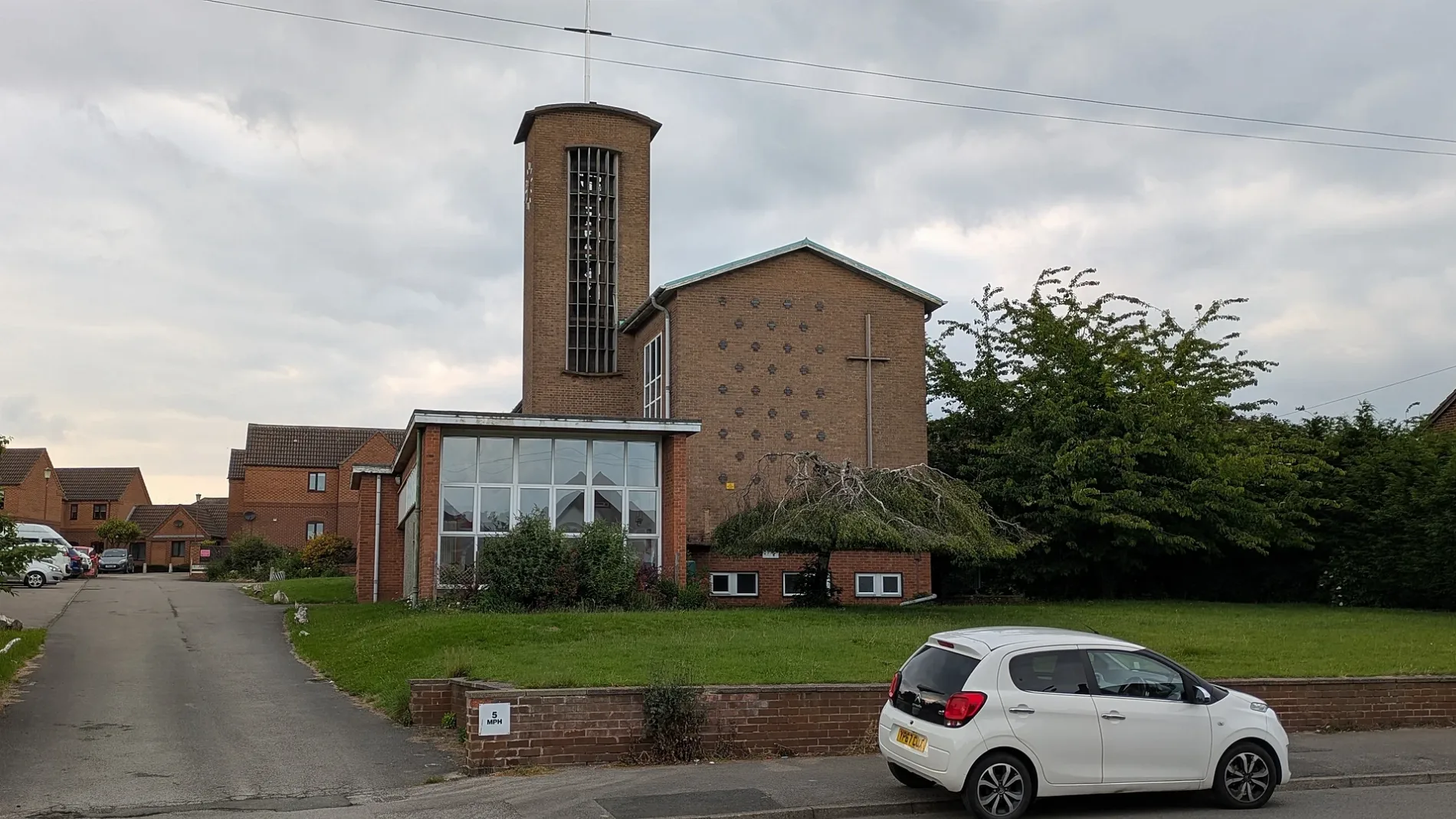
Roads nearby
St Johns Court50 m
Cliff Road100 m
Southdale Drive150 m
Onchan Drive150 m
Avondale Road200 m
Southdale RoadSacred Heart Primary School, Cliff Road, Southdale Road, Southlea Road
250 m
Onchan Avenue250 m
Fearn Chase250 m
Griffs Hollow300 m
Broadway East300 m
Bonser Close350 m
Towe's Mount350 m
Greenhill Road350 m
Greenhill Crescent350 m
Shipley Rise350 m
Douglas Crescent350 m
Douglas Avenue400 m
Poplar Close400 m
Greenwood Crescent400 m
Orchard Avenue400 m
Holme Lodge400 m
Newgate Close450 m
Oakdale RoadBakersfield Medical Centre, Parkdale Road, Eastdale Road, Tally Ho, Trentdale Road, Avondale Road, Booze Corner, Navarra, Carlton Ceramics, Cox Pharmacy, Oakdale Road Post Office, Hallmark Motors, Oakdale Auto Centre, Blondes, Beauty Spot, Pizza Hut Delivery, Bakersfield, Cutting Edge
450 m
Kensington Gardens450 m
Belvoir Lodge450 m
Greenhill Rise450 m
Midland Wood Cycle RouteNetherfield Junction
500 m
Whimsey Park500 m
Martins Hill500 m
George Road550 m
Hotspur Drive550 m
Colwick Lodge550 m
Furzebrook Road550 m
Spray Close600 m
Langton Close600 m
Lawrence Avenue650 m
Dale Lodge650 m
Revena Close650 m
Verona Avenue650 m
Cameo Close700 m
Buildings nearby
Short 360600 m
Apartment buildings nearby
Orchard Court350 m
Car repair shops nearby
Lindleys Garage150 m
Houses nearby
Holmfield550 m
Pubs nearby
Elwes Arms400 m
Railway lines nearby
Nottingham to Lincoln Line500 m
Nottingham to Grantham Line550 m
Recreation grounds nearby
Oakdale Road Recreation Ground350 m
Woodlands nearby
Midland Wood450 m
| Dedicated to | John the Baptist |
|---|---|
| Diocese | Diocese of Southwell and Nottingham |
| Located in | Gedling |
| Country | United Kingdom |
 Public transport map Gedling Legend
| Railway | |
| Bus | |
| Tram |
 Cycling map Gedling Legend
| Cycle path | |
| Cycle lane on road | |
| Cycling on bus lane | |
| Bicycle street | |
| Cyclists allowed | |
| Cyclists allowed, good surface | |
| No cycling | |
| Cobblestones |
| Long-distance cycle route | (depending on scale) | |
| Long-distance cycle route |
 Walking map Gedling Legend
| Path |
| Long-distance hiking trail | (depending on scale) | |
| Long-distance hiking trail | ||
| No pedestrians |