South Holland District

This City map of South Holland shows the streets, paths and places of the region in Lincolnshire, England. South Holland is a non-metropolitan district covering around 750.9 square kilometres. About 96,983 people lived in the district in 2022, compared with approximately 88,500 in 2012. Founded in 1974, the district is divided into 22 subregions, including towns, villages, hamlets and civil parishes.

City map South Holland
Stephen McKay, CC BY-SA 2.0 – Wikimedia Commons
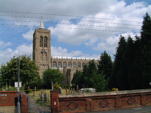
City map Holbeach CP
Uksignpix, CC BY-SA 3.0 – Wikimedia Commons

Holbeach CP

Holbeach CP is a town in the South Holland district of southern Lincolnshire, England. Its recorded population is 10,458, making it one of the larger subregions in South Holland.

As an admin_level=10 area, Holbeach CP forms a defined local division within the district. The town lies in the low-lying Lincolnshire landscape of eastern England.

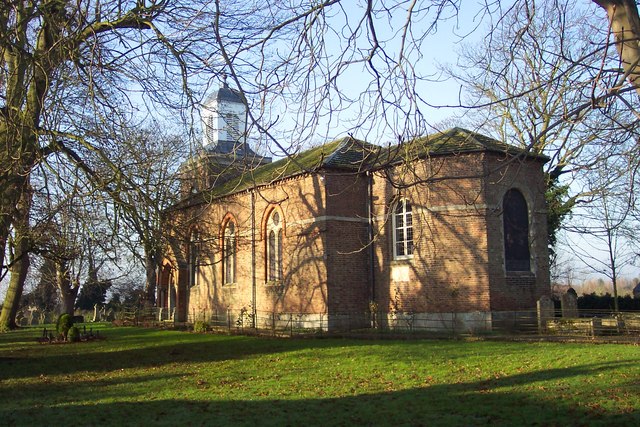
City map Long Sutton
Martin Addison, CC BY-SA 2.0 – Wikimedia Commons

Long Sutton

Long Sutton is a town in Lincolnshire and an admin_level=10 subregion of South Holland. It has a recorded population of 5,095.

The town belongs to the northern part of the South Holland district, whose administrative area covers around 750.9 square kilometres. Long Sutton is one of the 22 subregions represented on this regional map.

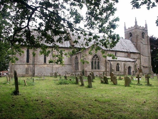
City map Little Sutton
David Prestidge, CC BY-SA 2.0 – Wikimedia Commons

Little Sutton

Little Sutton is a hamlet and civil parish in Lincolnshire, United Kingdom. The subregion has a recorded population of 117.

Little Sutton is administered at level 10 within South Holland. Its small population distinguishes it from larger local centres such as Holbeach and Long Sutton.

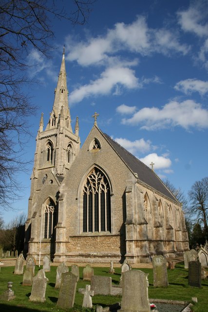
City map Tydd St. Mary
David Prestidge, CC BY-SA 2.0 – Wikimedia Commons

Tydd St. Mary

Tydd St. Mary is a village and civil parish in Lincolnshire, UK. It has a recorded population of 1,097.

The subregion is one of the 22 admin_level=10 divisions of South Holland. South Holland itself is a Lincolnshire district with approximately 96,983 residents in 2022.

City map Gedney Hill
David Prestidge, CC BY-SA 2.0 – Wikimedia Commons

Gedney Hill

Gedney Hill is a village in Lincolnshire, England, United Kingdom. Its recorded population is 820.

Gedney Hill forms an admin_level=10 subregion within South Holland. The district includes rural settlements of different sizes across an area of around 750.9 square kilometres.

City map Sutton St. James
Geoff Pick, CC BY-SA 2.0 – Wikimedia Commons

Sutton St. James

Sutton St. James is a village in Lincolnshire, England, United Kingdom. The village has a recorded population of 1,196.

It is one of the 22 local subregions mapped within South Holland. The surrounding district is part of Lincolnshire in eastern England and was founded as an administrative district in 1974.

City map Gedney
Peter Latham, CC BY-SA 2.0 – Wikimedia Commons

Gedney

Gedney is a village in South Holland, Lincolnshire, United Kingdom. Its recorded population is 2,312.

Gedney is represented as an admin_level=10 subregion in the district. South Holland had about 96,983 residents in 2022, following population growth from approximately 88,500 in 2012.

City map Fleet
Guy Erwood, CC BY-SA 2.0 – Wikimedia Commons

Fleet

Fleet is a village and civil parish in Lincolnshire, England, UK. The subregion has a recorded population of 2,456.

As one of South Holland’s 22 subregions, Fleet belongs to a district covering around 750.9 square kilometres. The district is located entirely within Lincolnshire.

City map Sutton St. Edmund
Jonathan Billinger, CC BY-SA 2.0 – Wikimedia Commons

Sutton St. Edmund

Sutton St. Edmund is a village in Lincolnshire, England, UK. Its recorded population is 683.

The village is mapped as an admin_level=10 division of South Holland. It represents one of the smaller settlements among the district’s 22 subregions.

City map Sutton Bridge
Brian Abbott, CC BY-SA 2.0 – Wikimedia Commons

Sutton Bridge

Sutton Bridge is a civil parish in South Holland, Lincolnshire, England. It has a recorded population of 4,532.

Sutton Bridge is one of the larger local subregions in the northern part of the district. South Holland’s total area is around 750.9 square kilometres, and its population reached 96,983 in 2022.

City map Lutton
mega monty, CC BY-SA 2.0 – Wikimedia Commons

Lutton

Lutton is a village and civil parish in Lincolnshire, United Kingdom. The subregion has a recorded population of 1,308.

Lutton is classified as an admin_level=10 area within South Holland. The district forms part of Lincolnshire, an English county on the eastern side of the country.

City map Gosberton CP
MOTORAL1987, CC BY-SA 3.0 – Wikimedia Commons

Gosberton CP

Gosberton CP is a village in Lincolnshire, England, UK. Its recorded population is 2,914.

The civil parish is one of the 22 admin_level=10 subregions shown for South Holland. The district was established in 1974 and covers approximately 750.9 square kilometres.

City map Surfleet CP
Dave Hitchborne, CC BY-SA 2.0 – Wikimedia Commons

Surfleet CP

Surfleet CP is a village in Lincolnshire, England, UK. The subregion has a recorded population of 1,365.

Surfleet CP is mapped as an admin_level=10 division within South Holland. The district’s population increased from about 88,500 in 2012 to 96,983 in 2022.

City map Donington CP
Guy Erwood, CC BY-SA 2.0 – Wikimedia Commons

Donington CP

Donington CP is a village and civil parish in Lincolnshire, England, UK. Its recorded population is 2,805.

The subregion belongs to South Holland, a non-metropolitan district founded in 1974. Donington CP is one of 22 local divisions within the district’s area of around 750.9 square kilometres.

City map Quadring CP
Richard Croft, CC BY-SA 2.0 – Wikimedia Commons

Quadring CP

Quadring CP is a village in Lincolnshire, England, UK. The recorded population of the subregion is 1,336.

Quadring CP is an admin_level=10 area within South Holland. The district is part of Lincolnshire and had approximately 96,983 residents in 2022.

City map Pinchbeck CP
Brian Green, CC BY-SA 2.0 – Wikimedia Commons

Pinchbeck CP

Pinchbeck CP is a village and civil parish in Lincolnshire, England, UK. It has a recorded population of 6,012.

Pinchbeck CP is among the more populous subregions in South Holland, which contains 22 mapped local divisions. The district covers around 750.9 square kilometres and lies within Lincolnshire.

City map Weston CP
Dave Hitchborne, CC BY-SA 2.0 – Wikimedia Commons

Weston CP

Weston CP is a village and civil parish in South Holland, Lincolnshire, England. Its recorded population is 2,100.

The civil parish is classified as an admin_level=10 subregion. South Holland’s population rose by roughly 8,483 people between 2012 and 2022, from about 88,500 to 96,983.

City map Moulton CP
Mat Fascione, CC BY-SA 2.0 – Wikimedia Commons

Moulton CP

Moulton CP is a civil parish in South Holland, Lincolnshire, England. The subregion has a recorded population of 3,681.

Moulton CP is one of the 22 admin_level=10 areas shown on the South Holland map. South Holland is a non-metropolitan district with an area of around 750.9 square kilometres.

City map Whaplode CP
Uksignpix, CC BY-SA 3.0 – Wikimedia Commons

Whaplode CP

Whaplode CP is a village in Lincolnshire, England, UK. Its recorded population is 3,519.

The subregion forms part of South Holland’s local administrative structure at admin_level=10. The wider district is located in Lincolnshire and contained about 96,983 people in 2022.

City map Cowbit CP
Richard Croft, CC BY-SA 2.0 – Wikimedia Commons

Cowbit CP

Cowbit CP is a village in Lincolnshire, England, UK. It has a recorded population of 1,517.

Cowbit CP is one of the 22 subregions within South Holland. The district was founded in 1974 and extends across approximately 750.9 square kilometres.

City map Crowland
mym, CC BY-SA 2.0 – Wikimedia Commons

Crowland

Crowland is a town and civil parish in South Holland, Lincolnshire, UK. The recorded population is 4,854.

Crowland is one of the larger settlements represented at admin_level=10 in the district. South Holland is a Lincolnshire non-metropolitan district with a population of 96,983 recorded for 2022.

City map Deeping St. Nicholas
Richard Croft, CC BY-SA 2.0 – Wikimedia Commons

Deeping St. Nicholas

Deeping St. Nicholas is a village and civil parish in Lincolnshire, England, UK. Its recorded population is 1,974.

The parish is one of South Holland’s 22 admin_level=10 subregions. The district covers around 750.9 square kilometres and forms part of Lincolnshire, England.

Data sources: OpenStreetMap (ODbL), Wikidata (CC0) · Image: Wikimedia Commons

South Holland – Facts

Inhabitants 96983
Area 750.9 km²
Subregions 22
Inception 1974
Located in Lincolnshire
Country United Kingdom
Website http://www.sholland.gov.uk/

Data source: Wikidata (CC0)

Roads in South Holland District

Roads

Market Place
Red Lion, Lloyds Bank, Hayes Travel, Halifax, Boots Opticians, Charmed Interiors, Santander, Yorkshire Trading Co, Curtis Bakers, Spalding News, British Heart Foundation, Profile, Mobile Master, Element 78, Spalding Travel, NatWest, Shanghai Garden, Peacocks, Vodafone, New Look, HSBC UK, Sunshine Cafe Restaurant, St Barnabas Hospice Shop, Bonmarché, Occasions Jewellers, Geoff Neal & Son, The Original Factory Shop
New Road
The Barber Shoppe, Artisan Bakery, Olivia Faith Aesthetics, Traders, Ink Warrior, Broad Street, The Punchbowl, Hot & Spicy, Be You, Booth Fruit & Veg, Ginger Cat Antiques, Christadephian Hall, USA Chicken, Fishing Tackle, Marie Clare, Masons Models, The Ivy Wall, Euro Star, Sultan Kebabs & Pizza, Stuarts The Barber Shop, UK Pizza, The Black Swan, Lucy Shoes, Alfies
The Crescent
Golden City, Tip 2 Toe, Aspire, Wrights Flooring, Geo Adams & Sons, Electronic Beach, Best Lashes, Sue Ryder, Debonair, M & M Antiques, Love T Sew, Rumblings, King & Cook, No 10 Dental Surgery, Magistrates Court, Studio 369 Art, J Studio, Buy Sell Swap, Kittens Got Claws, Hairitage, Hughes, Nasza Biendronka, Diamond Styles, The Crescent Dental Practise, No 8 Hair & Beauty
Hall Place
Spalding, Bentleys, Greggs, Afterglow Tanning, Holland & Barrett, Costa, Nationwide, Specsavers, WHSmith, Vision Express, Barclays, Superdrug, Cancer Research UK, Ladbrokes, Gary Simpson Butchers, Card Factory, Boots, Betfred, Savers, Scissor Steel, Gibbs of Spalding, Lincolnshire Co-Op Travel
Station Street
The Corner Shop, Istanbul, Sense, My Local Health Store, Estilo, Mr Burger, Ecigwizard, Hug the Taste, Doris Bistro, Perfect Nails, Spalding Market, The Barber Shop, The Butterfly Hospice Trust, Oxfam, Baby Boutique, Gurkha Oven, Rustic, Domino's
Westlode Street
Graffiti Bar and Restaurant, Food Express, The Imaginarium, Domuk Pizza, Little Europe, Equichoice, Taste of China, Silk Rose Takeaway, Toppings, Town Carz, Xpress Pizza, Spalding Market, Fitzgeralds, The Umbrella, Spalding Quaker Meeting House, Joes Takeaway, XO, Rafael's Coffee Shop
Holbeach Road
St Pauls Church, adj, St Pauls Church, opp, St. Pauls Church Hall, Ash Court, adj, Ash Court, opp, Riverside Chinese, Europe Store, Queens Road, opp, Queens Road, adj, Hollywood, Lithuanian Grocery, Bridge Farm, Sycamore Farm, Swindler's Drove, adj, Swindler's Drove, opp, IMO Car Wash, Nisa Lateshopper, Jacks Fish Bar, Fulney
Swan Street
Mark Forth, Kwik Fit, The Loft, J&M Fabrics, Scooby Doos, Spalding Baptist Church, Fenland Carpets, Seacroft Mobility, Beccas, Starbucks, Hers & Sirs, Global Foods, Mulberrys Bar @ The Chequers, Spalding Funeralcare
Pinchbeck Road
Park Road, Chappell Centre, adj, Chappell Centre, opp, Kings Road, adj, Kings Road, opp, Taylors of Spalding (Vauxhall), The Woodlands, Westbrooke House, Tulip Tandori, The Office Shop, Draugyste, Masonic Hall, UK Appliances
Station Approach
Spalding, Sainsbury's Petrol Station, Argos, Lidl, Railway Station, Star Mobile, The Art of Ink, CJ's Diner
Broad Street
The American Burger Bar, Impressions, Elderkin Gun Makers, Herring Lane, Golden Lee, Hedonim, Methodist Church, Barberettes, Spalding Constitutional Club, Prezzo, Spalding Gentlemans Society, Oscars
Sheep Market
Hinckley & Rugby Building Society, The Lighthouse Project, Heron Foods, 888 Vapour, K Collective, Phone Trader, Eye Care Centre, Classic News, Airbrushed Aesthetics, Priors Oven, The Pied Calf, WaffleOpolis
Red Lion Street
Marco's Ice Cream, Foxy Locks Hair And Beauty, Image International, Flowers and Things, Pacey's Coffee Shop, Turners Fish Restaurant, Adams Shop, Royal Taxis, Penningtons, Sushi & Boba, Pendragons Antiques
Short Street
The Co-operative Food, Kabanosik, Baltic, Trio Cafe, Turkish Best Kebab, New Tasty, Leos Pizzeria, Lisboa Tejo, Chilli Master, Spalding European Food Store, Spalding Post Office
London Road
121 London Road, Briton Court, Welland Road, River Lodge B&B, Dorothy and Mark, Tattoo Studio, Essential Well-Being
Glenn Avenue
Glenn Avenue, Poundland, Perfectly Polished, Mini Poli, BT Blinds, Sofia Bakery, The Hair Shop, Hair Dot Calm, Aron Moyses
Winfrey Avenue
Spalding Bus Station 8, Bus Station, Spalding Bus Station 7, Spalding Bus Station 6, Spalding Bus Station 5, Spalding Bus Station 1, Spalding Bus Station 2, Spalding Bus Station 3, Spalding Bus Station 4
West Elloe Avenue
Enterprise, Health Centre, opp, Oakley Drive, adj, Oakley Drive, opp, Greenrigg Gardens, opp, Greenrigg Gardens, adj, Health Centre, adj, West Elloe Pharmacy
Woolram Wygate
Mill Green, South Field House, Primary School, Southfield House Residential Home, Tulip Dental Practice
Vine Street
Avoca, J F Inkley, Filius, Painted Lady, Rubys Brow Studio, Amici Italian Restaurant, Mob, Boston Blinds
Camelgate
Springfields Outlet, John-dawn, Springfields Designer Outlet, Springfields Coach Parking, Springfields Outlet Shopping & Leisure, Tulip, Lego
Hawthorn Bank
Westminister Drive, St John Baptist School, Hawthorn Bank, Little London, St. Johns Care Home, Balls Newsagents, Oasis Beauty
Bourne Road
Quaker Lane, Abbotts Way, Fantasia, Reload Pizza, The Alder Veterinary Surgery, Bourne Road, Pode Hole, Branton's Bridge
Priory Road
Council Offices, Sandra's, Bookmark, South Holland District Council, Munchkins Kindergarten
Halmer Gate
Halmer Gardens, Grange Drive, Carlton Stores, White Lodge, White Lodge Guest House
Pennygate
Carrington Road, Monkshouse Primary School, Second Avenue, Penny Gate Supermarket, Pennygate Community Cafe
Park Road
28 Park Road, Jubilee Close, 112 Park Road, Speyer Avenue, Park Road
Park Close
Clumber Drive, Cathedral Drive, Park Avenue
Francis Street
Sue Ryder, C H Stennett, Sergis Tapas Bar, Back On Track Therapy, Jacq Alexander Salon, #PE11
Commercial Road
Spalding Delicious, Spalding Express, The Moorings, Commercial Road Garage, Londis, Zig Zag Barber Shop
St Thomas's Road
Green Lane, Ria, Golden Tree Chinese, Grammar School
High Street
Holland Road, Spalding Services Club, Rookes Pet Products, Cley Hall Hotel, Lilliput Day Nursery, Total Healthcare Clinic
Acacia Avenue
Beech Avenue, Chestnut Avenue, Acacia Stores
Winsover Road
Kirpykla, Bennetts, Winsover Road, Pennygate Parent Link
Little London
Hawthorn Bank, The Draymans Arms, Short Cut Barbers, Essar Fuel, Amazon Locker - mila, InPost Locker
Victoria Street
Not Just Nailz, Encanto, Buy it Sell it, Cosmetique, No 3 Victoria Street
Double Street
Bridge Street, Spalding Town Centre, Double Street, Riverside Funeral Services
East Avenue
Game, Craghoppers Outlet, Winter Wonderland Walk, Dare2be, Kaleidoscope Wheel
St John's Road
Victory Court, Beechams Mews
Balmoral Avenue
St James Way, Marlborough Avenue
The Raceground
Goodfellows Road, London Road
Wygate Road
28 Wygate Road, 125 Wygate Road
Gore Lane
Carmen, Computer Shop, Spalding Furniture, Ladbrokes
Lincs Gateway Services
Taco Bell, KFC, Greggs, Starbucks
The Parkway
Rembrandt Way, Aalsmeer Rise
Church Gate
Love Lane, Ayscoughfee Hall, The Crystal Inn
Wygate Park
Strands of Spalding, Oh My Cod, St Barnabas Hospice Day Care Centre
Victoria Mews
Spalding Nails, Coocumber, Mirror Mirror
Matmore Gate
Tesco Express, Southernwood House Residential Home, Voice of the Razor
Stone Gate
Oak Court, High School
Abbey Path
Magistrates Court, Daisies, The Candy Bar
Maple Grove
Halmer Gate
The Green
Spalding Police Station, Lajkonik
Severn Road
Thames Road, Wensum Close
Herring Lane
The Lincolnshire Poacher, Click Flowers
Estella Way
Avignon Road
Horseshoe Road
Delft Court, Horseshoe Farm, Jordan's Bridge, East Road, Brightman's Bridge, Cuckoo Junction Cottage
Edward Road
Pennygate
Bridge Street
Hills Furnishings, The Lincoln Arms
Weston Hills Road
Mallard Road, Bleak House, Pit Stop Cafe
Haverfield Road
Chancery Court
Mallard Road
Low Fulney Estate, West Nursery, Petals Nursery
Spalding Drove
Smart Cabs, Act II Theatre Company
Thames Road
Severn Road, Nene Court Community Centre
Holyrood Walk
Balmoral Avenue, Clarence Gardens
Queens Road
St Paul's Primary School
Goodfellows Road
n°52
Clay Lake
Clay Lake Lane School
Parkside Crescent
41 Parkside Crescent, 17 Parkside Crescent
Claudette Avenue
Nicolette Way
Albion Street
The Ship Albion Inn, Katana Spalding
Rembrandt Way
Amstel Close
West Road
South Drove, Charinton Farm, Sly's Farm, Horseshoe Farm, Danem
Paddock Green
The Ropewalk Bed & Breakfast
Barge Close
Premier Hand Car Wash
Park Avenue
The Bungalow Rest Home
Cross Street
Acorn Childcare
Monkhouse Court
4th Spalding Scouts H Q
Cedar Falls
Tanglewood Cedar Falls
Clover Way
co-operative