South Kesteven

This page is the City map of South Kesteven, a non-metropolitan district in Lincolnshire, England, showing roads, paths and places across the region. South Kesteven covers approximately 942.6 square kilometres and was established in 1974. About 141,853 people lived in the district in 2018, while the population increased from 135,000 in 2012 to 144,249 in 2022. The district contains 84 subregions, including the towns of Stamford, Bourne and Market Deeping and numerous civil parishes.

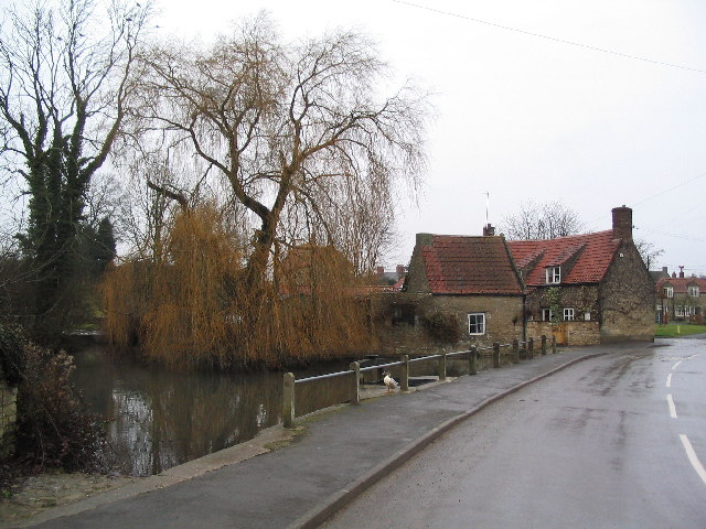
City map South Kesteven
David Johnson, CC BY-SA 4.0 – Wikimedia Commons
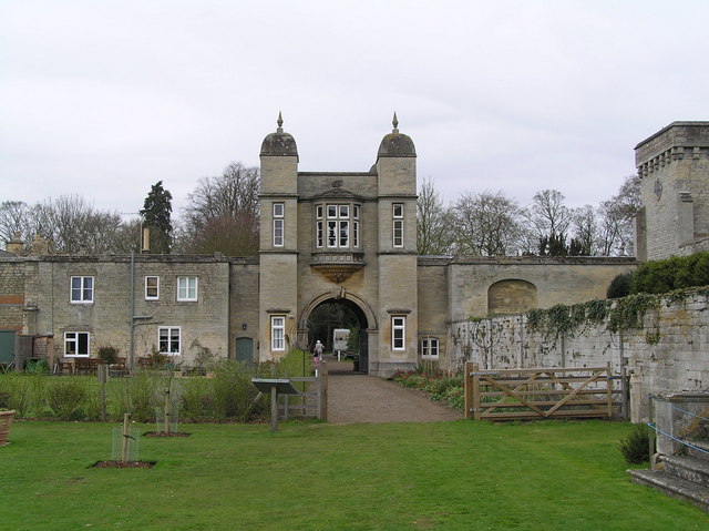
City map Market Deeping
James, CC BY-SA 2.0 – Wikimedia Commons

Market Deeping

Market Deeping is a civil parish in South Kesteven, Lincolnshire, with a recorded population of 6,801. The town lies in the Deepings area near the River Welland and forms part of the eastern lowlands of the district. Its position connects it with nearby Deeping St. James, West Deeping and Langtoft. The parish is mapped at administrative level 10.

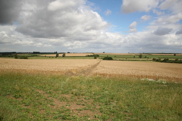
City map Langtoft
Stephen Horncastle, CC BY-SA 2.0 – Wikimedia Commons

Langtoft

Langtoft is a civil parish in South Kesteven with a population of 2,010. It lies close to Market Deeping and the River Welland in the eastern part of Lincolnshire. The parish belongs to the Deepings landscape of low-lying agricultural land. Langtoft is recorded at administrative level 10.

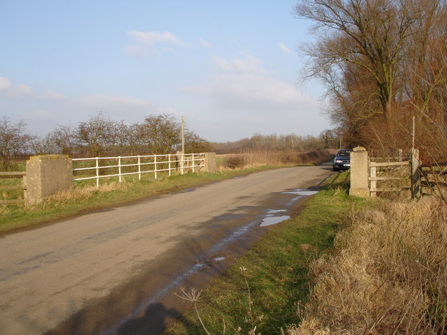
City map West Deeping
Paul Bragg, CC BY-SA 2.0 – Wikimedia Commons

West Deeping

West Deeping is a village and civil parish in Lincolnshire with 286 residents. It is situated west of Market Deeping and near the River Welland. The parish forms part of the group of settlements known as the Deepings. West Deeping is mapped at administrative level 10.

City map Deeping St. James
Uksignpix, CC BY-SA 3.0 – Wikimedia Commons

Deeping St. James

Deeping St. James is a village and civil parish in South Kesteven with a population of 7,272. It lies beside the River Welland, immediately east of Market Deeping, in the fen-edge landscape of eastern Lincolnshire. The parish is one of the larger settlements in the Deepings area. It is recorded at administrative level 10.

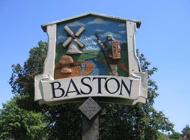
City map Baston
Rodney Burton, CC BY-SA 2.0 – Wikimedia Commons

Baston

Baston is a village in Lincolnshire with 1,577 residents. It lies south of the Deepings and close to the fenland edge of South Kesteven. The surrounding area includes low-lying farmland and drainage channels associated with the Lincolnshire fen landscape. Baston is mapped as an administrative level 10 parish.

City map Stamford
Richard Humphrey, CC BY-SA 2.0 – Wikimedia Commons

Stamford

Stamford is a civil parish and the largest town listed here, with a population of 20,750. The town stands on the River Welland and is noted for its extensive historic stone architecture, including medieval churches and Georgian buildings. Stamford lies near the borders with Rutland and Cambridgeshire. Its historic centre is one of Lincolnshire’s best-preserved urban areas.

City map Uffington
al partington, CC BY-SA 2.0 – Wikimedia Commons

Uffington

Uffington is a civil parish in Lincolnshire with 661 residents. It lies east of Stamford in the valley and catchment of the River Welland. The parish is surrounded by agricultural land and is connected to the wider Stamford and Deepings area. Uffington is recorded at administrative level 10.

City map Tallington
Rodney Burton, CC BY-SA 2.0 – Wikimedia Commons

Tallington

Tallington is a civil parish in South Kesteven with 1,040 residents. It lies near the River Welland and the railway corridor between Peterborough and Stamford. The village occupies a lowland position east of Stamford. Tallington is mapped at administrative level 10.

City map Braceborough and Wilsthorpe
Tim Heaton, CC BY-SA 2.0 – Wikimedia Commons

Braceborough and Wilsthorpe

Braceborough and Wilsthorpe is a civil parish in South Kesteven with 303 residents. The two settlements lie in the rural eastern part of the district, north of Bourne. The parish is surrounded by cultivated Lincolnshire farmland. It is recorded at administrative level 10.

City map Greatford
Bill Dunnakey, CC BY-SA 2.0 – Wikimedia Commons

Greatford

Greatford is a civil parish in South Kesteven with 255 residents. It lies north of Bourne in the drainage basin of the River Glen. The parish is a small rural settlement within the central Lincolnshire lowlands. Greatford is mapped at administrative level 10.

City map Haconby
Terry Butcher, CC BY-SA 2.0 – Wikimedia Commons

Haconby

Haconby is a civil parish in South Kesteven with 483 residents. It lies north of Bourne near the River Glen and the western margin of the Lincolnshire fenlands. The surrounding land is predominantly agricultural. Haconby is recorded at administrative level 10.

City map Bourne
Rex Needle, CC BY-SA 2.0 – Wikimedia Commons

Bourne

Bourne is a civil parish and market town with a population of 17,988. The town lies at the western edge of the fenlands, where springs rise near the limestone uplands and feed local watercourses. Bourne is known for Bourne Abbey and its association with the medieval bishop and theologian Robert Manning. The town is an important settlement in central South Kesteven.

City map Thurlby
Tony Atkin, CC BY-SA 2.0 – Wikimedia Commons

Thurlby

Thurlby is a village and civil parish in South Kesteven with 2,140 residents. It lies immediately south of Bourne near the fen edge and the A15 corridor. The parish includes lowland farmland and access to the wider Bourne area. Thurlby is recorded at administrative level 10.

City map Rippingale
Rodney Burton, CC BY-SA 2.0 – Wikimedia Commons

Rippingale

Rippingale is a civil parish in South Kesteven with a population of 941. It lies north-east of Bourne within the rural landscape between the River Glen and the fenlands. The parish is surrounded by agricultural fields and drainage channels. Rippingale is mapped at administrative level 10.

City map Dunsby
Kate Jewell, CC BY-SA 2.0 – Wikimedia Commons

Dunsby

Dunsby is a civil parish in South Kesteven with 124 residents. It lies near Rippingale and Billingborough in the agricultural countryside of central Lincolnshire. The settlement is part of the rural drainage landscape around the River Glen. Dunsby is recorded at administrative level 10.

Morton & Hanthorpe

Morton & Hanthorpe is a civil parish in South Kesteven with 2,515 residents. It lies east of Bourne and includes settlements within the fen-edge countryside. The parish is connected to the local road network around Bourne and Billingborough. It is mapped at administrative level 10.

City map Dowsby
Rodney Burton, CC BY-SA 2.0 – Wikimedia Commons

Dowsby

Dowsby is a civil parish in South Kesteven with 195 residents. It lies in the agricultural countryside north-east of Bourne. The parish is situated close to Rippingale and other small settlements of the River Glen catchment. Dowsby is recorded at administrative level 10.

City map Horbling
Donnylad, CC BY-SA 2.0 – Wikimedia Commons

Horbling

Horbling is a civil parish in South Kesteven with 472 residents. It lies near the River Glen and the settlement of Billingborough in central Lincolnshire. The parish consists of a small village surrounded by cultivated lowland. Horbling is mapped at administrative level 10.

City map Billingborough
Rodney Burton, CC BY-SA 2.0 – Wikimedia Commons

Billingborough

Billingborough is a civil parish in South Kesteven with a population of 1,390. It lies beside the River Glen between Bourne and Folkingham. The village is part of the fen-edge agricultural zone of Lincolnshire. Billingborough is recorded at administrative level 10.

City map Pointon and Sempringham
Rodney Burton, CC BY-SA 2.0 – Wikimedia Commons

Pointon and Sempringham

Pointon and Sempringham is a civil parish in South Kesteven with 533 residents. It lies north-east of Billingborough in the flat agricultural landscape near the River Glen. Sempringham is historically associated with the medieval Gilbertine religious order founded by Saint Gilbert of Sempringham. The parish is mapped at administrative level 10.

City map Careby Aunby and Holywell
Tim Heaton, CC BY-SA 2.0 – Wikimedia Commons

Careby Aunby and Holywell

Careby Aunby and Holywell is a civil parish in South Kesteven with 148 residents. It lies west of Bourne in the rolling countryside near the Lincolnshire limestone belt. The three settlements occupy a rural area between Stamford and the River Glen. The parish is recorded at administrative level 10.

City map Little Bytham
Tim Heaton, CC BY-SA 2.0 – Wikimedia Commons

Little Bytham

Little Bytham is a village in South Kesteven with 317 residents. It lies on the River West Glen between Stamford and Bourne. The village is part of the limestone and clay countryside of western Lincolnshire. Little Bytham is mapped at administrative level 10.

City map Toft with Lound and Manthorpe
Mat Fascione, CC BY-SA 2.0 – Wikimedia Commons

Toft with Lound and Manthorpe

Toft with Lound and Manthorpe is a civil parish in South Kesteven with 302 residents. It lies north-west of Bourne in the rural landscape around the River Glen. The parish includes three named settlements within the central Lincolnshire countryside. It is recorded at administrative level 10.

City map Witham on the Hill
Tim Heaton, CC BY-SA 2.0 – Wikimedia Commons

Witham on the Hill

Witham on the Hill is a village in Lincolnshire with 242 residents. It lies south-west of Bourne on the higher ground between the River Glen and the limestone uplands. The parish is surrounded by farmland and small rural communities. Witham on the Hill is mapped at administrative level 10.

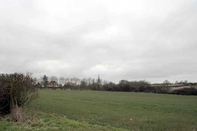
City map Carlby
Uksignpix, CC BY-SA 3.0 – Wikimedia Commons

Carlby

Carlby is a village in South Kesteven with 533 residents. It lies north of Stamford near the River Welland and the Lincolnshire–Rutland border area. The settlement is surrounded by agricultural land and connected with the villages of Greatford and Uffington. Carlby is recorded at administrative level 10.

City map Irnham
Andrew Tatlow, CC BY-SA 2.0 – Wikimedia Commons

Irnham

Irnham is a civil parish in South Kesteven with 168 residents. It lies west of Bourne in the rolling limestone countryside near the River Glen. The village is known for Irnham Hall, a historic country house in the parish. Irnham is mapped at administrative level 10.

City map North Witham
Tim Heaton, CC BY-SA 2.0 – Wikimedia Commons

North Witham

North Witham is a civil parish in South Kesteven with 161 residents. It lies in the western part of the district near the River Witham and the Lincolnshire limestone uplands. The parish is rural and closely associated with South Witham and Colsterworth. North Witham is recorded at administrative level 10.

City map Counthorpe and Creeton
Bob Harvey, CC BY-SA 2.0 – Wikimedia Commons

Counthorpe and Creeton

Counthorpe and Creeton is a civil parish in South Kesteven with 83 residents. It lies west of Bourne in the limestone countryside near the River Glen. The parish contains two small settlements within a predominantly agricultural landscape. It is mapped at administrative level 10.

City map Corby Glen
Tim Heaton, CC BY-SA 2.0 – Wikimedia Commons

Corby Glen

Corby Glen is a village and civil parish in South Kesteven with 1,008 residents. It lies in the valley of the River Glen, west of Bourne and south of Grantham. The village is located in the rolling countryside of the Lincolnshire limestone belt. Corby Glen is recorded at administrative level 10.

City map Colsterworth
Toby Speight, CC BY-SA 2.0 – Wikimedia Commons

Colsterworth

Colsterworth is a village and civil parish in Lincolnshire with 1,821 residents. It lies beside the River Witham and the A1, south of Grantham. The village is associated with Isaac Newton, who was born at nearby Woolsthorpe. Colsterworth is mapped at administrative level 10.

City map Castle Bytham
Tim Heaton, CC BY-SA 2.0 – Wikimedia Commons

Castle Bytham

Castle Bytham is a civil parish in South Kesteven with 740 residents. It lies in the valley of the River West Glen between Stamford and Grantham. The village takes its name from the medieval castle whose earthworks remain above the settlement. Castle Bytham is recorded at administrative level 10.

City map Swayfield
Tim Heaton, CC BY-SA 2.0 – Wikimedia Commons

Swayfield

Swayfield is a civil parish in South Kesteven with 308 residents. It lies near Castle Bytham and the River West Glen in western Lincolnshire. The surrounding area contains rolling farmland and limestone villages. Swayfield is mapped at administrative level 10.

City map Kirkby Underwood
Tony Atkin, CC BY-SA 2.0 – Wikimedia Commons

Kirkby Underwood

Kirkby Underwood is a village in South Kesteven with 193 residents. It lies north of Bourne in the rural countryside near the Lincolnshire limestone escarpment. The village is surrounded by farmland and small parish settlements. Kirkby Underwood is recorded at administrative level 10.

City map Easton
thorpe, CC BY-SA 2.0 – Wikimedia Commons

Easton

Easton is a village and civil parish in South Kesteven with 90 residents. It lies in the countryside west of Bourne near the upper reaches of the River Glen. The parish is one of the smallest by population in the district. Easton is mapped at administrative level 10.

City map Swinstead
Tim Heaton, CC BY-SA 2.0 – Wikimedia Commons

Swinstead

Swinstead is a civil parish in South Kesteven with 222 residents. It lies near Corby Glen and the River Glen in the western Lincolnshire countryside. The parish is surrounded by rolling agricultural land. Swinstead is recorded at administrative level 10.

City map Edenham
Mark Hurn, CC BY-SA 2.0 – Wikimedia Commons

Edenham

Edenham is a village and civil parish in South Kesteven with 333 residents. It lies near the River Glen, north-west of Bourne. Edenham is associated with Edenham Regional Park and the historic Edenham Hall estate. The parish is mapped at administrative level 10.

City map South Witham
Steve F, CC BY-SA 2.0 – Wikimedia Commons

South Witham

South Witham is a village and civil parish in South Kesteven with 1,589 residents. It lies on the River Witham near the southern boundary of Lincolnshire and close to the A1. The village is surrounded by wooded and agricultural countryside. South Witham is recorded at administrative level 10.

City map Gunby and Stainby
John Sutton, CC BY-SA 2.0 – Wikimedia Commons

Gunby and Stainby

Gunby and Stainby is a civil parish in South Kesteven with 134 residents. It lies near the River Witham and Colsterworth in the western part of Lincolnshire. The parish contains two small rural settlements and agricultural land. It is mapped at administrative level 10.

City map Burton Coggles
Stuart and Fiona Jackson, CC BY-SA 2.0 – Wikimedia Commons

Burton Coggles

Burton Coggles is a village and civil parish in Lincolnshire with 112 residents. It lies north-west of Bourne near the River Witham and the limestone countryside. The parish is a small rural community surrounded by farmland. Burton Coggles is recorded at administrative level 10.

City map Skillington
Kate Jewell, CC BY-SA 2.0 – Wikimedia Commons

Skillington

Skillington is a civil parish in South Kesteven with 314 residents. It lies near the River Witham in the western Lincolnshire countryside. The village is positioned between Colsterworth and Grantham. Skillington is mapped at administrative level 10.

City map Pickworth
Bob Danylec, CC BY-SA 2.0 – Wikimedia Commons

Pickworth

Pickworth is a civil parish in South Kesteven with 153 residents. It lies north of Stamford in the rolling agricultural landscape near the Lincolnshire limestone belt. The parish is close to Careby and Little Bytham. Pickworth is recorded at administrative level 10.

City map Folkingham
Bob Harvey, CC BY-SA 2.0 – Wikimedia Commons

Folkingham

Folkingham is a civil parish in South Kesteven with 781 residents. It lies north-east of Bourne and near the River Glen in central Lincolnshire. The village contains the remains of Folkingham Castle, a medieval castle site. Folkingham is mapped at administrative level 10.

City map Old Somerby
Richard Croft, CC BY-SA 2.0 – Wikimedia Commons

Old Somerby

Old Somerby is a civil parish in South Kesteven with 216 residents. It lies east of Grantham in the rolling countryside of the district. The parish is close to Ropsley and the A52 corridor. Old Somerby is recorded at administrative level 10.

City map Ingoldsby
Bob Danylec, CC BY-SA 2.0 – Wikimedia Commons

Ingoldsby

Ingoldsby is a civil parish in South Kesteven with 285 residents. It lies south-east of Grantham near the limestone uplands and the River Witham catchment. The parish is surrounded by farmland and small villages. Ingoldsby is mapped at administrative level 10.

City map Boothby Pagnell
Bob Danylec, CC BY-SA 2.0 – Wikimedia Commons

Boothby Pagnell

Boothby Pagnell is a village in Lincolnshire with 134 residents. It lies east of Grantham in the agricultural countryside near the River Witham. The village is noted for Boothby Pagnell Hall, a medieval stone manor house. Boothby Pagnell is recorded at administrative level 10.

City map Ropsley and Humby
Kate Jewell, CC BY-SA 2.0 – Wikimedia Commons

Ropsley and Humby

Ropsley and Humby is a civil parish in South Kesteven with 807 residents. It lies east of Grantham on the edge of the Lincolnshire Wolds and near the A52. The parish includes two settlements surrounded by arable farmland. It is mapped at administrative level 10.

City map Bitchfield and Bassingthorpe
Richard Croft, CC BY-SA 2.0 – Wikimedia Commons

Bitchfield and Bassingthorpe

Bitchfield and Bassingthorpe is a civil parish in South Kesteven with 145 residents. It lies south-east of Grantham in the rolling countryside of the River Witham catchment. The two villages are surrounded by agricultural land and small country lanes. The parish is recorded at administrative level 10.

City map Braceby and Sapperton
Kate Jewell, CC BY-SA 2.0 – Wikimedia Commons

Braceby and Sapperton

Braceby and Sapperton is a civil parish in South Kesteven with 62 residents. It lies east of Grantham in the rural limestone landscape of central Lincolnshire. The parish contains two small settlements and extensive farmland. It is mapped at administrative level 10.

City map Aslackby and Laughton
Roger Callow, CC BY-SA 2.0 – Wikimedia Commons

Aslackby and Laughton

Aslackby and Laughton is a civil parish in Lincolnshire with 257 residents. It lies north-east of Bourne near the River Glen and the fen-edge agricultural zone. The parish includes two rural settlements connected by local roads. Aslackby and Laughton is recorded at administrative level 10.

City map Lenton Keisby and Osgodby
Kate Jewell, CC BY-SA 2.0 – Wikimedia Commons

Lenton Keisby and Osgodby

Lenton Keisby and Osgodby is a civil parish in South Kesteven with 158 residents. It lies north-east of Bourne in the flat countryside around the River Glen. The parish contains three small settlements within an agricultural landscape. It is mapped at administrative level 10.

City map Barholm and Stowe
Bill Dunnakey, CC BY-SA 2.0 – Wikimedia Commons

Barholm and Stowe

Barholm and Stowe is a civil parish in Lincolnshire with 178 residents. It lies north of Stamford near the River Welland and the border with Rutland. The parish contains two rural settlements surrounded by farmland. Barholm and Stowe is recorded at administrative level 10.

City map Stoke Rochford
Kate Jewell, CC BY-SA 2.0 – Wikimedia Commons

Stoke Rochford

Stoke Rochford is a village in Lincolnshire with 127 residents. It lies south of Grantham near the River Witham and the A1 corridor. The village is associated with Stoke Rochford Hall, a historic country house and estate. Stoke Rochford is mapped at administrative level 10.

City map Londonthorpe and Harrowby Without
Richard Croft, CC BY-SA 2.0 – Wikimedia Commons

Londonthorpe and Harrowby Without

Londonthorpe and Harrowby Without is a civil parish in South Kesteven with 5,026 residents. It lies on the northern and eastern outskirts of Grantham, the district’s principal urban centre. The parish includes countryside around Londonthorpe and the suburban area beyond Harrowby. It is recorded at administrative level 10.

City map Little Ponton and Stroxton
Kate Jewell, CC BY-SA 2.0 – Wikimedia Commons

Little Ponton and Stroxton

Little Ponton and Stroxton is a civil parish in South Kesteven with 156 residents. It lies south of Grantham near the River Witham and the A1. The two settlements occupy a rural corridor between Grantham and Great Ponton. The parish is mapped at administrative level 10.

City map Great Ponton
Kate Jewell, CC BY-SA 2.0 – Wikimedia Commons

Great Ponton

Great Ponton is a civil parish in South Kesteven with 408 residents. It lies south of Grantham beside the River Witham and close to the A1. The village is situated in the wooded and agricultural countryside of western Lincolnshire. Great Ponton is recorded at administrative level 10.

City map Barrowby
Kate Jewell, CC BY-SA 2.0 – Wikimedia Commons

Barrowby

Barrowby is a civil parish in South Kesteven with 2,041 residents. It lies west of Grantham near the River Witham and the edge of the Vale of Belvoir. The village is connected with Grantham by local roads and lies near the A1. Barrowby is mapped at administrative level 10.

City map Wyville cum Hungerton
Kate Jewell, CC BY-SA 2.0 – Wikimedia Commons

Wyville cum Hungerton

Wyville cum Hungerton is a civil parish in South Kesteven with 47 residents. It lies west of Grantham near the Lincolnshire border with Leicestershire. The parish contains two very small rural settlements in the Vale of Belvoir landscape. It is recorded at administrative level 10.

City map Woolsthorpe By Belvoir
Russ Hamer, CC BY-SA 3.0 – Wikimedia Commons

Woolsthorpe By Belvoir

Woolsthorpe By Belvoir is a village in Lincolnshire with 468 residents. It lies in the Vale of Belvoir near the River Witham and the border with Leicestershire. Woolsthorpe Manor, the birthplace of Isaac Newton in 1642, stands in the village. The settlement is recorded at administrative level 10.

City map Harlaxton
Kate Jewell, CC BY-SA 2.0 – Wikimedia Commons

Harlaxton

Harlaxton is a civil parish in South Kesteven with 846 residents. It lies west of Grantham near the Vale of Belvoir and the A1. Harlaxton Manor is a prominent nineteenth-century country house and is associated with the University of Evansville’s British campus. The parish is mapped at administrative level 10.

City map Denton
Richard Croft, CC BY-SA 2.0 – Wikimedia Commons

Denton

Denton is a village and civil parish in Lincolnshire with 277 residents. It lies south-west of Grantham in the rolling countryside near the River Witham. The parish is close to Harlaxton and the Vale of Belvoir. Denton is recorded at administrative level 10.

Data sources: OpenStreetMap (ODbL), Wikidata (CC0) · Image: Wikimedia Commons

South Kesteven – Facts

Inhabitants 141853
Area 942.6 km²
Subregions 84
Inception 1974
Located in Lincolnshire
Country United Kingdom
Has part Bourne, Aslackby and Laughton, Barholm and Stowe, Baston, Billingborough, Braceborough and Wilsthorpe, Careby Aunby and Holywell, Carlby, Castle Bytham, Corby Glen, Counthorpe and Creeton, Deeping St James, Dowsby, Dunsby, Edenham, Folkingham, Greatford, Haconby, Horbling, Irnham, Kirkby Underwood, Langtoft, Little Bytham, Market Deeping, Morton and Hanthorpe, Pointon and Sempringham, Rippingale, Swayfield, Swinstead, Tallington, Thurlby, Toft with Lound and Manthorpe, Uffington, West Deeping, Witham on the Hill, Stamford, Grantham, Allington, Barkston, Barrowby, Belton and Manthorpe, Bitchfield and Bassingthorpe, Boothby Pagnell, Braceby and Sapperton, Burton Coggles, Carlton Scroop, Caythorpe, Claypole, Colsterworth, Denton, Easton, Fenton, Foston, Fulbeck, Great Gonerby, Great Ponton, Gunby and Stainby, Harlaxton, Heydour, Honington, Hough-on-the-Hill, Hougham, Ingoldsby, Lenton, Keisby and Osgodby, Little Ponton and Stroxton, Londonthorpe and Harrowby Without, Long Bennington, Marston, Normanton, North Witham, Old Somerby, Pickworth, Ropsley and Humby, Sedgebrook, Skillington, South Witham, Stubton, Syston, Welby, Westborough and Dry Doddington, Woolsthorpe by Belvoir, Wyville cum Hungerton, Stoke Rochford
Website http://www.southkesteven.gov.uk/

Data source: Wikidata (CC0)