West Lindsey

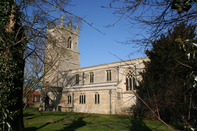
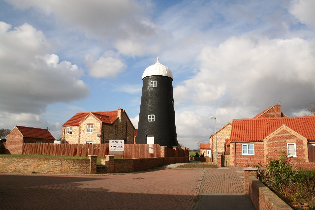
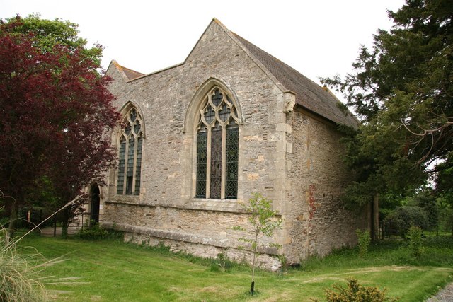
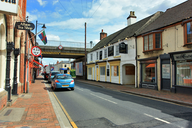
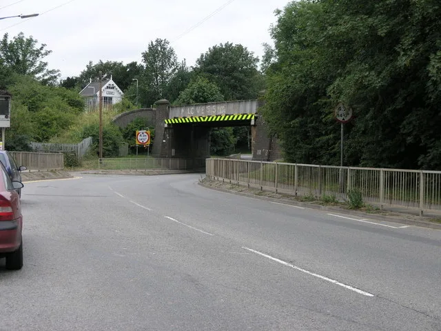
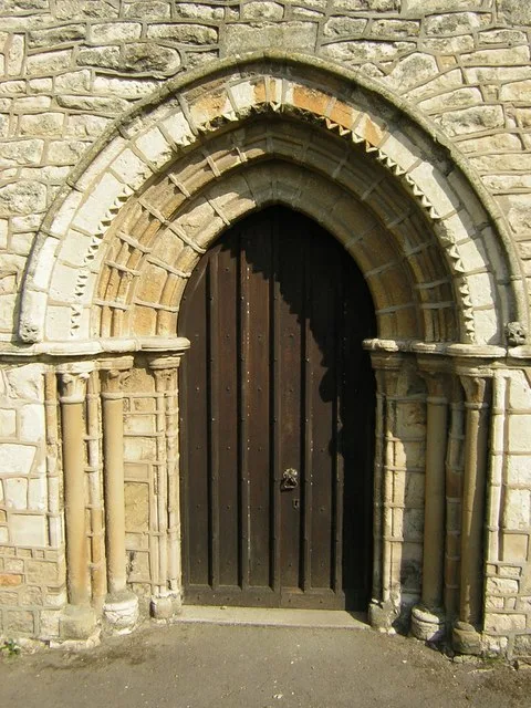
This page is the City map of West Lindsey, a local government district in Lincolnshire, England, showing streets, paths and places across the region. West Lindsey covers approximately 1,155.7 square kilometres and had about 94,869 residents in 2018. Population estimates increased from 90,000 in 2012 to 96,817 in 2022. Created in 1974, the district is divided into 128 subregions and includes the River Trent, the Lincolnshire Wolds and the towns of Gainsborough, Caistor and Market Rasen.

City map West Lindsey
Chris Coleman, CC BY-SA 2.0 – Wikimedia Commons
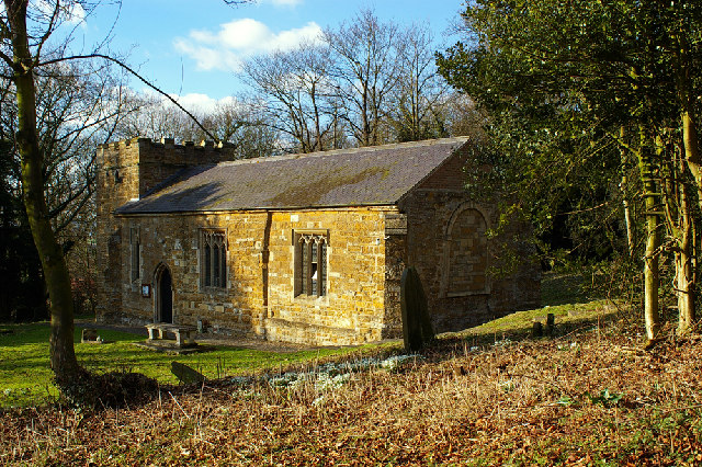
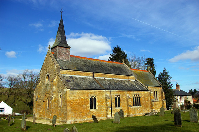
City map Aisthorpe
Richard Croft, CC BY-SA 2.0 – Wikimedia Commons

Aisthorpe

Aisthorpe is a village and civil parish area in West Lindsey, Lincolnshire. The subregion has admin level 10 and a recorded population of 88. It lies in the rural landscape north of Lincoln. The local map identifies Aisthorpe alongside the roads and paths connecting nearby Lincolnshire settlements.

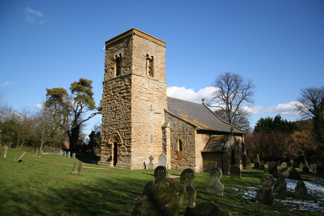
City map Broadholme
Richard Croft, CC BY-SA 2.0 – Wikimedia Commons

Broadholme

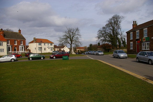
Broadholme is a village in Lincolnshire, England, within West Lindsey. Its recorded population is 83 and its administrative level is 10. The settlement is situated in the countryside north of Lincoln. Streets and paths around Broadholme connect it with neighbouring rural communities.

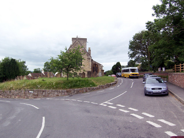
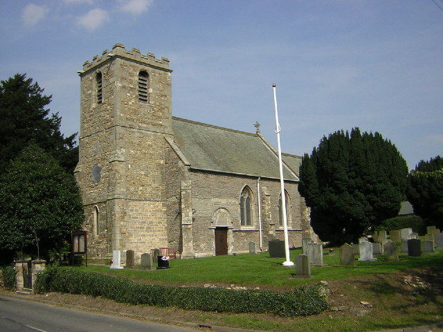
City map Gainsborough CP
Chris Coleman, CC BY-SA 2.0 – Wikimedia Commons

Gainsborough CP

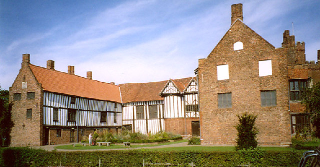
Gainsborough is a town and civil parish on the River Trent in West Lindsey, Lincolnshire. The civil parish has a recorded population of 20,536 and an area of 6,722,000 square metres. Gainsborough is known for Gainsborough Old Hall, a major medieval brick building associated with the Burgh family. The town’s streets and paths connect the centre with the Trent waterfront and surrounding settlements.

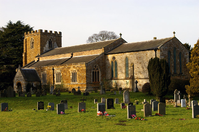
City map Scotter CP
David Wright, CC BY-SA 2.0 – Wikimedia Commons

Scotter CP

Scotter is a village and civil parish in West Lindsey, Lincolnshire. It has a recorded population of 3,167 and admin level 10 status. The settlement stands near the River Eau and the north Lincolnshire countryside. Local roads connect Scotter with Gainsborough and nearby villages.

City map Scotton CP
David Wright, CC BY-SA 2.0 – Wikimedia Commons

Scotton CP

Scotton is a village and civil parish in West Lindsey, Lincolnshire. Its recorded population is 611. The settlement lies close to Scotter and the River Eau in the northern part of the district. The map covers Scotton’s local streets and paths within this rural setting.

City map East Ferry CP
Jon Clark, CC BY-SA 2.0 – Wikimedia Commons

East Ferry CP

East Ferry is a village and civil parish in Lincolnshire with a recorded population of 132. It lies in the low-lying countryside east of the River Trent. The area is associated with the Trent floodplain and the waterways of the Isle of Axholme. Local roads and paths link East Ferry with neighbouring river settlements.

City map Laughton CP
Richard Croft, CC BY-SA 2.0 – Wikimedia Commons

Laughton CP

Laughton is a village and civil parish in West Lindsey, Lincolnshire. The recorded population is 417. It stands in the rural landscape west of the Lincolnshire Wolds and east of the River Trent. Streets and paths in Laughton connect the settlement with nearby villages and farmland.

City map Northorpe CP
Richard Croft, CC BY-SA 2.0 – Wikimedia Commons

Northorpe CP

Northorpe is a village and civil parish in West Lindsey, Lincolnshire. It has a recorded population of 140. The settlement is located in the northern countryside near the villages of Scotter and Blyton. Its local road network serves a small rural community.

City map East Stockwith CP
Dave Hitchborne, CC BY-SA 2.0 – Wikimedia Commons

East Stockwith CP

East Stockwith is a village and civil parish in Lincolnshire with a population of 222. It lies close to the River Trent and the settlement of West Stockwith. The area forms part of the flat river landscape in northern West Lindsey. Roads and paths provide access to the Trent-side communities.

City map Wildsworth CP
David Wright, CC BY-SA 2.0 – Wikimedia Commons

Wildsworth CP

Wildsworth is a village in Lincolnshire with a recorded population of 81. It is situated in the rural north of West Lindsey near the River Trent. The settlement forms part of the low-lying landscape around the Isle of Axholme. Local streets and paths connect Wildsworth with nearby hamlets.

City map Blyton CP
The original uploader was Asterion at English Wikipedia ., CC BY-SA 2.5 – Wikimedia Commons

Blyton CP

Blyton is a village in Lincolnshire and has a recorded population of 607. It lies north of Gainsborough in the countryside between the River Trent and the Lincolnshire Wolds. The village is close to Blyton Park, a motor-racing circuit on a former airfield. Local roads connect Blyton with Scotter, Corringham and Gainsborough.

City map Walkerith CP
Richard Croft, CC BY-SA 2.0 – Wikimedia Commons

Walkerith CP

Walkerith is a settlement and civil parish in Lincolnshire. Its recorded population is 71. The parish lies near the River Trent in the northern part of West Lindsey. Roads and paths around Walkerith cross a predominantly agricultural landscape.

City map Morton CP
Richard Croft, CC BY-SA 2.0 – Wikimedia Commons

Morton CP

Morton is a village and civil parish in West Lindsey, Lincolnshire, with a recorded population of 1,372. It lies near the Trent valley and the town of Gainsborough. The village is served by local roads leading towards Blyton, Walkerith and other northern settlements. Its map area includes streets and paths through the surrounding farmland.

City map Thonock CP
Jonathan Billinger, CC BY-SA 2.0 – Wikimedia Commons

Thonock CP

Thonock is a settlement in Lincolnshire with a recorded population of 37. It is located immediately north of Gainsborough in the rural Trent valley. The parish includes countryside and routes adjoining the town. Local roads and paths provide links between Thonock and Gainsborough.

City map Bigby CP
Richard Croft, CC BY-SA 2.0 – Wikimedia Commons

Bigby CP

Bigby is a village and civil parish in Lincolnshire with a population of 454. It lies on the southern edge of the Lincolnshire Wolds, near the Ancholme valley. The village is close to Brigg and the River Ancholme. Local streets and paths connect Bigby with Somerby, Kettleby and neighbouring Wolds settlements.

City map Somerby CP
David Wright, CC BY-SA 2.0 – Wikimedia Commons

Somerby CP

Somerby is a hamlet and civil parish near Bigby in West Lindsey, Lincolnshire. It has a recorded population of 46. The settlement lies on the western edge of the Lincolnshire Wolds near the Ancholme valley. Rural roads connect Somerby with Bigby and nearby villages.

City map Searby cum Owmby CP
David Wright, CC BY-SA 2.0 – Wikimedia Commons

Searby cum Owmby CP

Searby cum Owmby is a civil parish in Lincolnshire with a recorded population of 188. It lies on the western side of the Lincolnshire Wolds near the Ancholme valley. The parish includes the settlements of Searby and Owmby. Local roads and paths link the two communities with Bigby and Caistor.

City map Grasby CP
David Wright, CC BY-SA 2.0 – Wikimedia Commons

Grasby CP

Grasby is a village in Lincolnshire with a recorded population of 428. It stands on the western edge of the Lincolnshire Wolds, north of Caistor. The village overlooks the Ancholme valley and lies near the A1084 corridor. Local streets and paths connect Grasby with Searby, Owmby and neighbouring Wolds villages.

City map Brocklesby CP
David Wright, CC BY-SA 2.0 – Wikimedia Commons

Brocklesby CP

Brocklesby is a village and civil parish in Lincolnshire with a recorded population of 103. It lies near the Humber estuary and the Lincolnshire Wolds, west of Immingham. Brocklesby Park and Brocklesby Hall are notable features of the parish. Roads through the estate connect the village with Keelby, Great Limber and the A18.

City map Keelby CP
Richard Croft, CC BY-SA 2.0 – Wikimedia Commons

Keelby CP

Keelby is a village in Lincolnshire with a recorded population of 1,997. It lies west of Grimsby and south of the Humber estuary, close to the A18. The village is on the northern edge of the Lincolnshire Wolds. Local roads connect Keelby with Brocklesby, Great Limber and Grimsby.

City map Great Limber CP
David Wright, CC BY-SA 2.0 – Wikimedia Commons

Great Limber CP

Great Limber is a village in Lincolnshire with a recorded population of 254. It is situated near the northern edge of the Lincolnshire Wolds, west of Grimsby. The parish lies close to Brocklesby and the A18. Local streets and paths pass through the village and its surrounding agricultural land.

City map Riby CP
Richard Croft, CC BY-SA 2.0 – Wikimedia Commons

Riby CP

Riby is a village in Lincolnshire with a recorded population of 128. It lies on the northern side of the Lincolnshire Wolds near Great Limber and Keelby. The parish is within reach of Grimsby and the Humber-side industrial area. Rural roads connect Riby with surrounding Wolds villages.

City map Swallow CP
Richard Croft, CC BY-SA 2.0 – Wikimedia Commons

Swallow CP

Swallow is a village and civil parish in Lincolnshire with a recorded population of 188. It lies in the northern Lincolnshire Wolds, south-west of Grimsby. The parish is crossed by small rural roads leading towards Wold Newton and Caistor. Paths and streets serve the village and its agricultural surroundings.

City map Caistor TC
David Wright, CC BY-SA 2.0 – Wikimedia Commons

Caistor TC

Caistor is a town and civil parish in West Lindsey, Lincolnshire, with a recorded population of 3,095. It stands on the western escarpment of the Lincolnshire Wolds and developed around a Roman settlement. Caistor Roman Town includes surviving Roman walls and is a scheduled archaeological site. The town’s streets connect with Grasby, Nettleton, Clixby and the A46.

City map Cabourne CP
Jon Holland, CC BY-SA 2.0 – Wikimedia Commons

Cabourne CP

Cabourne is a hamlet and civil parish in Lincolnshire with a recorded population of 81. It lies in the Lincolnshire Wolds near Caistor and the valley of the River Ancholme. The parish is surrounded by agricultural land and small settlements. Local roads connect Cabourne with Clixby, Nettleton and Caistor.

City map South Kelsey CP
Bill Henderson, CC BY-SA 2.0 – Wikimedia Commons

South Kelsey CP

South Kelsey is a village and civil parish in Lincolnshire with a recorded population of 575. It lies in the Ancholme valley, north-east of Caistor. The settlement is close to North Kelsey and the River Ancholme. Local streets and paths connect South Kelsey with Waddingham and neighbouring villages.

City map North Kelsey CP
David Wright, CC BY-SA 2.0 – Wikimedia Commons

North Kelsey CP

North Kelsey is a village in Lincolnshire with a recorded population of 982. It stands beside the River Ancholme, east of the Lincolnshire Wolds. The village lies between Caistor and Lincolnshire’s northern market towns. Roads and paths connect North Kelsey with South Kelsey, Waddingham and Brandy Wharf.

City map Waddingham CP
Richard Croft, CC BY-SA 2.0 – Wikimedia Commons

Waddingham CP

Waddingham is a village in Lincolnshire with a recorded population of 603. It lies in the Ancholme valley near the River Ancholme and the town of Brigg. The village is east of the Lincolnshire Wolds. Local roads connect Waddingham with North Kelsey, South Kelsey and Brandy Wharf.

City map Grayingham CP
The original uploader was Asterion at English Wikipedia ., CC BY-SA 2.5 – Wikimedia Commons

Grayingham CP

Grayingham is a village in Lincolnshire with a recorded population of 130. It lies near the northern Lincolnshire Wolds and the Ancholme valley. The settlement is close to Waddingham, North Kelsey and the town of Brigg. Rural streets and paths serve the parish and its surrounding farmland.

City map Blyborough CP
Richard Croft, CC BY-SA 2.0 – Wikimedia Commons

Blyborough CP

Blyborough is a village in Lincolnshire with a recorded population of 110. It lies in the rural landscape between Caistor and Gainsborough, west of the Ancholme valley. The parish is close to Blyton and Corringham. Local roads provide access to the small village and nearby agricultural land.

City map Corringham CP
Richard Croft, CC BY-SA 2.0 – Wikimedia Commons

Corringham CP

Corringham is a village and civil parish in Lincolnshire with a recorded population of 461. It lies north of Gainsborough near Blyton and the River Trent. The village is part of the lowland countryside between the Trent valley and the Lincolnshire Wolds. Local roads connect Corringham with Blyborough, Blyton and Lea.

City map Willoughton CP
Richard Croft, CC BY-SA 2.0 – Wikimedia Commons

Willoughton CP

Willoughton is a village in Lincolnshire with a recorded population of 312. It stands in the countryside west of the Lincolnshire Wolds, near Corringham and Blyborough. The settlement lies within the rural north of West Lindsey. Local paths and roads connect Willoughton with neighbouring parishes.

City map Pilham CP
Richard Croft, CC BY-SA 2.0 – Wikimedia Commons

Pilham CP

Pilham is a village and civil parish in Lincolnshire with a recorded population of 60. It lies near the Trent valley and the rural settlements around Gainsborough. The parish is close to Lea and Knaith. Local roads and paths serve the small settlement and surrounding farmland.

City map Snitterby CP
David Wright, CC BY-SA 2.0 – Wikimedia Commons

Snitterby CP

Snitterby is a village in Lincolnshire with a recorded population of 230. It lies west of the Lincolnshire Wolds, near Bishop Norton and Willoughton. The parish is situated in the rural area between the River Trent and the Ancholme valley. Local roads connect Snitterby with neighbouring villages.

City map Bishop Norton CP
thorpe, CC BY-SA 2.0 – Wikimedia Commons

Bishop Norton CP

Bishop Norton is a village and civil parish in Lincolnshire with a recorded population of 343. It lies close to the River Ancholme and the northern Lincolnshire Wolds. The village is near Snitterby, Owersby and North Kelsey. Its streets and paths serve a mainly agricultural parish.

City map Owersby CP
Richard Croft, CC BY-SA 2.0 – Wikimedia Commons

Owersby CP

Owersby is a civil parish in Lincolnshire with a recorded population of 277. It lies in the countryside west of the Lincolnshire Wolds, close to Bishop Norton and Nettleton. The parish is part of the rural area north of Market Rasen. Local roads link Owersby with nearby Wolds villages.

City map Holton le Moor CP
Dave Hitchborne, CC BY-SA 2.0 – Wikimedia Commons

Holton le Moor CP

Holton le Moor is a village and civil parish in Lincolnshire with a recorded population of 178. It lies close to the River Ancholme and the eastern edge of the Lincolnshire Wolds. The parish is near Nettleton and Caistor. Local roads and paths connect the village with nearby rural settlements.

City map Nettleton CP
John Beal, CC BY-SA 2.0 – Wikimedia Commons

Nettleton CP

Nettleton is a village and civil parish in Lincolnshire with a recorded population of 706. It lies on the western edge of the Lincolnshire Wolds, south of Caistor. Nettleton Beck runs through the local landscape towards the Ancholme valley. Streets and paths connect Nettleton with Holton le Moor, Claxby and Caistor.

City map Claxby CP
David Wright, CC BY-SA 2.0 – Wikimedia Commons

Claxby CP

Claxby is a village and civil parish in West Lindsey, Lincolnshire, with a recorded population of 159. It lies in the northern Lincolnshire Wolds near Nettleton and Normanby le Wold. The village is close to the Wolds escarpment and the route between Caistor and Market Rasen. Local roads serve the village and its surrounding farmland.

City map Normanby le Wold CP
David Wright, CC BY-SA 2.0 – Wikimedia Commons

Normanby le Wold CP

Normanby le Wold is a village in Lincolnshire with a recorded population of 50. It stands on the Lincolnshire Wolds near the Wolds escarpment and Caistor. The parish lies close to Claxby and the upper Ancholme valley. Rural roads and paths cross the small settlement and surrounding farmland.

City map Osgodby CP
Richard Croft, CC BY-SA 2.0 – Wikimedia Commons

Osgodby CP

Osgodby is a village and civil parish in West Lindsey, Lincolnshire, with a recorded population of 579. It lies near Market Rasen and the western edge of the Lincolnshire Wolds. The village is close to the River Rase and the settlements of Walesby and Middle Rasen. Local roads connect Osgodby with Market Rasen and neighbouring parishes.

City map Walesby CP
Chris McKenna ( Thryduulf ( talk )), CC BY-SA 4.0 – Wikimedia Commons

Walesby CP

Walesby is a village and civil parish in Lincolnshire with a recorded population of 225. It lies in the Lincolnshire Wolds, north-east of Market Rasen. The settlement is close to Osgodby, Rothwell and the River Rase. Streets and paths provide local connections through the Wolds countryside.

City map Thoresway CP
David Wright, CC BY-SA 2.0 – Wikimedia Commons

Thoresway CP

Thoresway is a village and civil parish in Lincolnshire with a recorded population of 102. It lies in the northern Lincolnshire Wolds near Walesby and Stainton le Vale. The parish is part of the rural upland landscape north of Market Rasen. Local roads connect Thoresway with nearby Wolds settlements.

City map Rothwell CP
Richard Croft, CC BY-SA 2.0 – Wikimedia Commons

Rothwell CP

Rothwell is a village and civil parish in Lincolnshire with a recorded population of 230. It lies in the Lincolnshire Wolds near Walesby and Thoresway. The settlement is north-east of Market Rasen and close to the headwaters of local streams. Rural streets and paths serve the village and surrounding farmland.

City map Thorganby CP
Dave Hitchborne, CC BY-SA 2.0 – Wikimedia Commons

Thorganby CP

Thorganby is a village and civil parish in Lincolnshire with a recorded population of 36. It lies in the northern Lincolnshire Wolds near Stainton le Vale and Swinhope. The small parish is surrounded by Wolds farmland. Local roads connect Thorganby with neighbouring villages.

City map Stainton le Vale CP
Richard Croft, CC BY-SA 2.0 – Wikimedia Commons

Stainton le Vale CP

Stainton le Vale is a village in Lincolnshire with a recorded population of 66. It lies in the Lincolnshire Wolds near Thorganby and Swinhope. The parish is situated north-east of Caistor and west of the coastal plain. Local streets and paths cross the small Wolds settlement.

City map Swinhope CP
Richard Croft, CC BY-SA 2.0 – Wikimedia Commons

Swinhope CP

Swinhope is a village and civil parish in West Lindsey, Lincolnshire, with a recorded population of 147. It lies in the northern Lincolnshire Wolds near Stainton le Vale and Thoresway. The parish is part of the upland countryside north of Market Rasen. Roads and paths connect Swinhope with nearby Wolds communities.

City map Springthorpe CP
Richard Croft, CC BY-SA 2.0 – Wikimedia Commons

Springthorpe CP

Springthorpe is a village in Lincolnshire with a recorded population of 124. It lies west of Market Rasen, near the River Rase and the western edge of the Lincolnshire Wolds. The settlement is close to Upton and Willoughton. Local roads connect Springthorpe with the surrounding agricultural parishes.

City map Heapham CP
Richard Croft, CC BY-SA 2.0 – Wikimedia Commons

Heapham CP

Heapham is a village and civil parish in Lincolnshire with a recorded population of 104. It lies in the countryside west of Market Rasen and near Springthorpe. The parish is situated between the Trent valley and the Lincolnshire Wolds. Local streets and paths serve the village and adjoining farmland.

City map Upton CP
Richard Croft, CC BY-SA 2.0 – Wikimedia Commons

Upton CP

Upton is a village and civil parish in Lincolnshire with a recorded population of 457. It lies near Springthorpe and the River Rase, west of Market Rasen. The village is within the rural landscape between Gainsborough and the Lincolnshire Wolds. Local roads connect Upton with Heapham, Lea and nearby settlements.
City map Lea CP
Richard Croft, CC BY-SA 2.0 – Wikimedia Commons

Lea CP

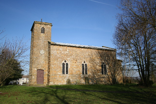
Lea is a village and civil parish in Lincolnshire with a recorded population of 1,005. It lies south of Gainsborough near the River Trent and the River Lea. The village is close to Knaith, Upton and the historic town of Gainsborough. Local roads and paths connect Lea with the Trent valley and surrounding farmland.

City map Kexby CP
Richard Croft, CC BY-SA 2.0 – Wikimedia Commons

Kexby CP

Kexby is a village and civil parish in Lincolnshire with a recorded population of 340. It lies near the River Trent, north-west of Gainsborough. The settlement is close to Lea, Upton and Knaith in the rural Trent valley. Local roads serve Kexby and connect it with neighbouring parishes.

City map Knaith CP
Richard Croft, CC BY-SA 2.0 – Wikimedia Commons

Knaith CP

Knaith is a village and civil parish in Lincolnshire with a recorded population of 316. It lies near the River Trent and the River Eau, south-west of Gainsborough. The village is close to Lea, Kexby and the Nottinghamshire boundary across the Trent. Local streets and paths cross the low-lying river landscape.

City map Middle Rasen
David Wright, CC BY-SA 2.0 – Wikimedia Commons

Middle Rasen

Middle Rasen is a village in Lincolnshire with a recorded population of 2,110. It lies on the River Rase between Market Rasen and the Lincolnshire Wolds. The settlement has a close geographic relationship with Market Rasen and West Rasen. Local streets and paths serve the village and the surrounding valley.

City map West Rasen CP
Richard Croft, CC BY-SA 2.0 – Wikimedia Commons

West Rasen CP

West Rasen is a village and civil parish in West Lindsey, Lincolnshire, with a recorded population of 81. It lies near the River Rase and west of Middle Rasen. The parish is situated between Market Rasen and the rural countryside towards Gainsborough. Local roads connect West Rasen with Middle Rasen and neighbouring villages.

City map Market Rasen
Peter Church, CC BY-SA 2.0 – Wikimedia Commons

Market Rasen

Market Rasen is a town and civil parish in West Lindsey, Lincolnshire, with a recorded population of 4,087. It stands on the River Rase at the western edge of the Lincolnshire Wolds. The town is known for Market Rasen Racecourse, located east of the centre. Streets and paths connect Market Rasen with Middle Rasen, Caistor and Lincoln.

City map Glentham CP
David Wright, CC BY-SA 2.0 – Wikimedia Commons

Glentham CP

Glentham is a village and civil parish in Lincolnshire with a recorded population of 439. It lies north of Market Rasen near the River Ancholme. The village is close to Normanby by Spital and Caenby. Local roads connect Glentham with the Ancholme valley and surrounding agricultural settlements.

City map Normanby by Spital CP
David Wright, CC BY-SA 2.0 – Wikimedia Commons

Normanby by Spital CP

Normanby by Spital is a village and civil parish in West Lindsey, Lincolnshire, with a recorded population of 377. It lies in the Ancholme valley near Glentham and the River Ancholme. The village is north of Lincoln and west of Market Rasen. Local streets and paths connect Normanby by Spital with neighbouring villages.

City map Caenby CP
Richard Croft, CC BY-SA 2.0 – Wikimedia Commons

Caenby CP

Caenby is a village in Lincolnshire with a recorded population of 68. It lies near the River Ancholme and the villages of Glentham and Normanby by Spital. The parish is situated north of Lincoln in the rural centre of West Lindsey. Local roads and paths serve the small settlement and nearby farmland.

City map Toft Newton
David Wright, CC BY-SA 2.0 – Wikimedia Commons

Toft Newton

Toft Newton is a civil parish in West Lindsey, Lincolnshire, with a recorded population of 479. It lies near the River Ancholme and the western edge of the Lincolnshire Wolds. Toft Newton Reservoir is a notable local water body used for fly fishing. Roads and paths connect the parish with Market Rasen, Caenby and surrounding villages.

Data sources: OpenStreetMap (ODbL), Wikidata (CC0) · Image: Wikimedia Commons

West Lindsey – Facts

Inhabitants 94869
Area 1155.7 km²
Subregions 128
Inception 1974
Located in Lincolnshire
Country United Kingdom
Website http://www.west-lindsey.gov.uk/

Data source: Wikidata (CC0)