
Barton Street in City of Westminster
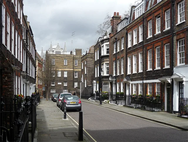
Barton Street in City of Westminster is an asphalted, lit residential street. The road has sidewalks (paving stones). It runs in a north-south direction starting from Great College Street and ends at Cowley Street. Barton Street is also known as Barton Street, London SW1. Barton Street also exists in Greater Manchester, Liverpool City Region, West Yorkshire and East Midlands.
- Road Type
- residential street
- Speed Limit
- 20 mph
- Postal Code
- SW1
- Route
- north-south
Image
Roads nearby
Liddell's Arch100 m
Great Smith StreetThe Cinnamon Club, Wash House, Westminster Abbey
150 m
The SanctuaryWestminster Abbey Shop
200 m
Dean's YardMilne’s House, Ashburnham House, Cellarium Café & Terrace
250 m
Abbey Orchard StreetMunich Cricket Club, Abbey Orchard Street
300 m
Little Sanctuary300 m
Dean Farrar Street350 m
Storey's GateStorey's Gate, Storey's Wine Bar, Wesley’s Café
350 m
Matthew Parker Street350 m
Prince's Mews350 m
Lewisham Street400 m
Dartmouth Street450 m
Old Queen Street450 m
Horse Guards RoadJubilee Walkway, Horse Guards Parade, The Royal Parks Ice-cream, Earl Mountbatten of Burma
450 m
Cockpit Steps450 m
Buildings nearby
Storey's Gate Jubilee line shaft500 m
Attraction nearby
Westminster Abbey250 m
Buildings nearby
The Sir Adrian Boult Building150 m
Department for Education150 m
Cellarium150 m
Frater150 m
Cheyney Gates150 m
Great Cloisters200 m
Royal Institution of Chartered Surveyors350 m
Conservative Campaign Headquarters400 m
National Crime Agency400 m
Embassy of the Republic of Slovenia400 m
Embassy of Chile450 m
Storey's Gate Lodge450 m
Resolution Foundation450 m
Courthouses nearby
Supreme Court350 m
Libraries nearby
Westminster Archives Centre200 m
Office buildings nearby
NIOC House300 m
Institution of Civil Engineers400 m
Institution of Mechanical Engineers450 m
Places of worship nearby
Methodist Central Hall300 m
Pubs nearby
The Sanctuary House350 m
Westminster Arms400 m
Two Chairmen450 m
Residential areas nearby
The Broadway350 m
Restaurants nearby
Old Queen Street Cafe450 m
School buildings nearby
Common Room and Head Master’s Study100 m
Hakluyt’s House100 m
Liddell’s House150 m
The Weston Building200 m
College Hall (medieval dining room)200 m
Harris Westminster Sixth Form350 m
Social facilities nearby
Change, Grow, Live400 m
Streams nearby
Tyburn300 m
Studios nearby
Zweites Deutsches Fernsehen Studio London450 m
| Named after | Barton Booth |
|---|---|
| Located in | City of Westminster |
| Country | United Kingdom |
 Public transport map City of Westminster Legend
| Railway | |
| Bus | |
| Tram |
 Cycling map City of Westminster Legend
| Cycle path | |
| Cycle lane on road | |
| Cycling on bus lane | |
| Bicycle street | |
| Cyclists allowed | |
| Cyclists allowed, good surface | |
| No cycling | |
| Cobblestones |
| Long-distance cycle route | (depending on scale) | |
| Long-distance cycle route |
 Walking map City of Westminster Legend
| Path |
| Long-distance hiking trail | (depending on scale) | |
| Long-distance hiking trail | ||
| No pedestrians |