
Barton Street in City of Westminster
Barton Street in City of Westminster is an asphalted, lit residential street. The road has sidewalks (paving stones). It runs in a north-south direction starting from Great College Street and ends at Cowley Street. Barton Street also exists in West of England and Lancashire.
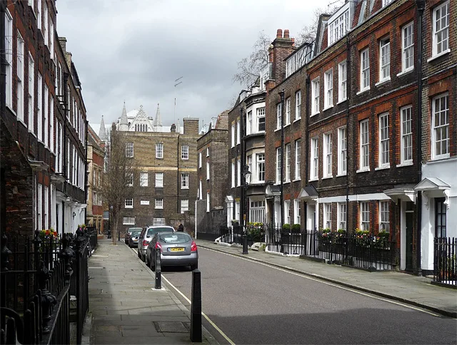
- Road Type
- residential street
- Speed Limit
- 20 mph
- Postal Code
- SW1
- Route
- north-south
Roads nearby
Liddell's Arch100 m
Great Smith StreetThe Cinnamon Club, Wash House, Westminster Abbey
150 m
The SanctuaryWestminster Abbey Shop
200 m
Dean's YardMilne’s House, Ashburnham House, Cellarium Café & Terrace
250 m
Abbey Orchard StreetMunich Cricket Club, Abbey Orchard Street
300 m
Little Sanctuary300 m
Dean Farrar Street350 m
Storey's GateStorey's Gate, Storey's Wine Bar, Wesley’s Café
350 m
Matthew Parker Street350 m
Prince's Mews350 m
Lewisham Street400 m
Dartmouth Street450 m
Old Queen Street450 m
Horse Guards RoadJubilee Walkway, Horse Guards Parade, The Royal Parks Ice-cream, Earl Mountbatten of Burma
450 m
Cockpit Steps450 m
Buildings nearby
Storey's Gate Jubilee line shaft500 m
Attraction nearby
Westminster Abbey250 m
Buildings nearby
The Sir Adrian Boult Building150 m
Department for Education150 m
Cellarium150 m
Frater150 m
Cheyney Gates150 m
Great Cloisters200 m
Royal Institution of Chartered Surveyors350 m
Conservative Campaign Headquarters400 m
National Crime Agency400 m
Embassy of the Republic of Slovenia400 m
Embassy of Chile450 m
Storey's Gate Lodge450 m
Resolution Foundation450 m
Courthouses nearby
Supreme Court350 m
Libraries nearby
Westminster Archives Centre200 m
Office buildings nearby
NIOC House300 m
Institution of Civil Engineers400 m
Institution of Mechanical Engineers450 m
Places of worship nearby
Methodist Central Hall300 m
Pubs nearby
The Sanctuary House350 m
Westminster Arms400 m
Two Chairmen450 m
Residential areas nearby
The Broadway350 m
Restaurants nearby
Old Queen Street Cafe450 m
School buildings nearby
Common Room and Head Master’s Study100 m
Hakluyt’s House100 m
Liddell’s House150 m
The Weston Building200 m
College Hall (medieval dining room)200 m
Harris Westminster Sixth Form350 m
Social facilities nearby
Change, Grow, Live400 m
Streams nearby
Tyburn300 m
Studios nearby
Zweites Deutsches Fernsehen Studio London450 m
| Named after | Barton Booth |
|---|---|
| Located in | City of Westminster |
| Country | United Kingdom |
Public transport map City of Westminster Legend
| Railway | |
| Bus | |
| Tram |
Cycling map City of Westminster Legend
| Cycle path | |
| Cycle lane on road | |
| Cycling on bus lane | |
| Bicycle street | |
| Cyclists allowed | |
| Cyclists allowed, good surface | |
| No cycling | |
| Cobblestones |
| Long-distance cycle route | (depending on scale) | |
| Long-distance cycle route |
Walking map City of Westminster Legend
| Path |
| Long-distance hiking trail | (depending on scale) | |
| Long-distance hiking trail | ||
| No pedestrians |