
Colyers Lane in London Borough of Bexley
Colyers Lane in London Borough of Bexley is an asphalted, lit tertiary road. It runs in an east-west direction and crosses Bexley Road, Brook Street, Erith Road, Barnehurst Avenue, Hurst Road, Heath Way, Ramsden Road, Colyers Close, Northumberland Way, Swallow Close, Normandy Way and Hurstwood Avenue. The nearest stops are Myrtle Close, Colyers Walk, Northumberland Way, Barnehurst Avenue and Hurst Road. The bus lines 89 and N89 serve this stop.
- Road Type
- tertiary road
- Speed Limit
- 20 mph
- Route
- east-west
Image
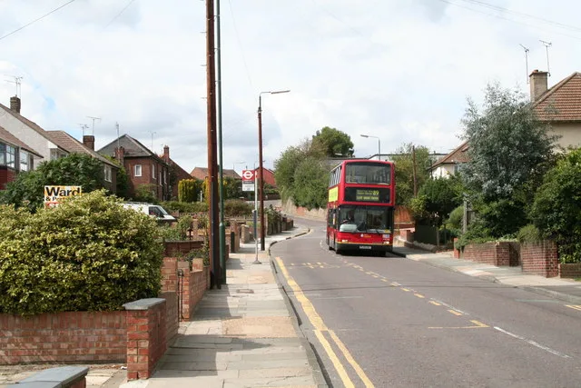
Bus stops
- bus lines 89, N89
Roads nearby
FP21850 m
Elmstead Road100 m
Colyers Walk, FP219150 m
Swallow Close150 m
Halstead Road150 m
Birling Road150 m
Normandy Way150 m
Brendon Close150 m
Highstead Crescent150 m
FP217200 m
Brasted Road200 m
Mendip Road250 m
Chipstead Road250 m
Hemsted Road250 m
Hurstwood Avenue250 m
Myrtle Close300 m
Doyle Close300 m
Stuart Mantle Way300 m
Callender Road350 m
Twigg Close350 m
Stuart Mantle Rise350 m
Badlow Close350 m
Stelling Road350 m
Edendale Road400 m
Detling Road400 m
Valence Road450 m
Peartree Close450 m
Northumberland Way500 m
Larner Road500 m
Colyers Close500 m
Frinsted Road500 m
Heathway500 m
Dell View Road500 m
Beechfield Road550 m
Ramsden Road550 m
Heath Way550 m
Broadoak Road550 m
Coniston Close600 m
Thanet Road600 m
Avenue RoadHail & Ride Lesney Park, Hail & Ride Avenue Road, Pickford Road, King Henry School, Glynde Road, Avenue Road / Crook Log
650 m
Lesney Park700 m
Clydon Close750 m
Grovebury Close750 m
Elm Grove750 m
Buxton Road750 m
Lesney Park Road800 m
Allotment gardens nearby
Bexley Allotments - Lesney Farm400 m
Fitness centres nearby
Erith Leisure Centre700 m
Places of worship nearby
Northend Baptist Church500 m
Public transport map London Borough of Bexley Legend
| Railway | |
| Bus | |
| Tram |
Cycling map London Borough of Bexley Legend
| Cycle path | |
| Cycle lane on road | |
| Cycling on bus lane | |
| Bicycle street | |
| Cyclists allowed | |
| Cyclists allowed, good surface | |
| No cycling | |
| Cobblestones |
| Long-distance cycle route | (depending on scale) | |
| Long-distance cycle route |
Walking map London Borough of Bexley Legend
| Path |
| Long-distance hiking trail | (depending on scale) | |
| Long-distance hiking trail | ||
| No pedestrians |