
West End Road in London Borough of Ealing
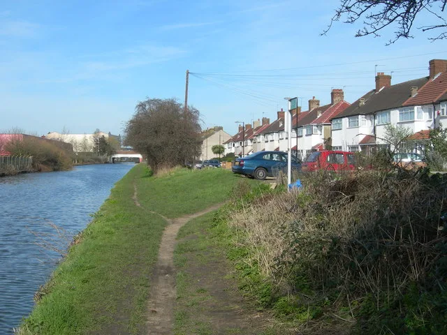
West End Road in London Borough of Ealing is a lit residential street. The road has sidewalks as well as cycle paths. It runs as a one-way street in a south-north direction starting from Beaconsfield Road and ends at The Broadway. The nearest stops are Harvey Road and Henson Place. The bus lines 696 and E7 serve this stop. West End Road also exists in London Borough of Hillingdon.
- Cycle Path
- opposite direction
- Road Type
- residential street
- Speed Limit
- 20 mph
- Route
- north-south
Image
Bus stops
- bus lines 696, E7
Roads nearby
Townsend Road100 m
Hambrough Road100 m
Trinity Roadself storage
150 m
Abbotts RoadExotic Juice
150 m
Oswald Road250 m
Orchard Avenue300 m
The BroadwayAbbotts Road, Northcote Avenue, Madhan's Shopping Centre, McDonald's, NatWest, J Halak Boutique, Gala Jewellers, Riwaaz UK, Lebas e Uroos, Momen Collections, The Jewellery Trunk, Omega, British Heart Foundation Home Store, Betfred, Paddy Power, Ealing Broadway Station, Sainsbury's Local, Barclays, Toni & Guy, Caffè Nero, Holland & Barrett, The Body Shop, Blank Street Coffee, itsu, Three., Vision Express, Poundland, Game, Adorai, Choice, Foreign Exchange, Greggs, Fight For Sight, Headmaster, Rush Hair, Wenzel's, Moss Bros, Sports Direct, The Works, Chocolate & Nails, Fix Station, Miabella, Laser Clinics, Thérapie Clinic, Deli Polonia, Frencheye, Lovisa, Lloyds Bank, Rawr Beauty, mobilebitz, The Bike Shop, Roxannes Pharmacy, Greenford Fish & Chips, Perfection Hair & Nail, Shan's News, Costa, Tickets, Joe Blake's, Santander, Hafeez Jewellers, Ria Money Transfer, A&M Kasuri, Junaid Jamshed, EuroAsia Travel, AR Exchange Ltd, Kabras Jewellery, Punjab Textiles, Aahar, Greenford, William Hill, Oldfield Lane South, Greenford Broadway, Iceland, Hayyi Food Centre, Halal Meat Centre, Greenford Hair & Beauty, Ladbrokes, Delight European Food Store, Boots Opticians, Halifax, Chaiiwala, Chicken Guys, Laine Brewing Company, Ali's Berlin Doner, Ealing Broadway, The Phone Box, Vapers Box, WHSmith, Subway, Five Guys, M&S Food, Southall / Trinity Road, Hayes Bridge, Popeyes, Morrisons, TK Maxx
300 m
Accolade Avenue300 m
Beachcroft Avenue350 m
Alfred Gardens400 m
Grange Road400 m
Northcote AvenueChildren's Hope Foundation
400 m
Raynor Close400 m
St. Joseph's DriveAjwa Jewellers, Anmol Fashion, Sherry's Chemist
400 m
Greenleaf Walk450 m
Hanson Gardens450 m
Lewis Road450 m
Seva DriveHouse of A.E.I.O.U, Parkside Yards Cafe
550 m
The Straight600 m
Randolph Road600 m
Apartment buildings nearby
Arber House400 m
Edwin House450 m
Bookshops nearby
Al Jannah Books250 m
Butcher's nearby
Hanif Halal Meat & Poultry250 m
Clothing shops nearby
Khan Collection300 m
Community centres nearby
Ramgarhia Hall250 m
Doctor's practice nearby
The Medical Centre500 m
Fast food restaurants nearby
German Doner Kebab250 m
Al-Haad250 m
Jeweller's nearby
Farman Jeweller250 m
Patisseries nearby
Little Dessert Shop250 m
Places of worship nearby
Abu Bakr Masjid250 m
Ramgarhia Sabha300 m
Railway lines nearby
Great Western Main Line600 m
Restaurants nearby
Watan200 m
Teri Meri Biryani250 m
Lahori Masala250 m
Butt Karahi250 m
Shinwari250 m
Mehman Khana250 m
Taste of Lahore250 m
Nirala Sweets250 m
Falooda Village250 m
Naanwala250 m
Noormahal Sweets300 m
School buildings nearby
Ayesha Siddiqa Girls School200 m
Sports centres nearby
Southall Sports Centre300 m
Terraced houses nearby
Beaconsfield Arms Court50 m
Water towers nearby
Water Tower550 m
Public transport map London Borough of Ealing Legend
| Railway | |
| Bus | |
| Tram |
Cycling map London Borough of Ealing Legend
| Cycle path | |
| Cycle lane on road | |
| Cycling on bus lane | |
| Bicycle street | |
| Cyclists allowed | |
| Cyclists allowed, good surface | |
| No cycling | |
| Cobblestones |
| Long-distance cycle route | (depending on scale) | |
| Long-distance cycle route |
Walking map London Borough of Ealing Legend
| Path |
| Long-distance hiking trail | (depending on scale) | |
| Long-distance hiking trail | ||
| No pedestrians |