
St John the Baptist in Mossley
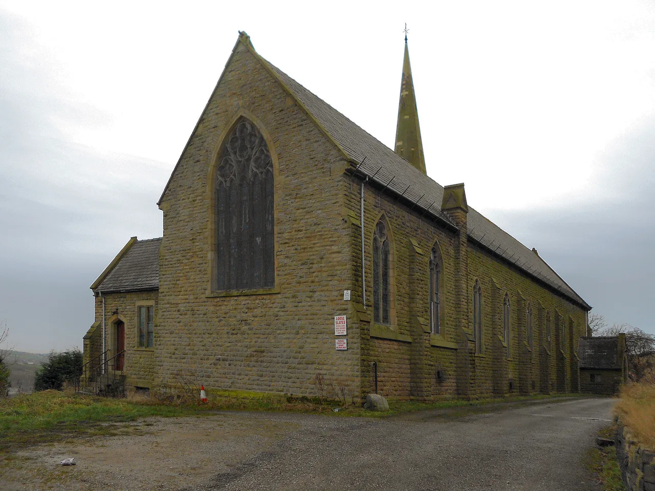
St John the Baptist in Mossley in Tameside is a Anglicana church. It is near Roughtown Road and is also known as St John the Baptist Church, Mossley. The church belongs to the Anglican Diocese of Manchester and is dedicated to John the Baptist. It is a listed building.
- Amenity
- place of worship
- Building Type
- church
Image
Bus stops
Roads nearby
Stoneswood Drive50 m
Quickwood100 m
Stockport RoadTop Mossley, SW-bound Stockport Road, Top Mossley, Stockport Road / adjacent Carhill Road, Stockport Road/Carhill Road, Stockport Road/Roughtown Road, Top Mossley, Stockport Road / near Roughtown Road, Stockport Road/Woodmeadow Garage, Top Mossley, on Stockport Road, The Rising Sun
100 m
Rock Terrace100 m
Saxon Street100 m
Roman Street150 m
Carrhill RoadCarrhill Road/Dane Street, Carrhill Road/New Earth Street, Carrhill Road/Mill Lane, Carrhill Road/Egerton Street, Top Mossley, Stockport Road / near Carrhill Road, Mill Lane
150 m
Foxwood Drive150 m
High Street150 m
St Johns Gardens150 m
Roughtown Road200 m
New Earth Street250 m
Saint Anthonys Drive250 m
Milton View300 m
Heron Lane300 m
Carrhill Quarry Close350 m
Tame Bank Close350 m
Wakefield Road350 m
Roughtown Court350 m
Woodmeadow Court400 m
Strawberry Lane400 m
Dark Lane400 m
Milton Street400 m
Roaches Mews400 m
Mill Lane450 m
Camden Street450 m
Manchester RoadRoaches, Manchester Road / opposite Camden Street, Roaches, Manchester Road / near Camden Street, Firestationdaynursery, Roaches, Manchester Road / near The Moorings, Roaches, Manchester Road / opposite The Moorings, Mossley, Manchester Road / outside Weir Mill, Heyrod, Manchester Road / near Boundary Close, Manchester Road/Boundary Close, The Friendship, The Best O'Brass, The Commercial, Mossley Post Office, Mossley, Manchester Road / Mossley Rail Station (Stop C), Mossley, Manchester Road / Mossley Rail Station (Stop B), Mossley, Manchester Road / near Waggon Road, Mossley, northbound Manchester Road, Mossley, Manchester Road / near Stanhope Street, Mossley Home Improvement Centre, Chadwick & Hadfield, Britannia Inn, Mossley, Manchester Road / near Portman Street, Mossley, Manchester Road / opposite Portman Street, Mossley, Manchester Road / near Queen Street, Mossley, Manchester Road / opposite Queen Street, Mossley, Manchester Road / opposite New Scout Mill, Manchester Road/New Scout Mill, The HoHo, Mossley, Manchester Road / near Roughtown Court, Mossley, Manchester Road / outside Woodend Mill, Mossley, Manchester Road / opposite Woodend Mill, Mossley, Manchester Road / adjacent Mill Lane, Mossley, Manchester Road / opposite Mill Lane, Mossley, Manchester Road / opposite Roughtown Court, Manchester Road/Egmont Street, Mossley, Manchester Road / opposite Egmont Street
450 m
Quick Road500 m
Three Counties RoadManchester Rd/Three Counties
500 m
Border Mill Fold500 m
Tame Street600 m
Tame Valley Close600 m
Winterford Lane600 m
Winterford Rd650 m
Station RoadMicklehurst, Mossley, Station Road / opposite Moorlands Crescent, Mossley, Station Road / near Moorlands Crescent, Mossley, Station Road / opposite Winterford Road
650 m
Winterford RoadMicklehurst, Winterford Road / near The Willows, Micklehurst, Winterford Road / near Mansfield Road, Micklehurst, Winterford Road / near Daisy Hill Road, Mossley, Winterford Road / near The Uplands
650 m
Spring Mill Drive700 m
The Cheshires700 m
Abandoned railways nearby
Micklehurst Line500 m
Buildings nearby
Woodend Mills350 m
Canals nearby
Huddersfield Narrow Canal400 m
Car repair shops nearby
TD Motors550 m
Car washes nearby
Wakss and Shine Car Wash200 m
Indoor plaies nearby
Tumbles550 m
Pubs nearby
Church Inn100 m
Roaches Lock400 m
Tollemache Arms600 m
Railway lines nearby
Huddersfield Line200 m
Rivers nearby
Tame400 m
| Dedicated to | John the Baptist |
|---|---|
| Diocese | Anglican Diocese of Manchester |
| Heritage designation | Grade II listed building |
| Located in | Mossley |
| Country | United Kingdom |
 Public transport map Mossley Legend
| Railway | |
| Bus | |
| Tram |
 Cycling map Mossley Legend
| Cycle path | |
| Cycle lane on road | |
| Cycling on bus lane | |
| Bicycle street | |
| Cyclists allowed | |
| Cyclists allowed, good surface | |
| No cycling | |
| Cobblestones |
| Long-distance cycle route | (depending on scale) | |
| Long-distance cycle route |
 Walking map Mossley Legend
| Path |
| Long-distance hiking trail | (depending on scale) | |
| Long-distance hiking trail | ||
| No pedestrians |