
Winslade Farm Lane
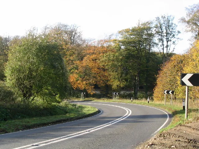
Winslade Farm Lane in Winslade in Basingstoke and Deane is an asphalted, unlit minor road. It runs in an east-west direction and crosses Longroden Lane and ends at Village Road. It connects Winslade and Tunworth. This road is part of the hiking trail "Three Castles Path".
- Road Type
- minor road
- Speed Limit
- 60 mph
- Route
- east-west
Image
Bus stops
Roads nearby
Swallick Farm Lane900 m
Winslade Lane900 m
Longroden Lane1,5 km
Bushywarren Lane1,5 km
Broad Walk1,7 km
Hackwood Lane1,8 km
Winslade Farm Lane1,8 km
Alley Lane1,8 km
Scratchface LaneHerriard Church, Herriard
2,2 km
Manor Close2,2 km
Oxlease Lane2,3 km
Abandoned railways nearby
Basingstoke and Alton Light Railway1,6 km
Buildings nearby
The Chalet500 m
AVS Fencing2,2 km
Farmyards nearby
Winslade Farm350 m
Swallick Farm1,0 km
Gardens nearby
The Cubs1,5 km
Polly Peachham's Garden1,6 km
Houses nearby
Tunworth Lodge1,8 km
Herriard House2,1 km
Industrial areas nearby
Green Waste Composting Facility1,2 km
Herriard Bio Power1,3 km
Places of worship nearby
St Mary's, Winslade200 m
All Saints Church1,8 km
St Mary's2,1 km
Residential buildings nearby
Winslade House200 m
Woodlands nearby
Little Hen Wood300 m
Buckshorn Copse450 m
Cowleaze Copse500 m
Lodge Plantation650 m
Swallick Wood700 m
West Field Beeches800 m
Stockham's Row850 m
Round Copse900 m
Whinkney's Copse1,2 km
Little Bushywarren Copse1,3 km
Spring Wood1,3 km
Hen Wood1,3 km
Allwood Copse1,4 km
Fryingdown Copse1,4 km
Hatwood's Copse1,4 km
Fulham's Copse1,4 km
Picked Craft Copse1,5 km
Pelican Wood1,6 km
Hummock Clump1,7 km
Peaked Bushywarren Copse1,7 km
Great Bushywarren Copse1,9 km
Coombe Wood2,0 km
Kingsmoor Copse2,0 km
Webb's Copse2,2 km
Public transport map Winslade Legend
| Railway | |
| Bus | |
| Tram |
Cycling map Winslade Legend
| Cycle path | |
| Cycle lane on road | |
| Cycling on bus lane | |
| Bicycle street | |
| Cyclists allowed | |
| Cyclists allowed, good surface | |
| No cycling | |
| Cobblestones |
| Long-distance cycle route | (depending on scale) | |
| Long-distance cycle route |
Walking map Winslade Legend
| Path |
| Long-distance hiking trail | (depending on scale) | |
| Long-distance hiking trail | ||
| No pedestrians |