
St Mary in Tyberton
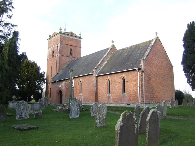
St Mary in Herefordshire, Tyberton is a Anglicana church. It is near Watery Lane and is also known as St Mary's Church, Tyberton. The church belongs to the Anglican Diocese of Hereford and is a listed building. St Mary also exists in Hereford, Collington, Byton, Linton and Welsh Newton.
- Amenity
- place of worship
- Building Type
- church
Image
Bus stops
Roads nearby
Watery Lane1,0 km
Bellamore Lane1,5 km
Old Thatch ClosePreston on Wye Mobile Post Office Service, Ploughfield
1,6 km
Upper Chilstone1,7 km
PloughfieldsPreston-on-Wye, Preston on Wye
1,8 km
Haynstone Court1,8 km
Cloverdale Drive1,9 km
Hacton Lane1,9 km
Cublington Court Road2,4 km
Vowchurch RoadVowchurch Common
2,6 km
Shenmore Batchy Hill2,8 km
Vowchurch CommonVowchurch Turn
3,3 km
Buildings nearby
Green Farm2,4 km
Preston Court2,6 km
Bycross Farm2,7 km
Kinley Farm2,7 km
Campsite nearby
Bycross Farm Campsite2,7 km
Chalet nearby
Hacton Cruck Medieval Hall2,1 km
Detached houses nearby
Blakemere House2,2 km
Farmyards nearby
Church House Farm150 m
Woodfield Farm350 m
Lower House Farm400 m
Lower Bellamore Farm850 m
New House2,0 km
Upper Chilstone Farm2,0 km
Lower Cublington Farm2,3 km
Shenmore Farm2,5 km
Carwardine Farm2,6 km
Newcourt Farm2,6 km
Houses nearby
Thossar Park3,2 km
Longmeadow3,2 km
Nature reserves nearby
The Flits850 m
Places of worship nearby
St Leonard2,2 km
St. Lawrence2,6 km
Pubs nearby
Yew Tree Inn1,6 km
Residential areas nearby
Tyberton Court150 m
Wellbrook Barn Farm1,9 km
Rivers nearby
River Wye3,2 km
Rocks nearby
Monnington Falls2,9 km
Woodlands nearby
Barrett's Hill Wood1,6 km
Timberline Wood1,8 km
Blakemere Hill Wood2,0 km
Bradley's Wood2,2 km
Kinley Coppice2,3 km
Birchypark Wood2,4 km
Oaken Coppice2,5 km
Ton Wood2,9 km
Ashley Coppice3,0 km
Lower Park Wood3,1 km
| Diocese | Anglican Diocese of Hereford |
|---|---|
| Heritage designation | Grade II* listed building |
| Located in | Tyberton |
| Country | United Kingdom |
 Public transport map Tyberton Legend
| Railway | |
| Bus | |
| Tram |
 Cycling map Tyberton Legend
| Cycle path | |
| Cycle lane on road | |
| Cycling on bus lane | |
| Bicycle street | |
| Cyclists allowed | |
| Cyclists allowed, good surface | |
| No cycling | |
| Cobblestones |
| Long-distance cycle route | (depending on scale) | |
| Long-distance cycle route |
 Walking map Tyberton Legend
| Path |
| Long-distance hiking trail | (depending on scale) | |
| Long-distance hiking trail | ||
| No pedestrians |