
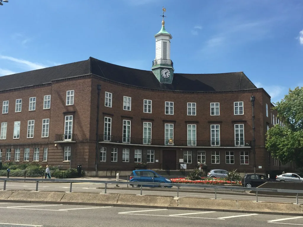
Watford Town Hall in Borough of Watford
Watford Town Hall in Watford is a town hall. Watford Town Hall is also known as Watford Borough Council. Watford Town Hall is near Gate House Place. Ⓦ.
- Alternative Name
- Watford Borough Council
- Amenity
- town hall
- Building Type
- public building
Image
Bicycle hires
Nightclubs
Bakeries
Pharmacy
Bus stops
Pubs
Ice cream parlours
Photography shops
Bank
Bar
Restaurants
Theatres
Post offices
Frozen food shops
Fast food restaurants
Roads nearby
Peace Prospect100 m
Peace Drive150 m
Cassio RoadLittle Learners Montesorri Nursery
150 m
Halsey Road200 m
Hyde Road200 m
Cassiobury DriveLangley Way, The Gardens, Stratford Way, Cassiobury Park Post Office, Rhubarb Cafe, Cassio Cleaners, UD Hair & Beauty Lounge
250 m
Rosslyn RoadTown and Country Club
300 m
Gate House Place300 m
Hempstead RoadCentral Leisure Centre, Russell Lane, Ridge Lane, Langley Way, Grove Mill Lane, Langley Road, Courtlands Drive, Hempstead Road/Courtland Drive, Bromet Close, Stratford Road, Woodville Court
350 m
Cassiobury Park AvenuePark Avenue, Watford Metropolitan Station
400 m
Rickmansworth RoadWatford Colosseum, Town Hall, The Pond, Creams, Rabbani's Indian Restaurant, Park Avenue, Shepherds Road, Metropolitan Station Approach, Gade Close
400 m
Court View450 m
Whippendell RoadCassio Road, Durban Road, Hagden Lane, Sydney Road, Cassiobridge Road, Queens Avenue, Budgens, Rising Sun, GSF Car Parts, Honour, Rapidocolor, Denka Power Solutions, J & M News, Puckatucka, Micron's Mini Mart, BetAnsells, Happy Palace, Harwoods Road, Tesco Express
500 m
Park Avenue500 m
Addiscombe Road600 m
Chester Road600 m
Durban Road EastPepe's
600 m
Durban Road West650 m
Mildred Avenue650 m
Burton Avenue650 m
Southsea Avenue700 m
Pretoria Road750 m
Apartment buildings nearby
Cassio Green400 m
Kennett Court500 m
Buildings nearby
The Peace Hospice100 m
Watford Leisure Centre100 m
Burvale Court150 m
Halsey Masonic Hall150 m
Faircross House200 m
Ballinger Court200 m
Homemanor House200 m
Watford Town and Country Club300 m
Dental practices nearby
Cassio Road Dental Practice200 m
Fast food restaurants nearby
China Garden750 m
Hairdresser's nearby
Tony's750 m
Libraries nearby
Watford Central Library150 m
Newsagent's nearby
Prajco750 m
Pharmacies nearby
MD Pharmacy550 m
Places of worship nearby
St Michael and All Angels600 m
Playgrounds nearby
Charter School Playground750 m
Pubs nearby
The Horns100 m
Recreation grounds nearby
West Herts & Watford Sports Club400 m
Residential areas nearby
Cassiobury Estate400 m
Residential buildings nearby
Rosslyn Court200 m
Dean Wace House250 m
Bridgeford House300 m
Crakers Mead300 m
School buildings nearby
Lanchester primary school300 m
Sports pitches nearby
West Herts & Watford Tennis Lawn Club400 m
| Located in | Watford |
|---|---|
| Country | United Kingdom |
 Public transport map Watford Legend
| Railway | |
| Bus | |
| Tram |
 Cycling map Watford Legend
| Cycle path | |
| Cycle lane on road | |
| Cycling on bus lane | |
| Bicycle street | |
| Cyclists allowed | |
| Cyclists allowed, good surface | |
| No cycling | |
| Cobblestones |
| Long-distance cycle route | (depending on scale) | |
| Long-distance cycle route |
 Walking map Watford Legend
| Path |
| Long-distance hiking trail | (depending on scale) | |
| Long-distance hiking trail | ||
| No pedestrians |