This page is the City map of East Riding of Yorkshire, with streets, paths and places across the unitary authority area in Yorkshire and the Humber, England. The region covers around 2,405.3 square kilometres and lies around Hull and East Yorkshire. Population figures recorded for the area include 339,614 people in 2018 and 346,309 in 2022. The landscape extends from the Humber estuary and low-lying river country to the Yorkshire Wolds and the North Sea coast.
North Ferriby is a village in East Riding of Yorkshire on the north bank of the Humber estuary. Its recorded population is 3,963. The settlement lies west of Hull and close to the Humber Bridge, which connects East Yorkshire with North Lincolnshire.
Welton is a village and civil parish in East Riding of Yorkshire, near the Humber and the town of Brough. It has a recorded population of 2,831. The village stands close to the southern edge of the Yorkshire Wolds and the A63 corridor.
Elloughton-cum-Brough is a civil parish in East Riding of Yorkshire with 10,489 residents. It includes the settlements of Elloughton and Brough on the northern side of the Humber estuary. Brough is associated with the Roman settlement of Petuaria and lies beside the A63 and the Hull–Selby railway route.
Ellerker is a village in East Riding of Yorkshire with a recorded population of 305. It lies west of Brough near the Humber and the southern escarpment of the Yorkshire Wolds. The surrounding area includes farmland and transport links leading towards Hull and Selby.
South Cave is a village and civil parish in East Riding of Yorkshire with 3,941 residents. It is situated beside the western Yorkshire Wolds and near the A1034. The settlement is north of the Humber and east of the River Derwent.
Broomfleet is a village in East Riding of Yorkshire with a recorded population of 304. It stands close to the Humber estuary and the former tidal marshes west of Brough. The village is connected with the lowland landscape around the River Humber and the Humberhead Levels.
Blacktoft is a village in East Riding of Yorkshire with 311 residents. It lies near the River Ouse, north of the Humber and west of the Yorkshire Wolds. The surrounding countryside is low-lying and shaped by drainage channels and agricultural fields.
Twin Rivers is a civil parish in East Riding of Yorkshire with a recorded population of 370. Its name refers to a lowland area associated with the nearby River Ouse and River Humber systems. The parish lies within the broad agricultural landscape west of the Yorkshire Wolds.
Reedness is a village in East Riding of Yorkshire with 322 residents. It lies close to the River Ouse in the Humberhead Levels, where extensive drainage has made the flat land suitable for agriculture. Goole is located nearby to the south-west.
Swinefleet is a village in East Riding of Yorkshire with a population of 885. It is situated near the River Ouse and the port town of Goole. The area consists largely of flat drained land between the Ouse and the Humber estuary.
Goole Fields is a civil parish in East Riding of Yorkshire with 116 residents. It lies around the western side of Goole, close to the River Ouse and the boundary with North Yorkshire. The landscape is part of the low-lying Humberhead Levels and contains agricultural fields and drainage waterways.
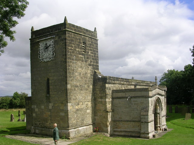
Snaith and Cowick is a civil parish in East Riding of Yorkshire with 3,867 residents. It lies near the River Aire and the boundary with North Yorkshire and North Lincolnshire. Snaith is known for the medieval church of St Laurence, whose origins date back to the Middle Ages.
Pollington is a village in East Riding of Yorkshire with a recorded population of 998. It stands near the River Aire and the A614, west of Goole. The surrounding land belongs to the flat agricultural region of the Humberhead Levels.
Gowdall is a village in East Riding of Yorkshire with 340 residents. It lies near the River Aire and the town of Snaith. The settlement is surrounded by low-lying farmland crossed by drainage ditches typical of the Humberhead Levels.
Rawcliffe is a village and civil parish in East Riding of Yorkshire with 2,382 residents. It lies near the River Ouse and the town of Goole, close to the boundary with North Yorkshire. The area combines a village settlement with broad agricultural land on the Humber plain.
Airmyn is a village in East Riding of Yorkshire with 729 residents. It stands at the confluence of the River Aire and the River Ouse near Goole. Its location places it within the riverine landscape of the Humberhead Levels.
Asselby is a village in East Riding of Yorkshire with a recorded population of 367. It lies east of the River Ouse in a flat agricultural area near Howden. Drainage channels and the nearby river network define the local landscape.
Barmby on the Marsh is a village in East Riding of Yorkshire with 433 residents. It lies near the River Derwent, close to where the river joins the River Ouse. The surrounding marshland is part of the low-lying countryside north of Goole.
Wressle is a village and civil parish in East Riding of Yorkshire with 269 residents. It lies near the River Derwent and the town of Howden. Wressle Castle, a medieval fortified residence built for the Percy family, is a notable historic feature in the area.
Bubwith is a village and civil parish in East Riding of Yorkshire with 1,323 residents. It lies on the River Derwent and is connected with Selby and Howden by local roads. The parish includes low-lying river meadows and agricultural land.
Ellerton is a village and civil parish in East Riding of Yorkshire with 386 residents. It stands near the River Derwent and south of the Vale of York. The surrounding area contains flat farmland and waterways connected with the Derwent and Ouse drainage system.
Cottingwith is a civil parish in East Riding of Yorkshire with a recorded population of 356. It lies near the River Derwent, east of York and north of the Humber. The parish occupies low-lying agricultural country between the Derwent valley and the Yorkshire Wolds.
Sutton upon Derwent is a village in East Riding of Yorkshire with 602 residents. It lies on the River Derwent, east of York and close to the edge of the Yorkshire Wolds. The village is associated with a historic church and a landscape of river meadows and farmland.
Newton on Derwent is a civil parish in East Riding of Yorkshire with 315 residents. It lies beside the River Derwent east of York. The parish contains agricultural land between the river valley and the rising ground of the Yorkshire Wolds.
Catton is a civil parish in East Riding of Yorkshire with a recorded population of 361. It is located near the River Derwent and the A1079 corridor between York and Beverley. The local landscape consists of farmland and gently undulating ground on the western side of the Wolds.
Stamford Bridge is a village and civil parish in East Riding of Yorkshire with 3,528 residents. It lies on the River Derwent, east of York. The Battle of Stamford Bridge was fought here in 1066, shortly before the Norman Conquest.
Skirpenbeck is a village in East Riding of Yorkshire with 490 residents. It lies in the rolling countryside east of York and west of the Yorkshire Wolds. The surrounding parish landscape consists of arable farmland and small valleys.
Bugthorpe is a village in East Riding of Yorkshire with a recorded population of 125. It lies in the foothills and valleys on the western side of the Yorkshire Wolds. The village is north-east of York and close to the boundary with North Yorkshire.
Kirby Underdale is a village and civil parish in East Riding of Yorkshire with 106 residents. It lies in a narrow valley within the Yorkshire Wolds. The parish is north-east of York and contains the rural church settlement of Kirby Underdale.
Huggate is a village in East Riding of Yorkshire with 313 residents. It lies on the high ground of the Yorkshire Wolds, an area of chalk hills and dry valleys. Huggate is north-east of Pocklington and close to the Wolds Way landscape.
Fridaythorpe is a village in East Riding of Yorkshire with 330 residents. It stands on the northern Yorkshire Wolds near the A166 between York and Bridlington. The surrounding chalk uplands contain large arable fields and shallow dry valleys.
Fimber is a village in East Riding of Yorkshire with a recorded population of 126. It lies in the northern Yorkshire Wolds, west of Driffield. The parish is surrounded by chalk farmland and valleys characteristic of the Wolds.
Sledmere is a village and civil parish in East Riding of Yorkshire with 166 residents. It is located in the Yorkshire Wolds near Driffield. Sledmere House, an 18th-century country house with an extensive estate, is the principal historic landmark.
Cottam is a hamlet and civil parish in East Riding of Yorkshire with 58 residents. It lies in the northern Yorkshire Wolds, east of Driffield. The surrounding land is predominantly agricultural and includes evidence of historic rural settlement.
Langtoft is a village in East Riding of Yorkshire with 513 residents. It lies north of Driffield on the western side of the Yorkshire Wolds. The village is surrounded by chalk farmland and is close to the valley of the Gypsey Race.
Thwing is a village and civil parish in the northern Yorkshire Wolds with 210 residents. It lies between Driffield and Bridlington in a chalk landscape. The parish is associated with the Gypsey Race valley, one of the notable dry-valley systems of the Wolds.
Wold Newton is a village and civil parish in East Riding of Yorkshire with 317 residents. It lies in the northern Yorkshire Wolds, west of Bridlington. The surrounding countryside includes chalk hills, dry valleys and large agricultural fields.
Burton Fleming is a village in East Riding of Yorkshire with 460 residents. It lies in the Gypsey Race valley in the northern Yorkshire Wolds. The area contains important prehistoric archaeological sites, including evidence of Iron Age settlement.
Grindale is a village in East Riding of Yorkshire with a recorded population of 96. It lies between the Yorkshire Wolds and the North Sea coast, north-west of Bridlington. The surrounding land is predominantly chalk farmland.
Bempton is a village and civil parish in East Riding of Yorkshire with 1,025 residents. It lies near the North Sea coast and the chalk cliffs north of Bridlington. Bempton Cliffs are internationally known for their large seabird colonies, including gannets, guillemots and razorbills.
Flamborough is a village and civil parish in East Riding of Yorkshire with 2,114 residents. It occupies the Flamborough Headland, where white chalk cliffs extend into the North Sea. Flamborough Head Lighthouse was built in 1806 and remains a major maritime landmark.
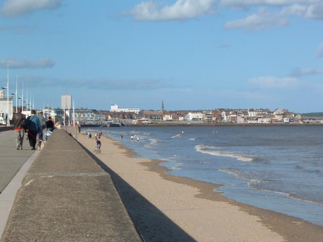
Bridlington is a coastal town and civil parish in East Riding of Yorkshire with 35,264 residents. It lies on Bridlington Bay between Flamborough Head and the Holderness coast. The town has a historic harbour, two sandy beaches and the medieval Priory Church of St Mary.
Carnaby is a village and civil parish in East Riding of Yorkshire with 356 residents. It lies immediately south of Bridlington on the coastal plain. The surrounding area includes farmland and industrial development connected with the Bridlington urban area.
Barmston is a village and civil parish in East Riding of Yorkshire with 274 residents. It lies on the Holderness coast south of Bridlington. The parish includes low coastal land and is affected by the erosional processes of the North Sea shoreline.
Ulrome is a village and civil parish in East Riding of Yorkshire with 246 residents. It is located near the North Sea coast between Bridlington and Hornsea. The surrounding Holderness landscape contains farmland, coastal settlements and areas of sandy beach.
Skipsea is a village and civil parish in East Riding of Yorkshire with 678 residents. It lies on the Holderness coast, south of Bridlington and north of Hornsea. Skipsea Castle is a medieval earthwork castle situated near the village.
Atwick is a village in East Riding of Yorkshire with 308 residents. It lies inland from the Holderness coast, north of Hornsea. The local landscape consists of gently rolling farmland between the Yorkshire Wolds and the North Sea.
Hornsea is a town and civil parish in East Riding of Yorkshire with 8,791 residents. It lies beside Hornsea Mere, Yorkshire’s largest freshwater lake, near the North Sea coast. Hornsea is also associated with the former Hornsea Pottery, which operated in the town from 1949 to 1984.
Mappleton is a village and civil parish in East Riding of Yorkshire with 329 residents. It lies on the Holderness coast south of Hornsea. The village is known for coastal protection works built to reduce erosion of the soft clay cliffs.
Aldbrough is a village and civil parish in East Riding of Yorkshire with 1,281 residents. It lies inland from the Holderness coast, east of Hull. The village stands near the site of the Roman settlement of Delgovicia and the historic church of St Bartholomew.
East Garton is a civil parish in East Riding of Yorkshire with 191 residents. It lies in the Holderness countryside east of Hull and west of the North Sea coast. The parish consists mainly of agricultural land and small rural settlements.
Roos is a village and civil parish in East Riding of Yorkshire with 1,202 residents. It lies on the Holderness peninsula between Hornsea and Withernsea. The village is surrounded by low-lying farmland and is close to the North Sea coastline.
Rimswell is a village in East Yorkshire with a recorded population of 189. It lies on the Holderness peninsula near the coast and south of Roos. The surrounding land is flat agricultural country shaped by coastal erosion and drainage.
Withernsea is a seaside resort town and civil parish in East Riding of Yorkshire with 5,980 residents. It lies on the Holderness coast at the southern end of the East Yorkshire coastline. Withernsea Pier was opened in 1877, although only the pier’s entrance towers remain after repeated storm damage and erosion.
Hollym is a village and civil parish in East Riding of Yorkshire with 520 residents. It lies on the Holderness peninsula, north of Withernsea and close to the North Sea coast. The village is surrounded by flat farmland and small coastal drainage channels.
Holmpton is a village in East Riding of Yorkshire with 237 residents. It lies near the eastern tip of the Holderness peninsula, south of Withernsea. The settlement is close to the rapidly eroding North Sea shoreline and the mouth of the Humber estuary.
Easington is a village and civil parish in East Riding of Yorkshire with 673 residents. It lies on the northern shore of the Humber estuary near Spurn Point. The parish contains the Easington gas terminal and extensive low-lying coastal land.
Skeffling is a village and civil parish in East Riding of Yorkshire with 147 residents. It lies beside the Humber estuary on the southern Holderness peninsula. The surrounding landscape consists of reclaimed marshland, embankments and agricultural fields.
Welwick is a village and civil parish in East Riding of Yorkshire with 291 residents. It lies near the Humber estuary, west of Easington and Spurn Point. The parish includes agricultural land and low coastal marshes on the southern Holderness peninsula.
Sunk Island is a village in East Riding of Yorkshire with 221 residents. It occupies reclaimed land on the north bank of the Humber estuary, east of Hull. The settlement is close to Spurn Point, a long coastal spit that shelters the entrance to the Humber.
Data sources: OpenStreetMap (ODbL), Wikidata (CC0) · Image: Wikimedia Commons