
St. Mary's in Lower Hardres and Nackington
St. Mary's in Lower Hardres and Nackington in Canterbury is a Anglicana church. It is near Church Lane and is also known as St Mary's Church, Nackington. The church belongs to the Diocese of Canterbury and is a listed building. St. Mary's also exists in Dover, Folkestone and Hythe and Tonbridge and Malling.
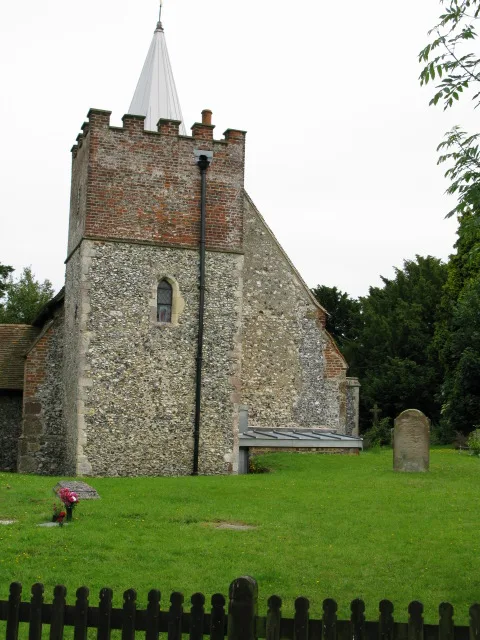
- Amenity
- place of worship
- Building Type
- church
Bus stops
Roads nearby
Church LaneNackington, War Memorial
150 m
Merton Lane (North)750 m
Bridge Road850 m
White Hill Close900 m
Nackington Park1000 m
Canterbury BypassPausa
1000 m
Little Nackington1,1 km
Langton Lane1,3 km
Underwood Close1,5 km
Nackington RoadThe Gap, Simon Langton Boys' School
1,5 km
The Foreland1,6 km
Ealham Close1,6 km
Junior PlaygroundChapel
1,6 km
School Lane1,7 km
Senior PlaygroundSt Anselm's School Grounds
1,7 km
New Dover RoadSt Lawrence Road, St Augustine's Road, Old Gate Inn, Barton Road, School Passage, Tesco Express, Pizza Hut Delivery
1,7 km
Old Dover RoadKent Cricket Ground, Ethelbert Road, Cowdrey Place, Health Centre, Simon Langton Girls' School, St Anselm's School
1,7 km
Dover RoadOld Gate Inn, Renville Cottages
1,7 km
Buildings nearby
Canterbury Rugby Football Club1000 m
Star Centre1,3 km
Langton Observatory1,3 km
Sports Hall1,5 km
E Block1,6 km
C Block1,6 km
F Block1,6 km
Moa 3 & 41,6 km
Moa 1 & 21,6 km
The Willow Centre1,6 km
T Block1,6 km
SRP1,6 km
SSC1,6 km
D Block1,6 km
B Block1,6 km
A Block1,6 km
Administration1,7 km
Main Hall1,7 km
More1,7 km
Gregory1,7 km
L Block1,7 km
Kitchen1,7 km
Cafés nearby
Cafe 421,3 km
Commercial buildings nearby
Winters Barns650 m
Gardens nearby
Memorial Garden1,6 km
Libraries nearby
School Library1,6 km
Places of worship nearby
St Mary’s Church, Lower Hardres1,5 km
School buildings nearby
The Drag1,6 km
Sports pitches nearby
The Cage1,6 km
Woodlands nearby
Langton Wood1,5 km
Whitehill Wood1,8 km
| Diocese | Diocese of Canterbury |
|---|---|
| Heritage designation | Grade I listed building |
| Located in | Lower Hardres and Nackington |
| Country | United Kingdom |
 Public transport map Lower Hardres and Nackington Legend
| Railway | |
| Bus | |
| Tram |
 Cycling map Lower Hardres and Nackington Legend
| Cycle path | |
| Cycle lane on road | |
| Cycling on bus lane | |
| Bicycle street | |
| Cyclists allowed | |
| Cyclists allowed, good surface | |
| No cycling | |
| Cobblestones |
| Long-distance cycle route | (depending on scale) | |
| Long-distance cycle route |
 Walking map Lower Hardres and Nackington Legend
| Path |
| Long-distance hiking trail | (depending on scale) | |
| Long-distance hiking trail | ||
| No pedestrians |