Cornwall

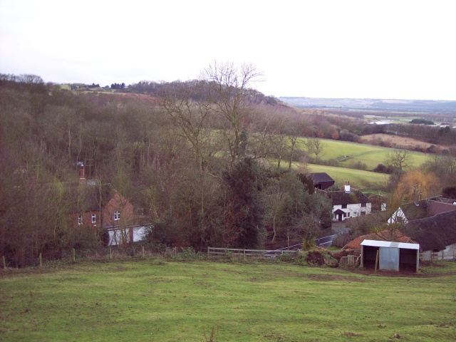
This City map of Cornwall is a regional map with streets, paths and places across the unitary council area in England, United Kingdom. Cornwall covers approximately 3,546 square kilometres and had about 565,968 residents in 2018. The population increased from 537,900 in 2012 to 575,413 in 2022. OpenStreetMap divides the region into 212 subregions, including towns, villages and civil parishes along the Atlantic and English Channel coasts.

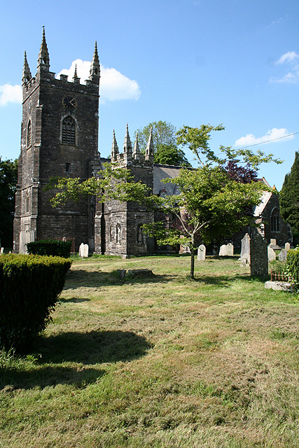
City map Kernow / Cornwall
Tim Green, CC BY 2.0 – Wikimedia Commons
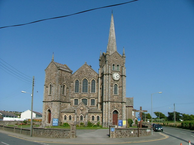
City map Padstow
Personal photograph taken by Mick Knapton at en.wikipedia, CC BY-SA 3.0 – Wikimedia Commons

Padstow

Padstow is a town and civil parish on the north coast of Cornwall with 2,786 residents. Its recorded area is approximately 13.6 square kilometres.

The town stands on the estuary of the River Camel, where the river reaches the Celtic Sea. Padstow is part of the coastal landscape of north Cornwall and is connected with nearby places such as Wadebridge and Rock.

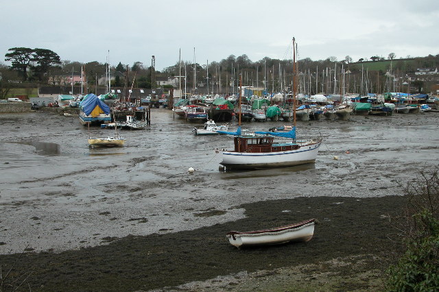
City map St. Minver Highlands
Malcolm Etherington, CC BY-SA 2.0 – Wikimedia Commons

St. Minver Highlands

St. Minver Highlands is a civil parish in north Cornwall with 820 residents. The parish lies inland from the Camel Estuary and opposite the coastal settlements around Padstow.

Its rural territory belongs to the north Cornish landscape between Wadebridge and the coast. The parish is adjacent to St. Minver Lowlands, which occupies the lower ground nearer the Camel Estuary.

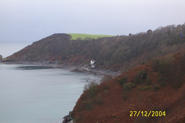
City map St. Minver Lowlands
Malcolm Etherington, CC BY-SA 2.0 – Wikimedia Commons

St. Minver Lowlands

St. Minver Lowlands is a civil parish in north Cornwall with 1,221 residents. It occupies lower-lying country near the Camel Estuary and the coastal area west of Rock.
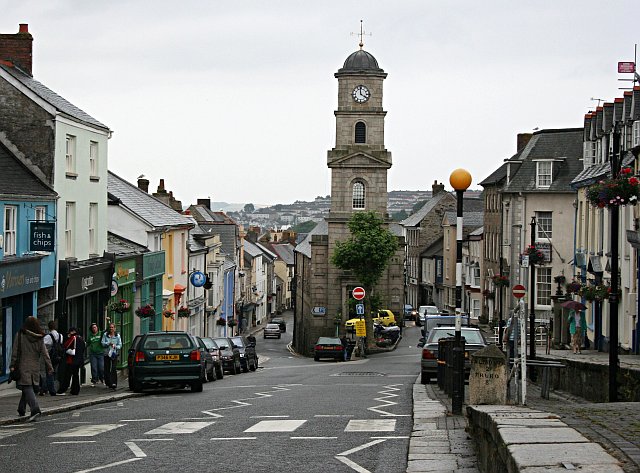
The parish is linked geographically with St. Minver Highlands and the town of Wadebridge. The Camel Estuary forms the principal water landscape nearby before opening toward the Celtic Sea.

City map Maker-with-Rame
Rob Farrow, CC BY-SA 2.0 – Wikimedia Commons

Maker-with-Rame

Maker-with-Rame is a civil parish on the Rame Peninsula in south-east Cornwall with 917 residents. The peninsula extends between Plymouth Sound and the English Channel.

Maker and Rame lie close to the Cornwall–Devon boundary, with the River Tamar separating Cornwall from Devon to the east. The parish is near Mount Edgcumbe and the settlements of Millbrook and Torpoint.

City map Millbrook
Mark Anderson, CC BY-SA 2.0 – Wikimedia Commons

Millbrook

Millbrook is a village and civil parish on the Rame Peninsula with 2,298 residents. It is situated beside Millbrook Lake, an inlet connected with Plymouth Sound.

The village lies near Maker-with-Rame and Torpoint in south-east Cornwall. The surrounding peninsula contains woodland, creeks and coastal ground along the Tamar estuary and Plymouth Sound.

City map Millbrook
Mark Anderson, CC BY-SA 2.0 – Wikimedia Commons

Millbrook

This Millbrook subregion is recorded at administrative level 10 within Cornwall. Millbrook is a village and civil parish on the Rame Peninsula, where the population is recorded as 2,298 for the named parish.

The settlement stands beside Millbrook Lake near Plymouth Sound. Torpoint, Maker-with-Rame and the River Tamar are nearby geographic references in south-east Cornwall.

City map Torpoint
Lewis Clarke, CC BY-SA 2.0 – Wikimedia Commons

Torpoint

Torpoint is a town on the Rame Peninsula in south-east Cornwall with 7,717 residents. It faces Plymouth across the Hamoaze, the tidal waterway formed by the River Tamar.

The town is connected with Plymouth by the Torpoint Ferry and lies near Millbrook and Maker-with-Rame. Its position at the mouth of the Tamar gives it a direct relationship with Plymouth Sound.

City map Antony
Tony Atkin, CC BY-SA 2.0 – Wikimedia Commons

Antony

Antony is a village and civil parish in south-east Cornwall with 436 residents. The parish occupies part of the Rame Peninsula near the estuarine waters of the River Lynher and Plymouth Sound.

Antony is associated with Antony House, a National Trust country house near the Lynher estuary. Torpoint and the wider Rame Peninsula lie to the south-east.

City map St. John
Tony Atkin, CC BY-SA 2.0 – Wikimedia Commons

St. John

St. John is a village and civil parish in south-east Cornwall with 379 residents. It lies in the rural coastal region around the Rame Peninsula and the Tamar estuary.

The parish is near Antony, Torpoint and Plymouth Sound. The River Tamar forms the principal boundary landscape east of this part of Cornwall.

City map Saltash
Kicior99, CC BY-SA 4.0 – Wikimedia Commons

Saltash

Saltash is a town and civil parish in Cornwall with 16,288 residents. It stands on the western bank of the River Tamar opposite Plymouth in Devon.

The Royal Albert Bridge carries the railway across the Tamar between Saltash and Plymouth, while the Tamar Bridge carries road traffic. Saltash is one of the largest settlements in south-east Cornwall.

City map Landulph
Sarah Charlesworth, CC BY-SA 2.0 – Wikimedia Commons

Landulph

Landulph is a hamlet and rural civil parish in south-east Cornwall with 534 residents. It lies on the western side of the River Tamar, north of Saltash.

The parish faces Devon across the tidal Tamar and includes farmland and wooded river slopes. Its location places it within the wider Tamar Valley landscape.

City map Pillaton
Paul Hutchinson, CC BY-SA 2.0 – Wikimedia Commons

Pillaton

Pillaton is a village and civil parish in Cornwall with 502 residents. It lies in east Cornwall inland from the Tamar Valley and west of the Devon border.

The parish is close to Callington and the rural settlements of the Tamar district. The River Tamar is the principal major watercourse in the surrounding region.

City map St. Dominick
Tony Atkin, CC BY-SA 2.0 – Wikimedia Commons

St. Dominick

St. Dominick is a civil parish in Cornwall with 792 residents. It occupies rural ground in the Tamar Valley, north of Saltash and west of the River Tamar.

The parish is near the National Trust estate of Cotehele, which stands beside the Tamar. Callington and Calstock are nearby settlements in east Cornwall.

City map Calstock
Ben Harris, Public domain – Wikimedia Commons

Calstock

Calstock is a village and civil parish in Cornwall with 6,253 residents. It lies in the Tamar Valley beside the River Tamar, which forms the boundary with Devon.

Calstock Viaduct carries the railway high above the valley and is a major local structure. The parish is also near Cotehele and the former mining landscapes of east Cornwall and west Devon.

City map Stokeclimsland
Milestone Society, CC BY-SA 2.0 – Wikimedia Commons

Stokeclimsland

Stokeclimsland is a civil parish in Cornwall with 1,655 residents. It lies in the Tamar Valley north of Callington and west of the River Tamar.

The parish contains rural settlements and farmland near the Cornwall–Devon boundary. Calstock and Launceston are important nearby places in east and north-east Cornwall.

City map Lezant
Tony Atkin, CC BY-SA 2.0 – Wikimedia Commons

Lezant

Lezant is a civil parish and village in east Cornwall with 754 residents. It lies south-east of Launceston in the rural border country near Devon.

The parish is close to the River Tamar and the A30 corridor across eastern Cornwall. Launceston and Lawhitton Rural are nearby administrative areas.

Lawhitton Rural

Lawhitton Rural is a civil parish in Cornwall with 301 residents. It lies immediately east of Launceston near the River Kensey and the Devon border.

The parish belongs to the agricultural landscape of north-east Cornwall. Lezant, St. Stephens by Launceston Rural and Werrington are nearby areas.

City map Launceston
John Baker, CC BY-SA 2.0 – Wikimedia Commons

Launceston

Launceston is a town, ancient borough and civil parish in Cornwall with 10,452 residents. It stands in north-east Cornwall close to the River Tamar, which separates Cornwall from Devon.

Launceston Castle is a prominent Norman fortress above the town. The settlement is a historic gateway between Cornwall, Devon and the A30 route toward Bodmin.

City map St. Stephens by Launceston Rural
Tony Atkin, CC BY-SA 2.0 – Wikimedia Commons

St. Stephens by Launceston Rural

St. Stephens by Launceston Rural is a civil parish in Cornwall with 350 residents. It surrounds rural areas near the town of Launceston in north-east Cornwall.

The parish lies close to the River Kensey and the Devon boundary. Launceston, Lawhitton Rural and Werrington provide the main nearby geographic references.

City map Werrington
Martin Bodman, CC BY-SA 2.0 – Wikimedia Commons

Werrington

Werrington is a village and civil parish in north-east Cornwall with 446 residents. It lies near the Tamar Valley and the border with Devon.

The parish is north of Launceston in a rural landscape crossed by small tributaries of the Tamar. Its position places it within Cornwall’s historic border country.

City map Boyton
Derek Harper, CC BY-SA 2.0 – Wikimedia Commons

Boyton

Boyton is a village in Cornwall with 521 residents. It lies in the north-east of the county near the River Tamar and the Devon boundary.

The surrounding area is rural and agricultural, with Launceston to the south-west and the coastal north of Cornwall farther west. Boyton is part of the landscape between the Tamar Valley and Bude.

City map North Tamerton
Mike Dodman, CC BY-SA 2.0 – Wikimedia Commons

North Tamerton

North Tamerton is a village in north-east Cornwall with 304 residents. Its recorded elevation is 119.2 metres above sea level.

The village lies near the River Tamar and the Cornwall–Devon boundary. Bude and Launceston are the principal nearby towns in the wider north-eastern region.

City map Morwenstow
Tony Atkin, CC BY-SA 2.0 – Wikimedia Commons

Morwenstow

Morwenstow is a village and civil parish on the north coast of Cornwall with 891 residents. The parish reaches the Atlantic coastline north of Bude.

Its recorded elevation is 121 metres, while the coast contains cliffs and coves exposed to the Celtic Sea. The parish lies near the Devon border and the village of Kilkhampton.

City map Tintagel
Stuart Logan, CC BY-SA 2.0 – Wikimedia Commons

Tintagel

Tintagel is a village on Cornwall’s north coast with 1,725 residents. Its recorded area is approximately 19.73 square kilometres.

Tintagel Castle stands on a rocky headland above the Atlantic and is associated with the medieval legends of King Arthur. The village lies between Boscastle and Port Isaac along the north Cornish coast.

City map Kilkhampton
Philip Halling, CC BY-SA 2.0 – Wikimedia Commons

Kilkhampton

Kilkhampton is a village and civil parish in north Cornwall with 1,480 residents. It lies inland from the coast near the border with Devon.

The parish is close to Morwenstow and Bude–Stratton. The surrounding landscape includes farmland and access routes toward the Atlantic cliffs of north Cornwall.

City map Bude–Stratton
Neil Lewin, CC BY-SA 2.0 – Wikimedia Commons

Bude–Stratton

Bude–Stratton is a civil parish in north Cornwall with 10,596 residents. Its recorded area is approximately 18.3 square kilometres.

Bude is a coastal town on the Atlantic with a harbour and beaches, while Stratton lies inland to the east. The parish is near the mouth of the River Neet and the boundary with Devon.

City map Whitstone
Jonathan Billinger, CC BY-SA 2.0 – Wikimedia Commons

Whitstone

Whitstone is a village and civil parish in east Cornwall with 646 residents. Its recorded elevation is 141.5 metres above sea level.

The parish lies inland between Bude and Launceston in the agricultural border landscape. The River Tamar and the Devon boundary are east of Whitstone.

City map Launcells
Dave Carn, CC BY-SA 3.0 – Wikimedia Commons

Launcells

Launcells is a hamlet and civil parish in Cornwall with 600 residents. It lies in north-east Cornwall near Bude and the Devon border.

The parish is rural and inland, while the Atlantic coast is west of the settlement. Kilkhampton, Bude–Stratton and Morwenstow are nearby areas.

City map Marhamchurch
Adrian King, CC BY-SA 2.0 – Wikimedia Commons

Marhamchurch

Marhamchurch is a civil parish and village in north Cornwall with 819 residents. Its recorded elevation is 52.6 metres.

The village lies south of Bude and west of Launceston in a landscape of fields and small valleys. The Atlantic coast and the River Neet are important nearby geographic features.

City map Truro
Tim Green, CC BY 2.0 – Wikimedia Commons

Truro

Truro is Cornwall’s city and has 21,555 residents within an area of approximately 6.21 square kilometres. It stands at the meeting of the rivers Kenwyn and Allen, which form the Truro River.

The city lies at the head of the Fal Estuary and contains Truro Cathedral, completed in 1910. Truro is the administrative centre of Cornwall and is connected with Falmouth by the River Fal corridor.

City map Philleigh
Peter Wasp, CC BY-SA 2.0 – Wikimedia Commons

Philleigh

Philleigh is a village and civil parish on the Roseland Peninsula with 155 residents. It lies east of the River Fal and south of the Truro estuary.

The parish is part of the rural Roseland landscape, with Gerrans and St. Just-in-Roseland nearby. The Fal Estuary separates the peninsula from Falmouth and the western shore of the estuary.

City map St. Michael Penkevil
Fred James, CC BY-SA 2.0 – Wikimedia Commons

St. Michael Penkevil

St. Michael Penkevil is a village in Cornwall with 200 residents. It lies near the River Fal south of Truro.

The village is close to the upper Fal Estuary and the road corridor between Truro and Falmouth. Philleigh and Kea are nearby rural areas.

City map St. Clement
N p holmes, CC BY-SA 3.0 – Wikimedia Commons

St. Clement

St. Clement is a village in Cornwall with 1,192 residents. It lies immediately east of Truro near the tidal River Tresillian.

The parish forms part of the landscape around the Truro River and the upper Fal Estuary. Truro city centre is only a short distance to the west.

City map St. Just-in-Roseland
Geertivp, CC BY-SA 4.0 – Wikimedia Commons

St. Just-in-Roseland

St. Just-in-Roseland is a village and civil parish on the Roseland Peninsula with 994 residents. It lies beside a creek opening into the Carrick Roads section of the Fal Estuary.

St. Just-in-Roseland Church is known for its position in a sheltered wooded valley near the water. Gerrans and Philleigh are nearby settlements on the Roseland Peninsula.

City map Gerrans
Tim Green, CC BY-SA 2.0 – Wikimedia Commons

Gerrans

Gerrans is a civil parish and village on the Roseland Peninsula with 835 residents. The parish lies between the Fal Estuary and the English Channel coast.

Gerrans Bay and Portscatho are coastal places within the wider Roseland area. St. Just-in-Roseland and Philleigh are nearby parishes across the peninsula.

City map Kea
Tony Atkin, CC BY-SA 2.0 – Wikimedia Commons

Kea

Kea is a village in Cornwall with 1,608 residents. It lies south of Truro on the western side of the River Fal and its upper estuary.

The parish is near the former mining landscape around Camborne and Redruth farther west. Feock, St. Michael Penkevil and Truro are nearby geographic references.

City map Feock
Tim Green, CC BY 2.0 – Wikimedia Commons

Feock

Feock is a coastal village in Cornwall with 3,716 residents. It stands on the western shore of the Fal Estuary opposite the Roseland Peninsula.

The parish includes access to creeks and woodland around Carrick Roads. Truro lies north of Feock, while Falmouth is across the estuary to the south-east.

City map Mylor
Philip Halling, CC BY-SA 2.0 – Wikimedia Commons

Mylor

Mylor is a civil parish in Cornwall with 2,680 residents. It occupies the peninsula between the Carrick Roads and Restronguet Creek near Falmouth.

Mylor Harbour lies within the sheltered waters of the Fal Estuary. Feock, Penryn and Falmouth are nearby settlements connected with the estuarine landscape.

City map Penryn
Tony Atkin, CC BY-SA 2.0 – Wikimedia Commons

Penryn

Penryn is a town in Cornwall with 8,266 residents. It stands at the head of Penryn River, an inlet of the Fal Estuary.

The town has a historic granite-built centre and lies close to Falmouth. Mylor and the university campus at Tremough are nearby locations in the lower Fal valley.

City map Falmouth
EvaK, CC BY-SA 2.5 – Wikimedia Commons

Falmouth

Falmouth is a town and port on the River Fal with 21,797 residents. Its recorded area is approximately 7.79 square kilometres.

Falmouth Harbour lies on one of the world’s deep natural harbours, opening into Carrick Roads. Pendennis Castle and the National Maritime Museum Cornwall are prominent features of the town.

City map Mevagissey
Olaf Tausch, CC BY 3.0 – Wikimedia Commons

Mevagissey

Mevagissey is a village and civil parish on the south coast of Cornwall with 2,160 residents. It occupies a narrow coastal valley around a historic fishing harbour.

The village lies east of St. Austell Bay and west of Dodman Point. Its harbour opens directly onto the English Channel coast.

City map St. Austell Bay
mike hancock, CC BY-SA 2.0 – Wikimedia Commons

St. Austell Bay

St. Austell Bay is a civil parish on Cornwall’s south coast with 1,475 residents. The parish faces the English Channel south of St. Austell.

Charlestown, a historic harbour near St. Austell, lies on this stretch of coast. Mevagissey and Carlyon are nearby coastal areas around the bay.

City map St. Austell
Derek Harper, CC BY-SA 2.0 – Wikimedia Commons

St. Austell

St. Austell is a town in Cornwall with 21,054 residents. It lies inland from St. Austell Bay in the south of the county.

The town is near the Eden Project, whose large biomes occupy a former china-clay pit near Bodelva. Charlestown and Carlyon Bay are coastal places south of St. Austell.

City map Carlyon
Nilfanion, CC BY-SA 4.0 – Wikimedia Commons

Carlyon

Carlyon is a civil parish on the south coast of Cornwall with 1,577 residents. It lies beside Carlyon Bay between St. Austell and the English Channel.

The parish is close to Charlestown and St. Austell Bay. The coastline contains sandy beaches and headlands overlooking the English Channel.

City map Tywardreath and Par
Tony Atkin, CC BY-SA 2.0 – Wikimedia Commons

Tywardreath and Par

Tywardreath and Par is a civil parish in Cornwall with 3,247 residents. It lies on the south coast between St. Austell and Fowey.

Par is associated with a coastal harbour and the Par River, while Tywardreath lies on higher ground inland. The parish is close to the china-clay landscapes around St. Austell.

City map St. Blaise
Dr Neil Clifton, CC BY-SA 2.0 – Wikimedia Commons

St. Blaise

St. Blaise is a civil parish in Cornwall with 6,932 residents. It lies in south Cornwall between St. Austell and the River Fowey.

The parish includes the coastal area around Par and the upper reaches of the Fowey estuary. Tywardreath and Fowey are nearby places on the south coast.

City map Fowey
Graham Proud, CC BY-SA 2.0 – Wikimedia Commons

Fowey

Fowey is a small town at the mouth of the River Fowey with 2,457 residents. It lies on the south coast of Cornwall opposite Polruan.

Fowey’s harbour opens into the English Channel and has long been connected with maritime trade. The town is near the estuary woodland of Fowey and the coastal settlements of Lanteglos and Polperro.

City map Looe
User:Tigershrike, Public domain – Wikimedia Commons

Looe

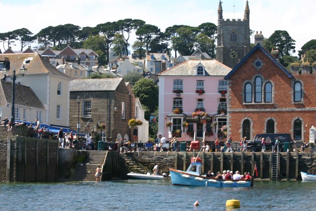
Looe is a coastal town, fishing port and civil parish in south-east Cornwall with 5,280 residents. The town stands where the East and West Looe rivers meet the English Channel.

Looe Harbour and the historic fishing waterfront define the lower valley. Polperro lies to the west, while the wider coastline extends east toward Plymouth Sound.

City map Polperro
Mick Knapton, CC BY-SA 3.0 – Wikimedia Commons

Polperro

Polperro is a village on Cornwall’s south coast with 1,554 residents. It lies in a narrow valley around a small harbour opening onto the English Channel.

The village is west of Looe and east of Fowey. Its coastal setting includes steep cliffs and the sheltered mouth of the Polperro stream.

City map Lanteglos
roger geach, CC BY-SA 2.0 – Wikimedia Commons

Lanteglos

Lanteglos is a civil parish and hamlet in south Cornwall with 823 residents. It lies inland from the coast between Fowey and Polperro.

The parish belongs to the rural landscape surrounding the River Fowey and its tributaries. Looe and Fowey are the principal nearby coastal towns.

City map Liskeard
Humphrey Bolton, CC BY-SA 2.0 – Wikimedia Commons

Liskeard

Liskeard is a market town and civil parish in Cornwall with 9,912 residents. It lies in south-east Cornwall on the route between Plymouth and Bodmin.

The town stands near the edge of Bodmin Moor and is close to the River Loveny. The Looe Valley and the fishing port of Looe lie south of Liskeard.

City map Bodmin
Tim Walker from United Kingdom, CC BY 2.0 – Wikimedia Commons

Bodmin

Bodmin is a town in Cornwall with 14,736 residents. It lies near the western edge of Bodmin Moor in the centre of the county.

Bodmin Moor is an upland granite landscape with prominent tors and the source areas of rivers including the Fowey. Bodmin Jail and the ruins of Bodmin Priory are notable features of the town.

City map Wadebridge
en:User:Benjaminevans82, Public domain – Wikimedia Commons

Wadebridge

Wadebridge is a town and civil parish in north Cornwall with 6,972 residents. It stands on the River Camel upstream from the estuary and west of Bodmin.

The town is connected with Padstow by the Camel Trail route along a former railway line. Rock, St. Minver and the north Cornish coast lie around the lower Camel valley.

City map Camelford
Chris Heaton, CC BY-SA 2.0 – Wikimedia Commons

Camelford

Camelford is a town in north Cornwall with 3,296 residents. It lies inland near the upper River Camel and the northern edge of Bodmin Moor.

The town is close to the slate and granite landscapes around the De Lank valley. Tintagel, Wadebridge and Boscastle are nearby destinations in north Cornwall.

City map Newquay
Kicior99, CC BY-SA 3.0 – Wikimedia Commons

Newquay

Newquay is a town, civil parish, seaside resort and fishing port on Cornwall’s north coast with 22,074 residents. It faces the Atlantic Ocean and is centred on Newquay Bay.

Fistral Beach and Towan Beach are prominent coastal sites, while the Gannel estuary lies west of the town. Newquay is one of Cornwall’s largest coastal settlements.

City map St. Endellion
Pam Brophy, CC BY-SA 2.0 – Wikimedia Commons

St. Endellion

St. Endellion is a village and civil parish in north Cornwall with 887 residents. It lies inland from the coast between Wadebridge and Port Isaac.

The parish includes the historic church of St Endellion and rural farmland near the Atlantic cliffs. Tintagel and Camelford are nearby places in the north Cornish interior.

City map Redruth
Joowwww, CC BY-SA 2.0 – Wikimedia Commons

Redruth

Redruth is a town and civil parish in Cornwall with 15,169 residents. It lies in the former copper and tin mining district of west Cornwall.

The town forms part of the Cornwall and West Devon Mining Landscape, a UNESCO World Heritage Site. Camborne and the coastal town of Hayle are nearby settlements along the historic mining belt.

City map Camborne
Tony Atkin, CC BY-SA 2.0 – Wikimedia Commons

Camborne

Camborne is a town and civil parish in west Cornwall with 22,074 residents. It developed as a major centre of the nineteenth-century copper and tin mining industry.

Camborne belongs to the Cornwall and West Devon Mining Landscape UNESCO World Heritage Site. Redruth lies to the east, while Hayle and St. Ives are westward toward the Atlantic coast.

City map Hayle
John Bennett, CC BY 3.0 – Wikimedia Commons

Hayle

Hayle is a town and civil parish in west Cornwall with 9,400 residents. It stands around the Hayle Estuary, where the rivers Hayle and Phillack reach St Ives Bay.

Hayle Harbour and the surrounding sand dunes are major features of the west Cornish coast. St. Ives lies north-west across the bay, while Camborne is inland to the east.

City map St. Ives
waterborough, Public domain – Wikimedia Commons

St. Ives

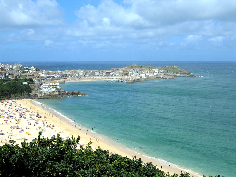
St. Ives is a seaside town, civil parish and port in west Cornwall with 11,226 residents. Its recorded area is approximately 9.41 square kilometres.

The town lies on St Ives Bay and is known for the Tate St Ives and the Barbara Hepworth Museum and Sculpture Garden. Hayle is south-east across the bay, while the Atlantic coast extends west toward Land’s End.

Data sources: OpenStreetMap (ODbL), Wikidata (CC0) · Image: Wikimedia Commons

Kernow / Cornwall – Facts

Inhabitants 565968
Area 3546.0 km²
Subregions 212
Located in Cornwall
Country United Kingdom
Native label Cornwall
Website https://www.cornwall.gov.uk/

Data source: Wikidata (CC0)

Roads in Cornwall

Important and frequently searched streets
Talland Street Masonic Hall