
Turton Tower in North Turton
Turton Tower in Blackburn with Darwen, North Turton is an attraction. Turton Tower is near Tower Drive. Ⓦ.
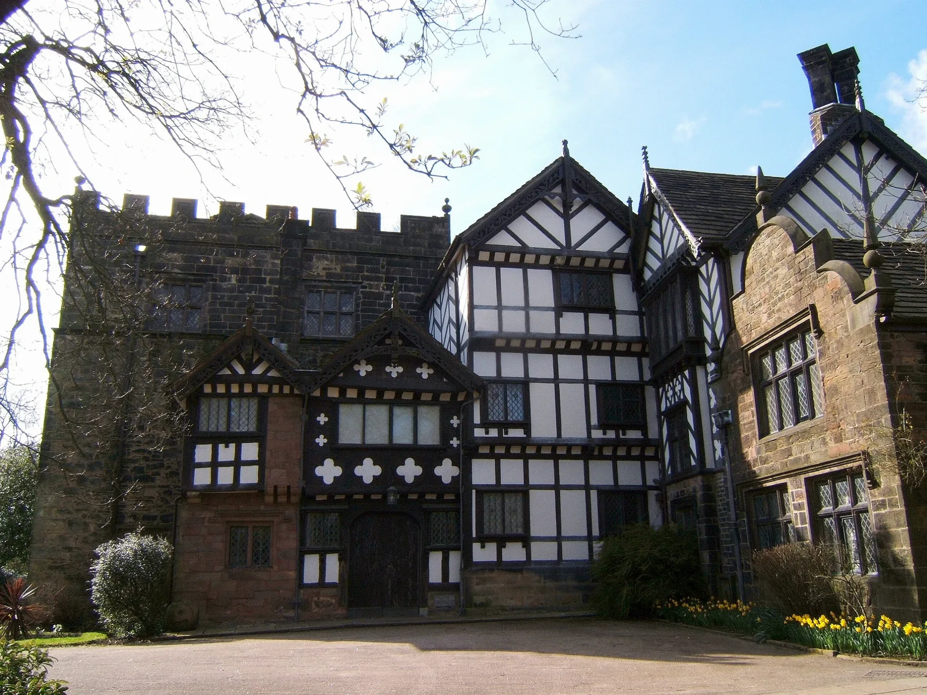
- Building Type
- building
- Tourism
- attraction
- Website
- https://turtontower.com/
Bus stops
Roads nearby
Tower Drive200 m
The Sidings400 m
Chapeltown RoadChapeltown by Turton Tower, Chapeltown by Horrobin Lane
400 m
Horrobin Lane400 m
The Copse450 m
Station RoadTurton Level Crossing
450 m
Chapel View450 m
The Spinney500 m
Kay Street550 m
Bank Street550 m
High StreetChapeltown opp St Annes Church, Chapeltown by St Annes Church, Belmont, adjacent to Black Dog Inn, Belmont opp Ryecroft Lane, Belmont opp Post Office, Belmont by High Street, Belmont by Anshaw Close
650 m
Tower Street650 m
Chapel Fields650 m
Back Tower StreetChapeltown
650 m
Charlotte Street650 m
Jumbles ReservoirHow can we tell this is a fossil plant?
700 m
Tower Court700 m
Chapel Grange850 m
Greens Arms RoadChapeltown by Railway Bridge
850 m
Backof Prospect Hill1000 m
Haydock Lane1,2 km
Kiln Brow1,3 km
Broadmeadow1,3 km
Grange Road1,3 km
Ramwells Court1,3 km
Woodland View1,3 km
Hillside Avenue1,4 km
Hospital RoadHospital Road
1,4 km
Windy Harbour Lane1,4 km
Dovecote Close1,4 km
Longridge1,4 km
Kibbles Brow1,5 km
Highland Road1,5 km
Beauty salons nearby
Calm650 m
Body of waters nearby
Hazelhurst Lodge700 m
Constructions nearby
The Grange1,4 km
Farmyards nearby
Chetham Farm600 m
Golf courses nearby
Turton Golf Course600 m
Places of worship nearby
St Anne's Church650 m
Pubs nearby
Chetham Arms600 m
The King William700 m
Railway lines nearby
Ribble Valley Line1,1 km
Residential areas nearby
Prospect Hill1,0 km
The Sanctuary1,4 km
Sports pitches nearby
Turton Crown Green Bowls Club650 m
Streams nearby
Swine Yard Brook600 m
Hazelhurst Brook1,1 km
Billy Brook1,1 km
Woodlands nearby
Hazelhurst Wood450 m
| Owner | Blackburn with Darwen |
|---|---|
| Heritage designation | Grade I listed building |
| Located in | North Turton |
| Postal code | BL7 0HG |
| Country | United Kingdom |
 Public transport map North Turton Legend
| Railway | |
| Bus | |
| Tram |
 Cycling map North Turton Legend
| Cycle path | |
| Cycle lane on road | |
| Cycling on bus lane | |
| Bicycle street | |
| Cyclists allowed | |
| Cyclists allowed, good surface | |
| No cycling | |
| Cobblestones |
| Long-distance cycle route | (depending on scale) | |
| Long-distance cycle route |
 Walking map North Turton Legend
| Path |
| Long-distance hiking trail | (depending on scale) | |
| Long-distance hiking trail | ||
| No pedestrians |