
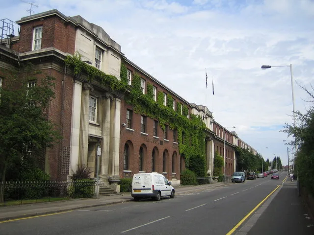
Woodland Avenue in Borough of Luton
Woodland Avenue in Luton is a main road. It runs in a northeast-southwest direction starting from Montrose Avenue and crosses Bishopscote Road and ends at Leagrave Road. In the vicinity, you can find a butcher's, a kindergarten and a travel agency. Woodland Avenue also exists in Brighton and Hove, Slough, City of Leicester, Stoke-on-Trent and Plymouth.
- Road Type
- main road
- Speed Limit
- 30 mph
- Route
- northeast-southwest
Image
Roads nearby
Tudor RoadWoodland Pharmacy, Sophisticut
150 m
St Ives CloseSt Monica's Day Centre
200 m
Rondini AvenueBaitul Abraar Jami Masjir
200 m
Ascot Road200 m
Kennington RoadDenbigh Pharmacy
250 m
Fitzroy AvenueLucky House, Bismillah Food Store
250 m
Montrose AvenueThe BIscot Mill, St Margarets Methodist Church
250 m
Biscot RoadBiscot, Kasmir Goldsmith, 5 Star Barbers, Bites & Delights, Al Amin C & C, Saree Bazaar, Family Choice, Perfect Touch Barbers, Muneeb Cash & Carry, FC News, Peri Peri Junction, Little Companions Day Care Nursery, Edwardian Care Home, Rise and Shine Day Nursery, Juniors Peri Peri, Sahara, First Steps Pre-School, Arabil Travel, Streamlink International, Al-Jalal Masjid, Biscot Mill Food Store, The Hire Shop, Sam's Fish Bar, Al-Baraka Superstore, Sub Box, Al Falah, The Oriental, Al-Islah Cash & Carry and Foodstore, Co-op Food, Biscot Pharmacy, Jerk and Peri Peri, S&S Fashions, Paps Hair Styles, Dessert Island
250 m
Millfield RoadDomenic's Cafe
250 m
Bishopscote RoadAmor Dessert Lounge, Hair Kutz, UK Peri Peri, Bishopscote Pharmacy, Rex Laundrette, Bamboo Garden, Paddy Power, Pauls Pet, Marinas, PJ Shoes
300 m
St James RoadN&D Local Discount Food & Wine, A&S Food
300 m
Beaumont Road300 m
St Christophers Place300 m
St Monicas Avenue300 m
Broadmead300 m
Cavendish RoadNayaabs's Boutique
350 m
Shervington Grove350 m
St Margarets AvenueJohal's, Co-operative, Ahmed Food Store
350 m
St Catherines Avenue350 m
Leagrave RoadLeagrave Service Station, Kodak Express, Booze Express, Alan's Tattoo Studio, Mega Mobiles, The Closet, Sam's Chicken, Rank Pharmacy, Your Choice Foods, AZ Auto Spares, Cafe Luton, Punjab, Laziza, Is-Haaq Fabrics, Fades, Newsway, Shawarma Express, QKI Food store, Air Express, MH Jewellers, Baba Lal, Surma Stores, Halal Sweet Shop, Town Tub, Scarves & Hijabs, P & R Travel, Spicy Chicken, Anando Mahal, JJ's Pizza & Peri Peri Express, Zaina's Boutique, Ali Home Bargains, The Fountain, Rahmah Travel, Rakesh Jewellers, Akram Second Hand Retailers, One Stop, Gul-e-Rana, Rajab Techo Luton, Aaghaz, Anchal Boutique, Polish Mini Market, Romanian Minimarket, Lahore Palace, Express Dry Cleaners, Usman's Blend, Banoful, Niralla Sweets, Shisha Planet, Sahib Jaan, BM Travel, Studio 21, HMK Mobiles, Mipur Jewellers, Araisha, Fatima, Diamond Jewellers, MK Carpets, Tiger, aa Carpets and Furniture, Rivaaj, Suits Me, Carpetzone, Coral, Beech Hill Conservative Club, Islam Travels, Ghzala, Link Fast Services, RK Hair Salon, Saba's Collection, Sheen, Alauddin Sweetcentre, Halal Butchers, A & K Motorist Centre, Jimmy's Wholesale Tyres, Venue Central, Bismillah Hair Salon, Ar-Raya, Shah's Newsagent, Partsline, Adam Baksh, Kayah Fashions, Farah's Boutique
400 m
Sheridan RoadFamily Choice
400 m
Holland RoadShires Funeral Directors
400 m
High Mead400 m
Selbourne RoadM & H Food Store, Hafsah, Teeny days, Zaheers Venue & Buffet
400 m
The Meads400 m
St Andrews Grove450 m
Alder CrescentCostcutter
450 m
Alexandra AvenueBiscot Mill Veterinary Centre
450 m
Dover Close450 m
St Augustine AvenueCulverhouse Road Post Office
450 m
St Mildreds Avenue450 m
Sherwood Road500 m
Norman RoadDFS Foodstore, Biscot Car Parts, Hiba Health Foods
500 m
Avenue Grimaldi500 m
Solway Road South500 m
Liddel Close500 m
Maidenhall RoadKiddies Kingdom, Treetop Nursery
500 m
Grantham RoadUK Halal
500 m
Dane RoadSacred Beans, The Grill Hot & Spicy Piri Piri Autentico
550 m
Maryport Road550 m
Trent Road600 m
Gayton Close600 m
Stratford Road650 m
Newark RoadMukhtar General Store, Newark General Store
650 m
Manx Close650 m
Industrial areas nearby
Britannia Estate450 m
Railway lines nearby
Limbury Road Sidings450 m
Recreation grounds nearby
Blundell Road Recreation Ground550 m
Alder Crescent Playing Fields550 m
 Public transport map Luton Legend
| Railway | |
| Bus | |
| Tram |
 Cycling map Luton Legend
| Cycle path | |
| Cycle lane on road | |
| Cycling on bus lane | |
| Bicycle street | |
| Cyclists allowed | |
| Cyclists allowed, good surface | |
| No cycling | |
| Cobblestones |
| Long-distance cycle route | (depending on scale) | |
| Long-distance cycle route |
 Walking map Luton Legend
| Path |
| Long-distance hiking trail | (depending on scale) | |
| Long-distance hiking trail | ||
| No pedestrians |