
Ranscombe Farm Nature Reserve in Cuxton
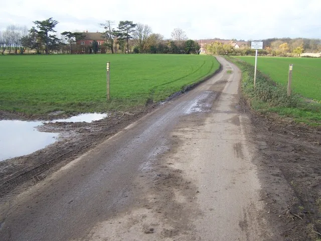
Ranscombe Farm Nature Reserve in Medway, Cuxton is a nature reserve (Plantlife). Ranscombe Farm Nature Reserve is near Rio. Ⓦ.
- Leisure
- nature reserve
- Operator
- Plantlife
Image
Guest house
School
Post offices
Fast food restaurants
Bus stops
Tourist information offices
Convenience stores
Library
Hairdressers
Platforms
Roads nearby
Rio500 m
Warren Road700 m
Upper Bush RoadUpper Bush
750 m
Down the Chute850 m
Burnt Car Climb850 m
Twist of Lime900 m
Riggall Court1,1 km
Demelza Close1,1 km
Nine Acres Road1,4 km
Poplicans Road1,4 km
Bush RoadScout Hut, Junior School, Cuxton Library, The Co-operative Food, Cuxton Post Office, Cuxton Mini-Market, Topiarys, Golden River, Beehive Playgroup, North Downs Barn B&B Rochester
1,5 km
Monkey Biz1,5 km
Cobhambury RoadNew College
1,5 km
Great Wood Street1,5 km
Lodge LaneInformation board, Cobham War Memorial, Tourist information centre
1,6 km
White Leaves Rise1,6 km
Charles DriveWhiteleaves Rise, Nine Acres Road, Charles Drive
1,6 km
Ladywood Road1,6 km
Tar Tank Lane1,6 km
Easy Legs1,7 km
Reginald Avenue1,8 km
Wood Street1,8 km
James RoadJames Road
1,8 km
William RoadCuxton
1,8 km
Hayley Close1,8 km
Harold Road1,8 km
Buildings nearby
Darnley Mausoleum850 m
Rochester and Cobham Park Golf Club1,3 km
Cobham Dairy1,5 km
The Aviary1,6 km
Farmyards nearby
Dean Farm1,5 km
Industrial areas nearby
Cuxton WSW650 m
Meadows nearby
Kitchen Field500 m
Brockles Field500 m
Parks nearby
Cuxton Recreation grounds1,6 km
Railway lines nearby
Chatham Main Line1,3 km
High Speed 11,8 km
Woodlands nearby
Red Wood850 m
Longbottom Wood950 m
Shoulder of Mutton Shaw1,2 km
North Wood1,2 km
Stonereed Shaw1,3 km
Swyre's Shaw1,3 km
Purty's Shaw1,5 km
Clarkes Wood1,6 km
Cobhambury Wood1,6 km
Little Red Wood1,7 km
May's Wood1,7 km
Other nearby
Cuxton B H Site B650 m
| Located in | Kent |
|---|---|
| Country | United Kingdom |
 Public transport map Cuxton Legend
| Railway | |
| Bus | |
| Tram |
 Cycling map Cuxton Legend
| Cycle path | |
| Cycle lane on road | |
| Cycling on bus lane | |
| Bicycle street | |
| Cyclists allowed | |
| Cyclists allowed, good surface | |
| No cycling | |
| Cobblestones |
| Long-distance cycle route | (depending on scale) | |
| Long-distance cycle route |
 Walking map Cuxton Legend
| Path |
| Long-distance hiking trail | (depending on scale) | |
| Long-distance hiking trail | ||
| No pedestrians |