Mole Valley

This City map of Mole Valley in Surrey, England, shows the region’s streets, paths and places across approximately 258.3 square kilometres. Mole Valley is a local government district in Surrey with about 87,253 residents recorded for 2018. The population increased from 85,800 in 2012 to 87,769 in 2022. The district is divided into 13 civil parishes and villages, including Charlwood, Dorking-area settlements and communities along the River Mole.

City map Mole Valley
PorgeHR, Public domain – Wikimedia Commons
City map Charlwood
Crispness, CC BY 3.0 – Wikimedia Commons

Charlwood

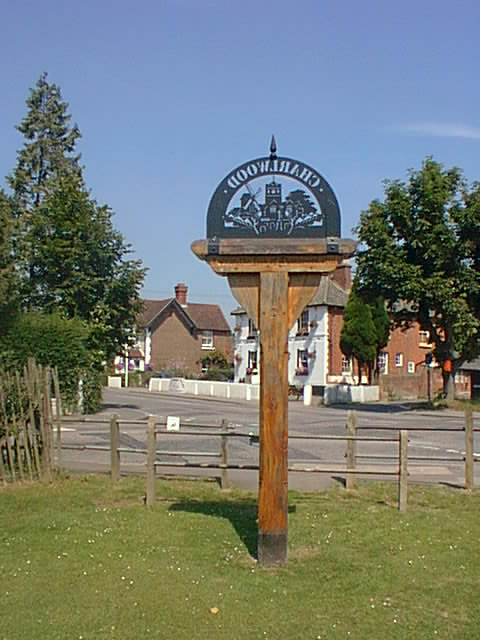
Charlwood is a village and civil parish in Mole Valley, Surrey, with a recorded population of 2,395. Its parish area covers approximately 14.56 square kilometres, making it one of the larger named parishes in the district.

The settlement is located in the western part of Mole Valley near the Surrey boundary with West Sussex. Charlwood’s administrative level is 10, placing it below Mole Valley’s district-level administration.

City map Leigh
Plucas58, CC BY-SA 3.0 – Wikimedia Commons

Leigh

Leigh is a village and civil parish in Surrey with a recorded population of 887. The parish covers approximately 13.82 square kilometres within Mole Valley.

Leigh belongs to the rural parish structure of the district and has administrative level 10 in the regional map data. Its location places it among the Surrey settlements surrounding the larger urban areas of Mole Valley.

City map Betchworth
Dr Neil Clifton, CC BY-SA 2.0 – Wikimedia Commons

Betchworth

Betchworth is a village and civil parish in the Mole Valley district of Surrey. It has a recorded population of 1,052 and covers approximately 9.91 square kilometres.

The parish is situated in the northern part of Mole Valley, close to the River Mole valley and the North Downs landscape. Betchworth is mapped at administrative level 10 within the district.

City map Headley
Ian Capper, CC BY-SA 2.0 – Wikimedia Commons

Headley

Headley is a village and civil parish in Surrey with a recorded population of 583. Its area is approximately 6.75 square kilometres.

The parish forms part of Mole Valley’s network of smaller rural communities and is represented at administrative level 10. Headley lies in the Surrey countryside south of the main settlements of the district.

City map Mickleham
Colin Smith, CC BY-SA 2.0 – Wikimedia Commons

Mickleham

Mickleham is a village and civil parish in Surrey with a recorded population of 513. The parish covers approximately 7.31 square kilometres and has administrative level 10.

Mickleham is located in the northern part of Mole Valley near the North Downs, a prominent chalk ridge extending across Surrey. Its position connects the parish with the countryside north of Dorking and the River Mole corridor.

City map Newdigate
Colin Smith, CC BY-SA 2.0 – Wikimedia Commons

Newdigate

Newdigate is a village and civil parish in the Mole Valley district of Surrey. It has a recorded population of 1,725 and covers approximately 19.18 square kilometres.

With its 19.18-square-kilometre area, Newdigate is among the larger parishes in Mole Valley. The village lies in the district’s southern lowland area and is administered at level 10.

City map Buckland
Chris Allen, CC BY-SA 2.0 – Wikimedia Commons

Buckland

Buckland is a village and civil parish in the Mole Valley district of Surrey with a recorded population of 574. Its parish area is approximately 5.51 square kilometres.

The settlement is part of the rural communities in the central and northern part of Mole Valley. Buckland has administrative level 10 and is located near the Surrey landscapes associated with the North Downs and the River Mole valley.

City map Holmwood
PorgeHR, Public domain – Wikimedia Commons

Holmwood

Holmwood is a parish in Surrey with a recorded population of 943. It forms one of the 13 subregions represented on the Mole Valley map.

The parish is located south of Dorking in the Surrey countryside and has administrative level 10 in the regional data. Holmwood includes the settlements known as North Holmwood and South Holmwood within the Mole Valley area.

City map Brockham
Ian Capper, CC BY-SA 2.0 – Wikimedia Commons

Brockham

Brockham is a village and civil parish in the Mole Valley district of Surrey. Its recorded population is 2,868, and the parish covers approximately 6.90 square kilometres.

Brockham is one of the more populous named parishes in Mole Valley and lies near the northern district boundary. The settlement is mapped at administrative level 10 in the Surrey district of Mole Valley.

City map Abinger
SuzanneKn at en.wikipedia, Public domain – Wikimedia Commons

Abinger

Abinger is a village and civil parish in Mole Valley, Surrey, with a recorded population of 1,912. The parish covers approximately 30.17 square kilometres, the largest area among the 13 listed subregions.

Abinger extends across the Surrey Hills landscape south-west of Dorking and includes countryside around the Tillingbourne valley. Its administrative level is 10 within Mole Valley.

City map Ockley
The Voice of Hassocks, CC0 – Wikimedia Commons

Ockley

Ockley is a village and civil parish in Mole Valley, Surrey, with a recorded population of 918. Its area is approximately 13.75 square kilometres.

The parish occupies part of the southern Surrey countryside and has administrative level 10. Ockley is one of Mole Valley’s rural civil parishes, located south of the North Downs and west of the district’s central settlements.

City map Capel
Speach, CC BY-SA 3.0 – Wikimedia Commons

Capel

Capel is a village and civil parish in Surrey with a recorded population of 3,787. The parish covers approximately 26.14 square kilometres, making it both one of the largest and one of the most populous subregions listed for Mole Valley.

Capel lies in the southern part of the district near the boundary with West Sussex. It has administrative level 10 and includes a substantial area of Surrey countryside within Mole Valley.

City map Wotton
Colin Smith, CC BY-SA 2.0 – Wikimedia Commons

Wotton

Wotton is a village and civil parish in Surrey with a recorded population of 560. Its parish area is approximately 22.43 square kilometres.

The parish lies in the Surrey Hills area of Mole Valley, south-west of Dorking and close to the Tillingbourne valley. Wotton is administered at level 10 and is one of the 13 subregions shown on the district map.

Data sources: OpenStreetMap (ODbL), Wikidata (CC0) · Image: Wikimedia Commons

Mole Valley – Facts

Inhabitants 87253
Area 258.3 km²
Subregions 13
Located in Surrey
Country United Kingdom
Website https://www.molevalley.gov.uk/

Data source: Wikidata (CC0)

Roads in Mole Valley