
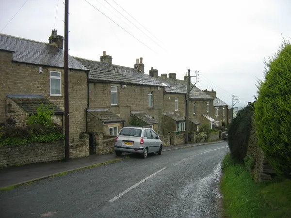
Bollihope House in Stanhope, County Durham
Bollihope House in County Durham, Stanhope is a building. Bollihope House is near White Kirkley Bridge. Ⓦ.
- Building Type
- building
Bus stops
Stations
Tourist information offices
Chalet
Places of worship
Roads nearby
White Kirkley BridgeWhite Kirkley
1,3 km
Bolling LaneHarehope
1,5 km
Mellbutts BankFrosterley, Welcome to Frosterley
1,8 km
Chapel CloseCo-op Store
1,9 km
Greenwell Terrace1,9 km
Wear View1,9 km
WestfieldTelephone Exchange
1,9 km
Holmefield1,9 km
Kirk RiseCo-op Store, Frosterley Methodist Fellowship, Frosterley Post Office
2,0 km
Glebe Side2,0 km
Western Hill2,0 km
Cromer Lea2,0 km
Dene Hill2,0 km
Glebe ViewFrosterley, Frosterley Inn
2,0 km
Intake Lane2,1 km
Tourism nearby
Fineburn Caravan Park100 m
Abandoned railways nearby
Bishopley Branch1,4 km
Bollihope Railway1,6 km
Buildings nearby
High Bishopley250 m
Rose Cottage300 m
Pye Close500 m
Fine House1,0 km
Former Bollihope miners' shop1,0 km
Bishopley Limekilns1,5 km
Broadwood View2,0 km
Caravan site nearby
Betsdale Caravan Park2,2 km
Churches nearby
St Michael & All Angels1,9 km
Community centres nearby
Frosterley Village Hall1,9 km
Farmyards nearby
Miln House Farm1,1 km
White Kirkley Farm1,3 km
Bridge End1,5 km
Woodcroft Farm2,0 km
Fast food restaurants nearby
Village Chip Bar1,9 km
Forests nearby
Folly Plantation1,7 km
Industrial areas nearby
Sawmill2,2 km
Quarries nearby
North Bishopley Quarry1,3 km
Parson Byers Quarry1,8 km
Railway lines nearby
Weardale Railway1,7 km
Residential areas nearby
Whitfield Brow1,2 km
Streams nearby
Wager Burn1,1 km
Dry Burn1,3 km
Fine Burn1,5 km
Howden Burn1,5 km
Supermarkets nearby
Lakes & Dales Co-operative2,0 km
Terraced houses nearby
Low Bishopley Cottages1,1 km
Croft Terrace (West)1,9 km
Croft Terrace (East)1,9 km
Osborne Terrace2,1 km
Woodlands nearby
Mellbutts Plantation1,8 km
| Located in | Stanhope |
|---|---|
| Country | United Kingdom |
 Public transport map Stanhope Legend
| Railway | |
| Bus | |
| Tram |
 Cycling map Stanhope Legend
| Cycle path | |
| Cycle lane on road | |
| Cycling on bus lane | |
| Bicycle street | |
| Cyclists allowed | |
| Cyclists allowed, good surface | |
| No cycling | |
| Cobblestones |
| Long-distance cycle route | (depending on scale) | |
| Long-distance cycle route |
 Walking map Stanhope Legend
| Path |
| Long-distance hiking trail | (depending on scale) | |
| Long-distance hiking trail | ||
| No pedestrians |