
Killhope Lead Mining Museum in Stanhope, County Durham
Killhope Lead Mining Museum in County Durham, Stanhope is a museum (free, web) (DL13 1AR). Killhope Lead Mining Museum is also known as Killhope the North of England Lead Mining Museum. Killhope Lead Mining Museum is near Carriers Way. Ⓦ.
- Postal Code
- DL13 1AR
- Tourism
- museum
- Website
- https://www.killhope.org.uk/
Image
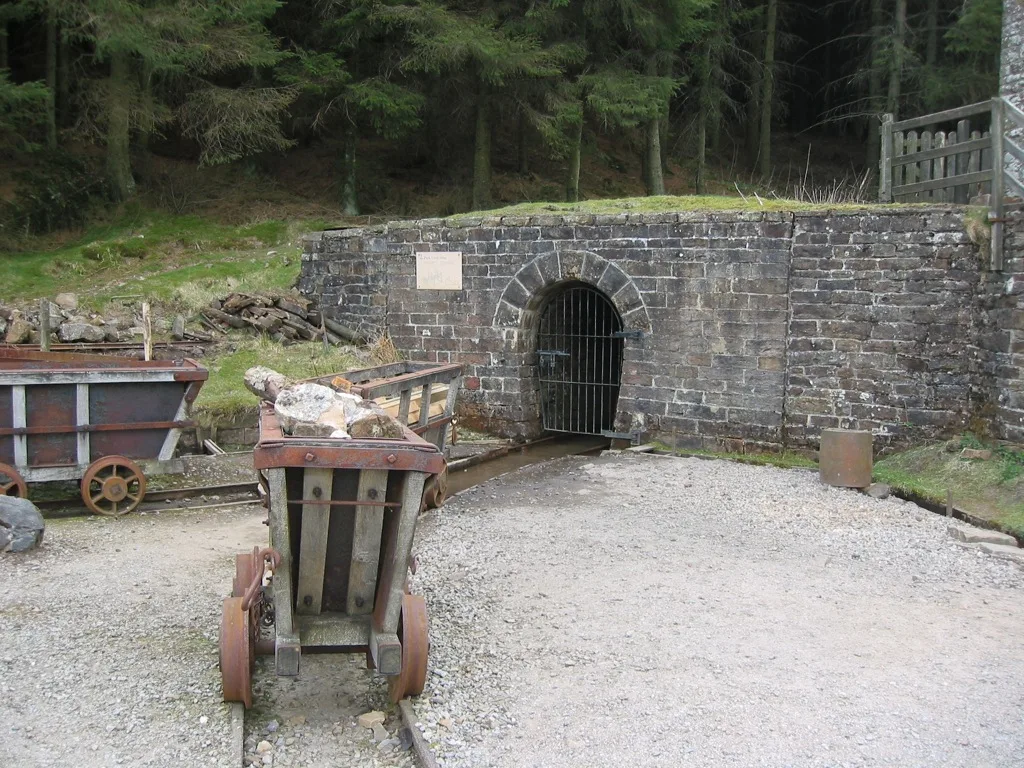
Tourist information offices
Viewpoint
Bus stops
Roads nearby
Carriers Way2,5 km
Body of waters nearby
Kidd's Dam750 m
Collierhill Dam1,0 km
Buildings nearby
Squirrel Hide150 m
High Byre1,5 km
Whitestone House1,9 km
Mutton Hall3,1 km
Campsite nearby
Killhope Lead Mining Museum Yurts50 m
Farmyards nearby
Bank Foot1,8 km
South Wellhope2,0 km
Guest house nearby
Lanehead Old School2,3 km
Gullies nearby
Cowhorse Hush900 m
Industrial buildings nearby
Mine Shop100 m
Jigger House200 m
Buddle House250 m
Ridges nearby
Rough Tongue2,6 km
Rivers nearby
Killhope Burn700 m
Ruins nearby
Middlehope Head3,0 km
Sheds nearby
Masterman Washer's Hut150 m
Streams nearby
Snodberry Cleugh700 m
Hard Sike800 m
Betty's Cleugh800 m
Isaac's Cleugh950 m
Clay Sike1,1 km
Killhopelaw Sike1,2 km
Snipe Sike1,6 km
Five Sike1,6 km
Coulson's Sike1,9 km
Bram Sike1,9 km
North Cleugh2,0 km
South Cleugh2,1 km
Wellhope Burn2,2 km
Washpool Cleugh2,5 km
Roundhill Sike2,5 km
Bridge Cleugh2,5 km
Groove Sike2,6 km
Todd's Sike2,7 km
Varty's Sike2,9 km
Short's Cleugh2,9 km
Deep Cleugh3,0 km
Whetstonemea Burn3,0 km
Quarry Sike3,1 km
Shop Cleugh3,1 km
Coal Cleugh3,2 km
Shieldridge Burn3,3 km
Valleies nearby
Kill Hope350 m
Well Hope2,4 km
Black Cleugh3,0 km
Woodlands nearby
Lanehead Plantation2,2 km
| Inception | 1984 |
|---|---|
| Located in | Cowshill |
| Country | United Kingdom |
| Described by source | Subterranea Britannica, Subterranea, Buddle Pit |
 Public transport map Stanhope Legend
| Railway | |
| Bus | |
| Tram |
 Cycling map Stanhope Legend
| Cycle path | |
| Cycle lane on road | |
| Cycling on bus lane | |
| Bicycle street | |
| Cyclists allowed | |
| Cyclists allowed, good surface | |
| No cycling | |
| Cobblestones |
| Long-distance cycle route | (depending on scale) | |
| Long-distance cycle route |
 Walking map Stanhope Legend
| Path |
| Long-distance hiking trail | (depending on scale) | |
| Long-distance hiking trail | ||
| No pedestrians |