
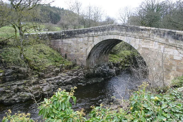
Stanhope Bridge in Stanhope, County Durham
Stanhope Bridge in County Durham, Stanhope is an asphalted, unlit secondary road. The road has no sidewalks. There is no cycle path. It runs in a north-south direction and ends in a cul-de-sac. Stanhope Bridge is also known as Stanhope Stone Bridge. This road is part of the hiking trail "Weardale Way" and the bicycle route "National Byway (County Durham and Northumberland)".
- Road Type
- secondary road
- Speed Limit
- 60 mph
- Route
- north-south
Image
Guest house
Boat hires
Artwork
Bus stops
Fountains
Cafés
Tourist information offices
Fast food restaurants
Pubs
Art galleries
Roads nearby
Unthank BankUnthank
550 m
Allerton BridgeBurnside Brae Guest House
600 m
Waterside CourtNewtown House, Memorial Fountain
650 m
Cowgarth Hill750 m
Westcroft850 m
Union Street850 m
Eastcroft900 m
Paragon Street950 m
Cross Hill950 m
St Thomas' Close950 m
Ashcroft950 m
Grosvenor Close950 m
Cross StreetStanhope Fish & Chips
950 m
Crawleyside BankCrawleyside Bank (Ashers Ho.), Crawleyside, West Terrace, Lane Head
1000 m
Barrington Court1000 m
Chapel Street1,0 km
Garden Close1,0 km
Park View1,1 km
Castle GardensAccess Land in the North Pennines, Welcome to the Durham Dales Centre
1,1 km
Dunsfield Farm Estate1,1 km
The ButtsChristine's Hair and Beauty
1,1 km
Beauty salons nearby
The Beauty Barn450 m
Body of waters nearby
Greenfoot Quarry50 m
Buildings nearby
Stanhope Hall Mill600 m
(Former) Town Hall950 m
Stanhope Silver band1000 m
The Bungalow1,0 km
North Lodge1,1 km
Aller Gill House1,1 km
Stanhope Castle1,1 km
Middle Farm1,2 km
Caravan site nearby
Belle Vue Caravan Site1,2 km
Community centres nearby
Stanhope Community Centre950 m
Disused railways nearby
Weardale Railway450 m
Farmyards nearby
Unthank Mill900 m
Widleyfield Farm1,1 km
Horsley Burn Farm1,1 km
Bushy Flatt Farm1,2 km
Belle Vue Farm1,2 km
Funeral directors nearby
Charlotte Fleming Funeral Services1,1 km
Guest house nearby
Belle Vue Country B&B1,2 km
Hospital nearby
Weardale Community Hospital450 m
Houses nearby
Stanhope Hall550 m
Quarries nearby
Ashes Quarry (West)1,1 km
Residential areas nearby
Stanhope Burn Caravan Park1000 m
Rivers nearby
Stanhope Burn950 m
Sports centres nearby
Weardale Open Air Pool700 m
Sports pitches nearby
Stanhope Cricket Club1000 m
Streams nearby
Allerton Burn850 m
| Inception | 1400 |
|---|---|
| Located in | Stanhope |
| Country | United Kingdom |
| Crosses | River Wear |
| Carries thoroughfare | B6278 road |
| Location | Stanhope |
 Public transport map Stanhope Legend
| Railway | |
| Bus | |
| Tram |
 Cycling map Stanhope Legend
| Cycle path | |
| Cycle lane on road | |
| Cycling on bus lane | |
| Bicycle street | |
| Cyclists allowed | |
| Cyclists allowed, good surface | |
| No cycling | |
| Cobblestones |
| Long-distance cycle route | (depending on scale) | |
| Long-distance cycle route |
 Walking map Stanhope Legend
| Path |
| Long-distance hiking trail | (depending on scale) | |
| Long-distance hiking trail | ||
| No pedestrians |