
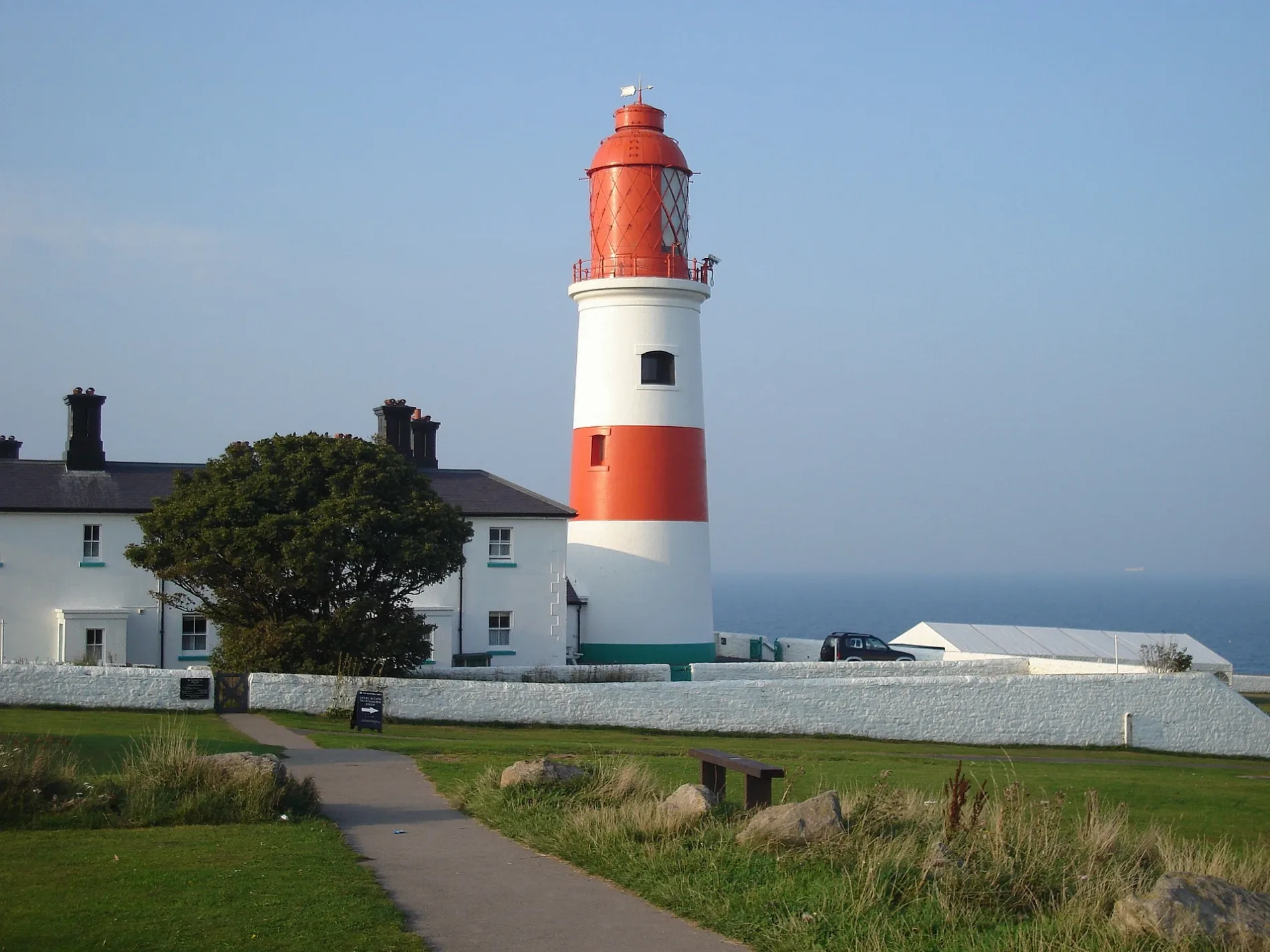
Souter Lighthouse in South Tyneside
Souter Lighthouse in South Tyneside is a museum (National Trust, fee required, web) (SR6 7NH). Souter Lighthouse is also known as Souter Point Lighthouse And Attached Buildings 25877;. Souter Lighthouse is near Arthur Street. Souter Lighthouse is made of brick. Ⓦ.
- Postal Code
- SR6 7NH
- Building Type
- building
- Operator
- National Trust
- Tourism
- museum
- Website
- https://www.nationaltrust.org.uk/souter-lighthouse-and-the-leas
Image
Chalet
Cafés
Tourist information offices
Bus stops
Roads nearby
Arthur Street450 m
Kitchener RoadKitchener Road - Authur Street (E/B)
600 m
Coast RoadCoast Road, Marsden Grotto, Linnet Way, Millennium Milepost Souter Lighthouse, Souter Lighthouse and The Leas, COAST ROAD-CHEVIOT ROAD-N/B, COAST ROAD-FRENCHMANS BAY-N/B, Coast Road - Souter (S/B), Coast Road - Souter (N/B), The Leas - Industry and Nature
650 m
ShearwaterWhitburn Coastal Park Local Nature Reserve
850 m
White Rocks Grove950 m
Lilac Avenue1,0 km
Lily Crescent1,1 km
May Grove1,1 km
Grotto Road1,2 km
Marsden Avenue1,2 km
Wheatall DriveSimars News - Best Buy
1,2 km
Fairfield Drive1,3 km
Rose Crescent1,3 km
Fern Avenue1,3 km
Fallow Road1,3 km
Quarry LaneQUARRY LANE-SUNDERLAND ROAD-E/B, QUARRY LANE-PINE AVENUE-E/B, QUARRY LANE-LARCH AVENUE-W/B, QUARRY LANE-PINE AVENUE-W/B, QUARRY LANE-SUNDERLAND ROAD-W/B, The White Horse, QUARRY LANE-THE LONNEN-E/B, WATSON AVENUE, White Horse Inn, Quarry Lane Tandoori, The Salon, Singh's Wine Store
1,3 km
Lakeside1,3 km
Mill LaneMill Lane, Mill Lane - Lilac Avenue (S/B), Mill Lane - St James Church, Mill Lane-Mill Tavern, Hebburn College, Whitburn, The Swarm, The Bee Hive
1,3 km
Lizard LaneLIZARD LANE-LAKE AVENUE-NW/B, Lizard Lane, Marsden, LIZARD LANE-CORNTHWAITE DRIVE, LIZARD LANE-HIGHCROFT DRIVE, LIZARD LANE-SOUTER VIEW-N/B, LIZARD LANE-SOUTER VIEW-S/B, LIZARD LANE-GOLF COURSE-S/B, LIZARD LANE-GOLF COURSE-N/B, LIZARD LANE-RIDING SCHOOL-S/B, Lizard Lane - Hillhead Farm
1,4 km
Souter View1,4 km
Grotto Gardens1,4 km
Lake AvenueLAKE AVENUE-NE/B, LAKE AVENUE-SW/B, LAKE AVENUE, LAKE AVENUE-LIZARD LANE-W/B, LAKE AVENUE-LIZARD LANE-E/B, JZ Hair Salon, Herbs & Spices Kitchen, The Lake
1,4 km
Cliffside1,4 km
Lake Shore Road1,4 km
Lindsay Court1,5 km
Green Hill Walk1,5 km
Fulmar Walk1,5 km
Farding Square1,5 km
White Horse View1,5 km
Redwell Lane1,6 km
Prince Edward Road EastMarsden, Prince Edward Road
1,6 km
Cedar Grove1,6 km
Marsden LaneMarsden, Marsden Lane, Dicksons, Tesco Express
1,6 km
Redwell Court1,6 km
Prince Edward Grove1,6 km
Attraction nearby
Marsden Rock1,1 km
Bird hides nearby
Whitburn Bird Observatory1,1 km
Buildings nearby
Souter Foghorn100 m
Coastal Conservation Center200 m
Marsden Lime Kilns400 m
Marsden Hall1,1 km
Caravan site nearby
Lizard Lane Caravan Park1000 m
Constructions nearby
The Fairways1,5 km
Golf courses nearby
Whitburn Golf Club600 m
Kiosks nearby
National Trust1,5 km
Picnic site nearby
Foghorn Field100 m
Places of worship nearby
Lighthouse Christian Fellowship400 m
Quarries nearby
Marsden Quarry650 m
Restaurants nearby
The Marsden Grotto1,1 km
| Inception | 1871 |
|---|---|
| Material | brick |
| Height | 23 m |
| Owner | National Trust |
| Heritage designation | Grade II* listed building |
| Located in | South Tyneside |
| Country | United Kingdom |
 Public transport map South Tyneside Legend
| Railway | |
| Bus | |
| Tram |
 Cycling map South Tyneside Legend
| Cycle path | |
| Cycle lane on road | |
| Cycling on bus lane | |
| Bicycle street | |
| Cyclists allowed | |
| Cyclists allowed, good surface | |
| No cycling | |
| Cobblestones |
| Long-distance cycle route | (depending on scale) | |
| Long-distance cycle route |
 Walking map South Tyneside Legend
| Path |
| Long-distance hiking trail | (depending on scale) | |
| Long-distance hiking trail | ||
| No pedestrians |