
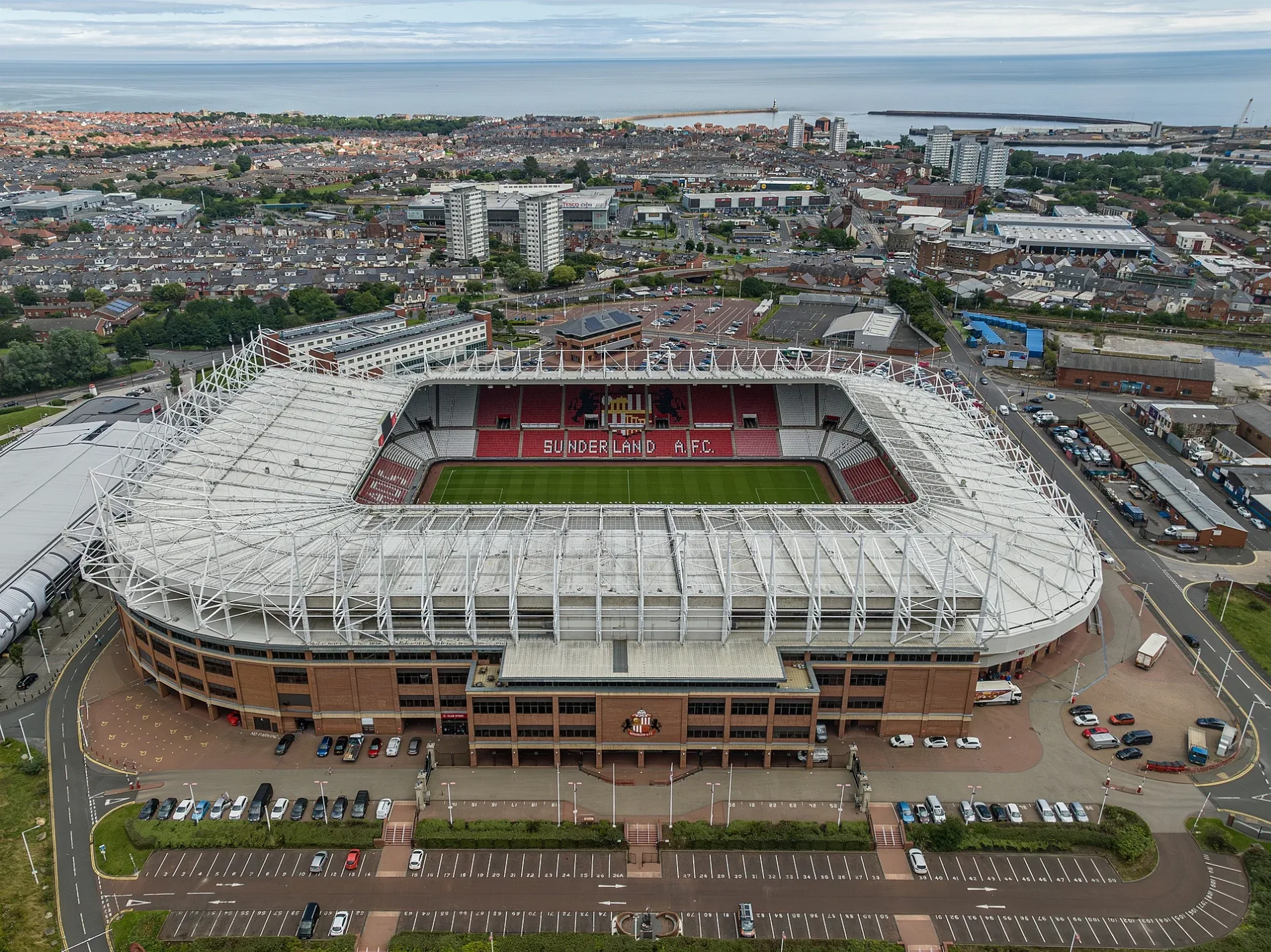
Stadium of Light in City of Sunderland
Stadium of Light in Sunderland is a stadium (Soccer). Stadium of Light is near Monkwearmouth Station Footbridge. Ⓦ.
- Leisure
- stadium
Image
Roads nearby
Millennium WayA2B Beds
200 m
Hay Street200 m
Stadium WayDavy Lamp
200 m
Back North Bridge Street200 m
Richmond StreetCTD Tiles, I Scream for Pizza, Taproom, Southpaw Studio, Back of The Pit
250 m
Southwick RoadZ.I.G.S, Southwick Road - Suddick Street (W/B), Southwick Road - Morgan Street, Southwick Barber Shop, Lillians Blinds, Halfway House, Southwick Road - Carley Road (W/B), SOUTHWICK ROAD-CARLEY SQUARE-E/B, SOUTHWICK ROAD-WALLACE STREET-W/B, Southwick Road-Stadium, SOUTHWICK ROAD-WALLACE STREET-E/B, Happy Wok, Southwick Road - Howard Street (W/B), Southwick Road - Howard Street (S/B), Sunderland Car Centre
250 m
Keir Hardie WaySouthwick Road-Stadium, Keir Hardie Way-Aquatic Centre
300 m
Howard Street300 m
North Bridge StreetWheatsheaf, La Cozza
300 m
Rosebery Street300 m
Monkwearmouth Station Footbridge300 m
Keel CrossingPropa!, Ember
300 m
Easington Street300 m
Abbs Street350 m
Sheepfolds NorthSt Peter's
350 m
Barclay StreetBerto's
350 m
Newcastle RoadMonkwearmouth Spiritualist Church, Newcastle Road-Crozier Street, Newcastle Road-Wearmouth Drive, Newcastle Road-Newbridge Avenue, NEWCASTLE ROAD-WEARMOUTH HOSPITAL-N/B, Newcastle Road - Grasmere Crescent, Newcastle Road, NEWCASTLE ROAD-NINE WELLS-E/B, NEWCASTLE ROAD-NINE WELLS-W/B, NEWCASTLE ROAD-HERBERT TERRACE-E/B, NEWCASTLE ROAD-HERBERT TERRACE-W/B, The Grange, Wheatsheaf, Vision Express, Scruples, Stadium of Light, Newcastle Road-Lochmaren Terrace
350 m
Devonshire Street350 m
Dame Dorothy StreetSt. Peter's National Glass Centre, Always Open Gates, DAME DOROTHY STREET-W/B, Roker, DAME DOROTHY STREET -S/B, Passing Through, Paddle Gate, DAME DOROTHY STREET-N/B, BP, NatWest, Londis
350 m
Sheepfolds Road400 m
Monk Street400 m
Sheepfolds SouthSt Peter's
400 m
Wearmouth Street400 m
Victoria Terrace South400 m
Liddell Street400 m
Howick Park450 m
Bonner's Field450 m
Wearmouth BridgeSecond Sun
450 m
Palmer's Hill Road500 m
Matlock Street600 m
Bridge Crescent600 m
Panns BankFrank Doyle's work at Panns Bank, which honours the shipyards
650 m
Cumberland Street650 m
Apartment buildings nearby
Eglinton Tower300 m
Devonshire Tower350 m
Buildings nearby
SAFC Ticket Office150 m
Stagecoach350 m
Bridge View500 m
Car parks nearby
St. Mary's Car Park650 m
Car repair shops nearby
Kwik Fit400 m
Events venues nearby
Sheepfolds Stables250 m
Fast food restaurants nearby
McDonald's400 m
Interior decorators nearby
Dunningham Decorators450 m
Museum nearby
Fans Museum300 m
Pubs nearby
The Colliery Tavern250 m
The Wheatsheaf300 m
Railway lines nearby
Durham Coast Line450 m
Sports shops nearby
Sunderland AFC Supporters Association400 m
Town halls nearby
Sunderland City Hall650 m
| Opening | 1997 |
|---|---|
| Located in | Sunderland |
| Country | United Kingdom |
| Website | https://www.safc.com/stadium-of-light |
| Native label | Stadium of Light |
| Location | Sunderland |
 Public transport map Sunderland Legend
| Railway | |
| Bus | |
| Tram |
 Cycling map Sunderland Legend
| Cycle path | |
| Cycle lane on road | |
| Cycling on bus lane | |
| Bicycle street | |
| Cyclists allowed | |
| Cyclists allowed, good surface | |
| No cycling | |
| Cobblestones |
| Long-distance cycle route | (depending on scale) | |
| Long-distance cycle route |
 Walking map Sunderland Legend
| Path |
| Long-distance hiking trail | (depending on scale) | |
| Long-distance hiking trail | ||
| No pedestrians |