
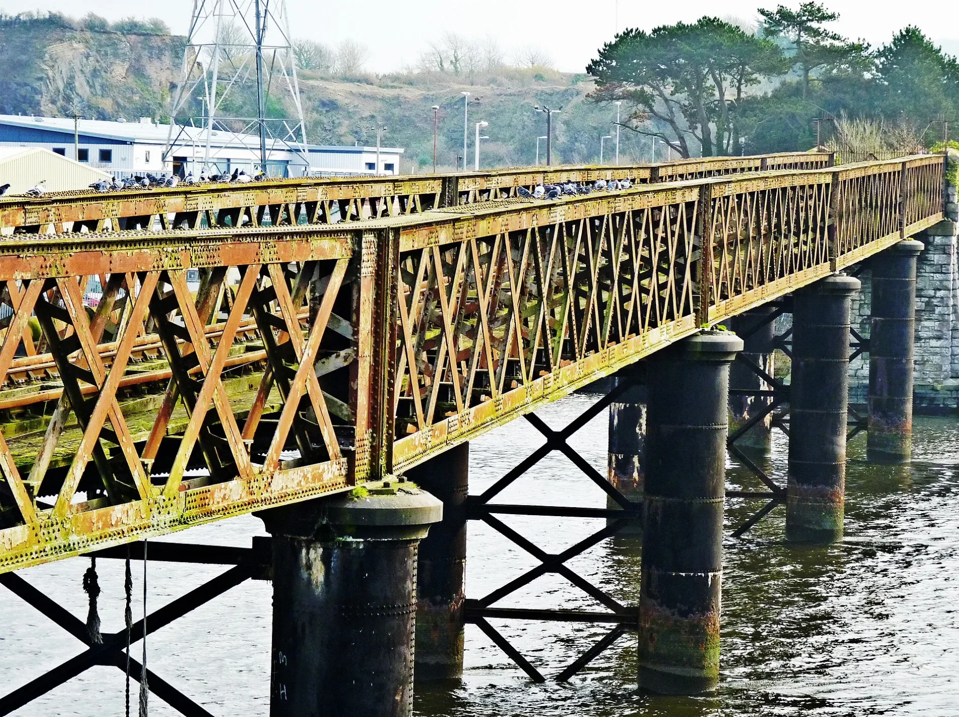
Old Laira Bridge in Plymouth
Old Laira Bridge in Plymouth is an asphalted, lit cycle path. It runs in a southeast-northwest direction and ends in a cul-de-sac. This road is part of the bicycle routes UK:National Cycle Network 27 and EuroVelo 1 - Atlantic Coast Route - part United Kingdom 2. Ⓦ.
- Bicycle
- designated
- Road Type
- cycle path
- Route
- southeast-northwest
Image
Clothing shops
Beauty salons
Parcel pickup points
Funeral directors
Frame shops
Bus stops
Specialist shops
Hairdressers
Off-licences
Sports shops
Charity shops
Outdoor shops
Car repair shops
Fishing shops
Car parts shops
Bathroom furnishing shops
Roads nearby
Finnigan RoadFaraday Road, Finnigan Road
100 m
The RideChelson Meadow
200 m
Billacombe RoadPleasure Hill, Morley Arms, Sugar Mill, Hugs, Trutex Schoolwear & More, St Lukes Hospice, Dream Bathrooms Ltd, Plymouth and District Funeral Services, The Range, Café Eighty-Nine, Billacombe Road, Rock Gardens, Pomphlett Super Store, Pomphlett Roundabout, Timpson, Boringdon Terrace
250 m
Faraday Mill Trade ParkM J T Controls Ltd
350 m
Faraday RoadGSF Car Parts, Kitworld, Faraday Mill Accident Repair Centre
400 m
Hele's TerraceHele's Terrace
400 m
Cattewater RoadMacron Store, KF Kitchens, Go Outdoors, Plymouth Auction Rooms, Plymouth Battery Centre, DollFace Beauty & Aesthetics
400 m
Cavendish Road400 m
Embankment Lane400 m
Faraday Mill Business ParkHome Supply Bathroom Showroom, Hideaway Cafe, TommyGun Tattoo, Wildflower Floristry Plymouth, ONYX, Signature Strawberries, County Fasteners Ltd, G&R Electrical, Custom Merch, The Tipple Cellar, Safeware, Just Beds, HiQ Tyres & Autocare, Toolstation, Sea View Angling, Carbon 6 Studio, Sound Framing, J&S Accessories Ltd
400 m
Hawarden Cottages450 m
Gdynia WayBonnie's Brunch, East End Community Centre, Laira Bridge
450 m
Embankment RoadLaira Flyover, Higher Stert Terrace, Lanhydrock Road, Embankment Road Post Office, Mini-Deli Polskie Delikatesy, Prince Rock Primary School, Astor Playing Field, Cattedown Roundabout, Rowing Club, Mount Gould Junction
450 m
Cromartie Road450 m
Britannia Place500 m
Stenlake Terrace500 m
Belvedere Road500 m
Stanley Place500 m
Clayton Road550 m
Stenlake Place550 m
Embankment Road Lane North550 m
Brentor Road550 m
Lucas Terrace600 m
Clayton Place600 m
Jubilee Terrace600 m
Sunnyside Road600 m
Shops nearby
Christal Supplies Ltd200 m
Boatyards nearby
Plymouth Boatyard & Marina Ltd300 m
Buildings nearby
K Allen200 m
Car repair shops nearby
Ocean City Autos150 m
PSG150 m
CDC Motor Services200 m
JMA250 m
Car washes nearby
The Car Wash Centre300 m
Carpet shops nearby
Carpet & Bed Warehouse250 m
Commercial areas nearby
Faraday Mill200 m
Convenience stores nearby
Nisa Local300 m
Industrial areas nearby
European Metal Recycling Limited300 m
Faraday Road STOR Generation300 m
Outdoor seatings nearby
Plates beer garden250 m
Pet shops nearby
Plymouth Reptile and Aquatic400 m
Petrol stations nearby
Valero350 m
Pubs nearby
Plates300 m
Railway lines nearby
Cattewater Branch100 m
Turnchapel Branch500 m
Razed railways nearby
Plymouth Loop No. 2650 m
Specialist shops nearby
Bradfords Building Supplies300 m
Tyre shops nearby
ETB250 m
Payless Tyres RY Ltd450 m
| Country | United Kingdom |
|---|---|
| Crosses | River Plym |
 Public transport map Plymouth Legend
| Railway | |
| Bus | |
| Tram |
 Cycling map Plymouth Legend
| Cycle path | |
| Cycle lane on road | |
| Cycling on bus lane | |
| Bicycle street | |
| Cyclists allowed | |
| Cyclists allowed, good surface | |
| No cycling | |
| Cobblestones |
| Long-distance cycle route | (depending on scale) | |
| Long-distance cycle route |
 Walking map Plymouth Legend
| Path |
| Long-distance hiking trail | (depending on scale) | |
| Long-distance hiking trail | ||
| No pedestrians |