
St Pancras in Plymouth
St Pancras in Plymouth is a Anglicana church. It is near Dryden Avenue and belongs to the Diocese of Exeter. The church is dedicated to Pancras of Rome and is a listed building.
- Amenity
- place of worship
- Building Type
- church
Image
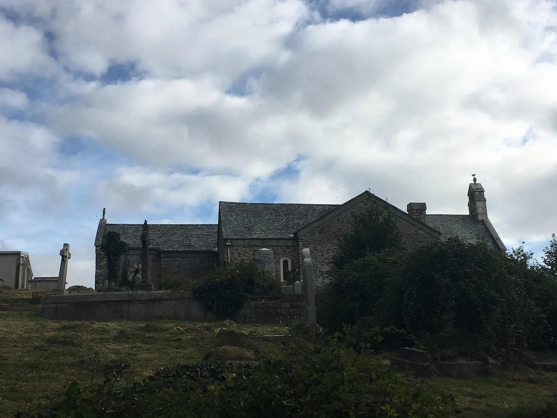
Bus stops
Roads nearby
Prouse Crescent50 m
Springhill100 m
Fountains CrescentMelrose Avenue Middle, Boxhill Gardens, Fountains Crescent West
100 m
Boxhill Gardens150 m
Boscastle Gardens150 m
Duloe Gardens200 m
Arden GrovePennycross Primary School
200 m
Honicknowle LaneShakespeare Road, Honicknowle, Cobbett Road, Kitto Centre, Honicknowle Lane, St Pancras Avenue, Springhill, Farm Lane, All Saints C of E Academy
200 m
Melrose AvenueHolman Court, Melrow Avenue West, Melrose Avenue Middle, Melrose Avenue East
200 m
Antony Gardens250 m
Tintagel Crescent300 m
Calstock Close300 m
Shirley Gardens350 m
Bethany Gardens400 m
Dryden AvenueDryden Avenue
400 m
Pennycross Close400 m
Macaulay Crescent450 m
Harlyn Drive450 m
Marazion Way450 m
Stratton Walk500 m
Carnock Road500 m
Mylor Close500 m
Drayton Road500 m
Conrad Road550 m
Congreve GardensChaucer Post Office, Central, headways unisex Salon
550 m
St Keverne Place550 m
Sheridan RoadSheridan Road Middle, Sheridan Road East, Shirley Gardens
550 m
Hilton Avenue550 m
Polzeath Gardens550 m
St Pancras AvenueDowngate Gardens, Ocean Delight, Tintagel Crescent East, Tintagel Crescent, Antony Gardens, St. Pancras Avenue West, Tintagel Crescent West, Stratton Walk, Trevone Gardens
550 m
Chaucer WaySwinburne Gardens, Thackeray Gardens, Chaucer Way, Chaucer library centre
600 m
Walton Crescent600 m
Downgate Gardens600 m
St Peters RoadHardy Crescent, Manadon Vale School, Hardy Crescent East, Hardy Crescent West, Ruskin Stores, Whin Bank Road, Ruskin Crescent, Chaucer Primary School, St Peters Road, St Peters Road Bungalows, Conrad Road, St Peter's Road, Sheridan Road
600 m
Trevone Gardens600 m
Vanguard Close650 m
Ballad Gardens700 m
Bulwark Close700 m
Gleaner Close750 m
Protector Road800 m
Ramsey Gardens800 m
Aberdeen Avenue800 m
Convenience stores nearby
Premier Melrose Stores250 m
Fast food restaurants nearby
Eastern Sunrise Chinese Takeaway250 m
Hairdresser's nearby
Nnouveaux Hair & Beauty250 m
Residential areas nearby
The Quarters700 m
Social facilities nearby
Honeybourne House350 m
Streams nearby
Ham Brook250 m
Devonport Leat (disused)750 m
| Dedicated to | Pancras of Rome |
|---|---|
| Diocese | Diocese of Exeter |
| Heritage designation | Grade II listed building |
| Located in | City of Plymouth |
| Country | United Kingdom |
 Public transport map Plymouth Legend
 | Railway | |
| Bus | |
| Tram |
 Cycling map Plymouth Legend
 | Cycle path | |
| Cycle lane on road | |
| Cycling on bus lane | |
| Bicycle street | |
| Cyclists allowed | |
| Cyclists allowed, good surface | |
| No cycling | |
| Cobblestones |
| Long-distance cycle route | (depending on scale) | |
| Long-distance cycle route |
 Walking map Plymouth Legend
 | Path |
| Long-distance hiking trail | (depending on scale) | |
| Long-distance hiking trail | ||
| No pedestrians |