
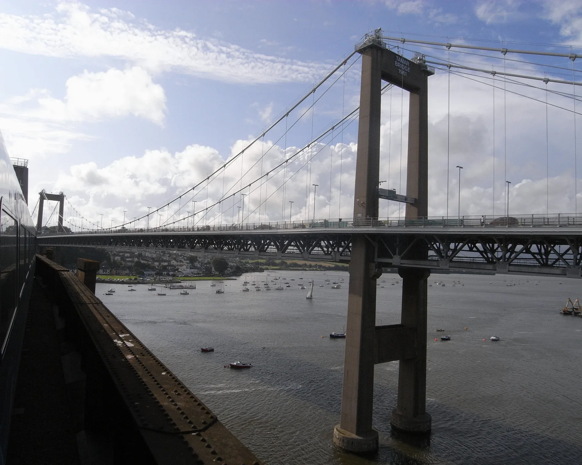
Tamar Bridge in Plymouth
Tamar Bridge in Plymouth is a three-lane, asphalted, lit expressway. The road has no sidewalks. There is a parking ban. There is no cycle path. It runs in an east-west direction and ends in a cul-de-sac. This road is part of the long-distance road "A38". Ⓦ.
- Bicycle
- yes
- Cycle Path
- no
- Road Type
- expressway
- Lanes
- 3
- Speed Limit
- 30 mph
- Operator
- Tamar Bridge and Torpoint Ferry Joint Committee
- Route
- east-west
Image
Pharmacy
Bus stops
- bus lines 2, 11, X11
Roads nearby
Wolseley RoadSaltash Passage, Gulf, Queens House, Wolseley Road, St Budeaux Post Office, St Budeaux Square, St Budeaux Ferry Road, Camels Head Dockyard, Ferry Road Station, St. Budeaux Junction, Lidl, KFC, D&W Auto Services MOT Centre, Lidls, Saltash Road, Ferry House Inn, Little Ash Gardens, Little Ash Road, Ford Shops, Tesco Express, North Down Crescent, Wolseley Home, North Prospect Library, Harbour Avenue, Harbor Avenue, Weston Mill Primary School, Camels Head Post Office, Cookworthy Road, Austin Avenue, Vicarage Gardens, Wolseley Road Sub-Station
100 m
Tamar Bridge Roundabout150 m
Pemros RoadSt Paul's Church, MacKenzie Place, Mackenzie Place, Stanhope Road, Saltburn Road
150 m
Tamar Bridge North Cantilever200 m
Bridgelands Close250 m
Normandy Hill250 m
Vicarage Gardens300 m
Normandy WayCornwall Gate Sports Bar
300 m
Admiralty RoadWildwood, Hook & Line, Enhance, South West Sup, Ace Swimming, The Shack
350 m
Mackenzie Place350 m
Blairgowrie Road450 m
Little Ash Gardens450 m
Walters Road450 m
Little Ash Road500 m
The ParkwayMarsh Mills Roundabout, Manadon Roundabout, Forder Valley Interchange, St Budeaux, Weston Mill, The Cabin Childcare Centre
500 m
Loughboro Road500 m
Old Ferry RoadHome Park Road, Old Ferry Road, Old Ferry Road Daws Court
500 m
Tenby Road500 m
Columbus Close500 m
Tamar StreetWaterside
550 m
Stirling Road550 m
Stanhope Road600 m
Brooke Close600 m
Loftus Gardens600 m
Stirling Court600 m
Kurnow Gate600 m
Saltburn Road650 m
Fegen Road700 m
Seacroft Road700 m
Warburton Gardens700 m
Foulston AvenueRennie Avenue, Beattie Road, Barne Road
800 m
Woodstock GardensWell Pharmacy, Ocean Health Group
800 m
Rennie Avenue800 m
Boatyards nearby
Tamar River Sailing Club500 m
Buildings nearby
Livewire Music Project550 m
Saltash Sailing Club600 m
Cafés nearby
Ashtorre Rock500 m
Civic buildings nearby
scouts350 m
Convenience stores nearby
Double J Mini-Market850 m
Grass nearby
Waterside Green550 m
Military areas nearby
Defence Munitions Plymouth450 m
Muds nearby
Kiln Bay600 m
Parks nearby
Seacroft Childrens park750 m
Pubs nearby
Royal Albert Bridge200 m
Union Inn550 m
Railway lines nearby
Tamar Valley Line200 m
Cornish Main Line550 m
Restaurants nearby
Hispania550 m
Streams nearby
Kinterbury Creek650 m
| Opening | 1962 |
|---|---|
| Located in | City of Plymouth, Saltash |
| Country | United Kingdom |
| Crosses | River Tamar |
| Carries thoroughfare | A38 road |
| Described by source | Akademi Kernewek's Place Names |
| Location | Saltash |
 Public transport map Plymouth Legend
| Railway | |
| Bus | |
| Tram |
 Cycling map Plymouth Legend
| Cycle path | |
| Cycle lane on road | |
| Cycling on bus lane | |
| Bicycle street | |
| Cyclists allowed | |
| Cyclists allowed, good surface | |
| No cycling | |
| Cobblestones |
| Long-distance cycle route | (depending on scale) | |
| Long-distance cycle route |
 Walking map Plymouth Legend
| Path |
| Long-distance hiking trail | (depending on scale) | |
| Long-distance hiking trail | ||
| No pedestrians |