
The Golden Hind in Plymouth
The Golden Hind in Plymouth is a pub, Mannamead Road 260 (PL3 5RJ) 🌐. The Golden Hind also exists in Portsmouth.
- House Number
- 260
- Postal Code
- PL3 5RJ
- Street
- Mannamead Road
- Amenity
- pub
- Building Type
- retail building
- Website
- https://www.greeneking.co.uk/pubs/devon/golden-hind
Image
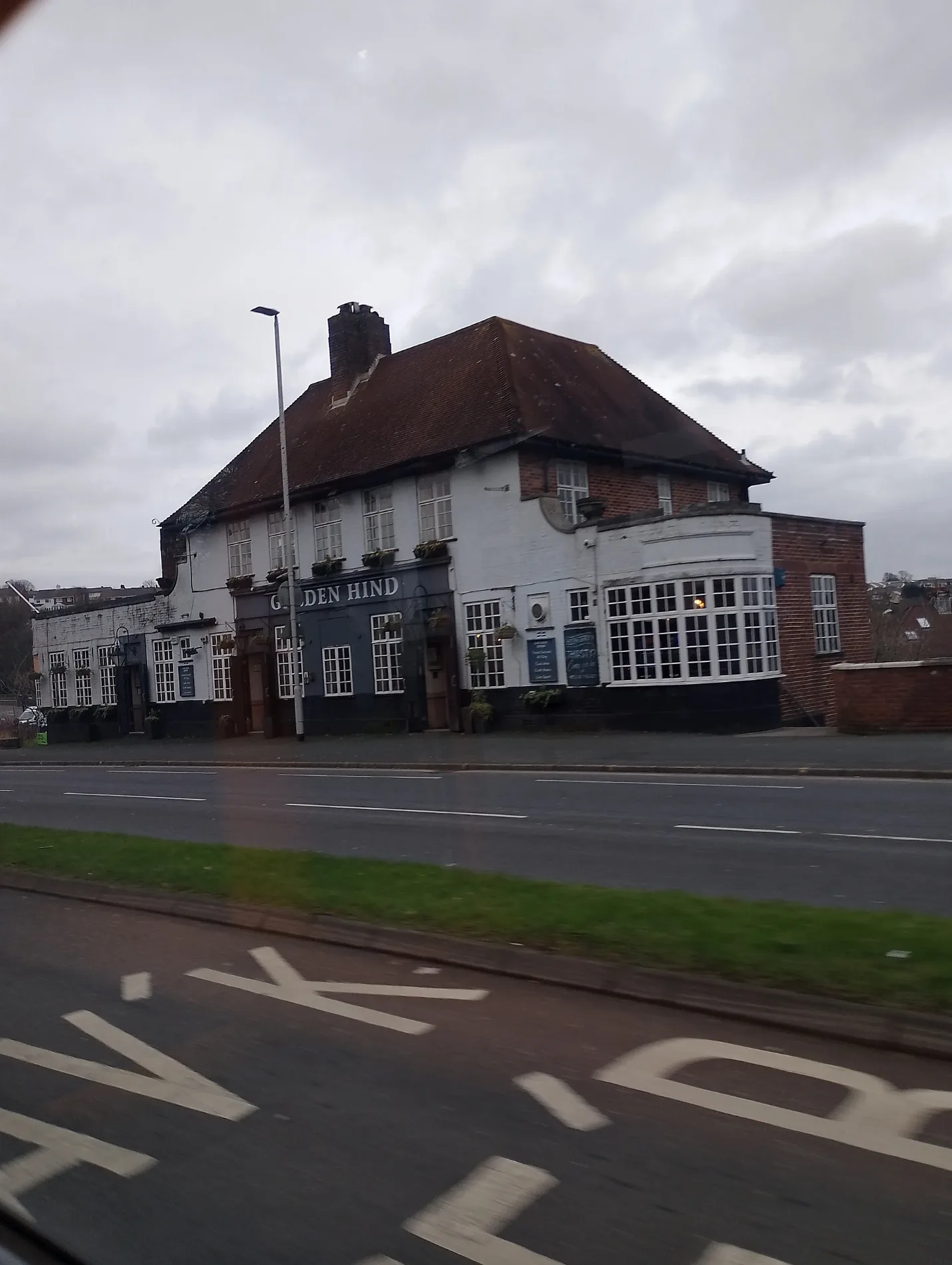
Convenience stores
Photo booths
Dry cleaner's
Bus stops
Roads nearby
Mannamead RoadGolden Hind, Henders Corner, Thornhill Road, Emmanuel Church, Amazon Hub Locker, Londis, Hartley Reservoir, Church of Latter Day Saints, Hartley Park (Disabled), Vapron Road, Thorn Park, Russell Avenue, Hartley, Mannamead Avenue
100 m
Alleyn Gardens100 m
Leighton Road150 m
Manadon RoundaboutManadon Roundabout
150 m
Maitland Drive200 m
Margaret Park200 m
St Peters RoadHardy Crescent, Manadon Vale School, Hardy Crescent East, Hardy Crescent West, Ruskin Stores, Whin Bank Road, Ruskin Crescent, Chaucer Primary School, St Peters Road, St Peters Road Bungalows, Conrad Road, St Peter's Road, Sheridan Road
200 m
Manadon Drive250 m
Manadon HillManadon Roundabout
250 m
Tavistock RoadPowisland Drive, Tavistock Road Woolwell, Roborough Footbridge, Woolwell Roundabout, Windsor House, Crownhill Fort, Derriford Retail Park, Tavistock Road, George Junction, Great Berry Road, George Hotel, Jack Rabbit, Tavistock Road Powisland Drive, Charlton Road, Tesco Pharmacy, Vision Express, St Boniface's College, Derriford Roundabout, Crownhill Low Level (South Bound), William Prance Road, Roborough Bypass
250 m
Outland RoadManadon Wood, Outland Road Church, Milehouse, Outland Road, Manadon Roundabout, DHS Girls, DHS Girls School Only, Tor Lane Chestnut Road, Peverell Post Office, Onslow Road, Peverell Corner, Venn Lane, Amazon Hub Locker, Milehouse LC 4, Segrave Road, Weston Park Road, Peverell Barbers, St Erth Road
250 m
Kneele GardensKneel Gardens Greeen, Premier Power Products Ltd, Kneele Gardens Shops, Kneele Gardens
250 m
Drax Gardens250 m
Linketty Lane West300 m
Hardy Crescent300 m
Southwell Road300 m
Beaumaris RoadPowderham Road
350 m
Beaumaris Gardens350 m
Torland Road350 m
Glentor Road350 m
Torr Crescent400 m
Corfe Avenue400 m
Tor Road400 m
Burnett Road400 m
Russell Avenue450 m
Powderham RoadPowderham Road
450 m
Lyndrick Road500 m
Tor Close500 m
Broughton Close500 m
The Drive550 m
Glenburn Close550 m
Bainbridge Avenue550 m
Richards Row600 m
Consort Close650 m
Amenities nearby
Pixieland Day Nursery600 m
Buildings nearby
Golden Hind50 m
Plymouth BT Social Club150 m
Plymouth District Scouts HQ200 m
Blindmans Wood Scout Centre200 m
Car repair shops nearby
Hartley Service Centre350 m
Car washes nearby
Smarthand Car Wash350 m
Churches nearby
Trinity URC Church Hall600 m
Petrol stations nearby
Esso Hartley Service Station50 m
Places of worship nearby
Trinity600 m
Retail buildings nearby
Seymour Signs300 m
Social facilities nearby
Improving Lives Plymouth Mannamead Wellbeing Centre700 m
Veterinary practices nearby
Woodlands Veterinary Hospital300 m
Woodlands nearby
Blindmans's Wood200 m
Manadon Wood350 m
| Located in | City of Plymouth |
|---|---|
| Country | United Kingdom |
| Location | Plymouth |
 Public transport map Plymouth Legend
| Railway | |
| Bus | |
| Tram |
 Cycling map Plymouth Legend
| Cycle path | |
| Cycle lane on road | |
| Cycling on bus lane | |
| Bicycle street | |
| Cyclists allowed | |
| Cyclists allowed, good surface | |
| No cycling | |
| Cobblestones |
| Long-distance cycle route | (depending on scale) | |
| Long-distance cycle route |
 Walking map Plymouth Legend
| Path |
| Long-distance hiking trail | (depending on scale) | |
| Long-distance hiking trail | ||
| No pedestrians |