
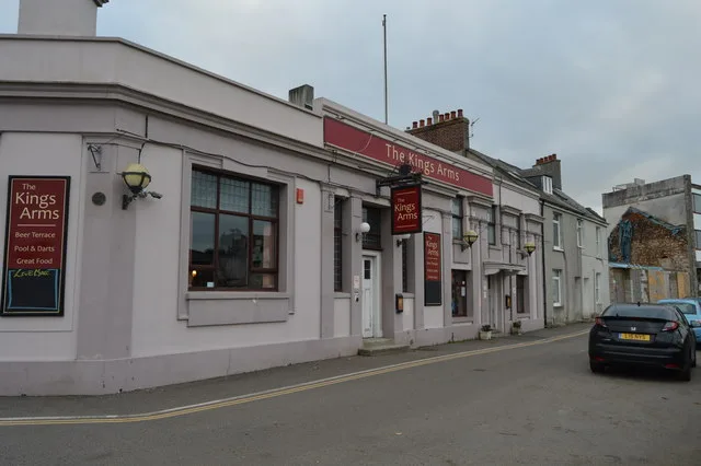
The Kings Arms in Plymouth
The Kings Arms in Plymouth is a pub, The Quay.
- Street
- The Quay
- Amenity
- pub
- Building Type
- building
Image
Bus stops
Roads nearby
Elford Drive50 m
Endsleigh Road100 m
Lapthorn Close100 m
Turnquay100 m
Marine Road100 m
Thornville Terrace150 m
Woburn Terrace150 m
The Quay150 m
Orchard Crescent150 m
Rollis Park Close150 m
Oreston Slipway200 m
Park Lane200 m
Rollis Park Road200 m
Park Crescent200 m
Plymstock RoadDean Cross, Two Parks, Birch Pond Road, Railway Cottages
200 m
Thornyville VillasThornyville Villas
250 m
The Old Wharf250 m
Bayly's Road300 m
Hayes RoadOreston
300 m
Broad Park300 m
Houldsworth Road350 m
Thornyville Close350 m
Lower Saltram350 m
Boston Close400 m
Kingfisher Way450 m
Neptune ParkTheatre Royal Production Centre
450 m
Yacht Haven QuaySSL Call Centre
550 m
Finnigan RoadFinnigan Road, Faraday Road
550 m
Shops nearby
Yacht Haven Quay Plymouth350 m
Abandoned railways nearby
Turnchapel Branch400 m
Cattewater Branch450 m
Bakeries nearby
Just Like Mumma's200 m
Buildings nearby
Plym Yacht Club50 m
Oreston Road Substation250 m
Oreston Road 45 Substation300 m
Commercial buildings nearby
Diamond Disposables550 m
Southern Packing Products550 m
Convenience stores nearby
Quay News150 m
Florist's nearby
H Watts200 m
Grasslands nearby
Oreston Quay50 m
Hairdresser's nearby
Peace200 m
Indoor plaies nearby
Supertramp550 m
Industrial areas nearby
Turnchapel Wharf450 m
Places of worship nearby
The Good Shepherd150 m
Oreston Methodist Church150 m
The Crusader Fellowshop250 m
Post depots nearby
Plynouth North Centre Delivery Office550 m
School buildings nearby
Oreston Community Academy250 m
Specialist shops nearby
Western Electrical500 m
| Located in | City of Plymouth |
|---|---|
| Postal code | PL9 7NE |
| Country | United Kingdom |
| Location | Oreston |
 Public transport map Plymouth Legend
| Railway | |
| Bus | |
| Tram |
 Cycling map Plymouth Legend
| Cycle path | |
| Cycle lane on road | |
| Cycling on bus lane | |
| Bicycle street | |
| Cyclists allowed | |
| Cyclists allowed, good surface | |
| No cycling | |
| Cobblestones |
| Long-distance cycle route | (depending on scale) | |
| Long-distance cycle route |
 Walking map Plymouth Legend
| Path |
| Long-distance hiking trail | (depending on scale) | |
| Long-distance hiking trail | ||
| No pedestrians |