
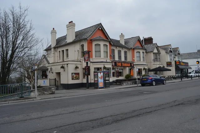
The Tamar in Plymouth
The Tamar in Plymouth is a pub, Morshead Road 1-7 (PL6 5AD) 🌐.
- House Number
- 1-7
- Postal Code
- PL6 5AD
- Street
- Morshead Road
- Amenity
- pub
- Building Type
- retail building
- Website
- https://www.greeneking.co.uk/pubs/devon/tamar
Image
Bus stops
Roads nearby
Morshead RoadCrownhill Post Office
50 m
Alexandra RoadAshford Hill, Crozier Road, Toasted Bar, Todays Kebab, Focus Barbers, Alexandra Road, Marina Terrace
50 m
Cross Park Avenue150 m
Whitleigh Avenue150 m
Plumer RoadCrownhill High Level, Warrens Bakery
200 m
Meavy Avenue200 m
Boniface Lane250 m
Tavistock RoadPowisland Drive, Tavistock Road Woolwell, Roborough Footbridge, Woolwell Roundabout, Windsor House, Crownhill Fort, Derriford Retail Park, Tavistock Road, George Junction, Great Berry Road, George Hotel, Jack Rabbit, Tavistock Road Powisland Drive, Charlton Road, Tesco Pharmacy, Vision Express, St Boniface's College, Derriford Roundabout, Crownhill Low Level (South Bound), William Prance Road, Roborough Bypass
250 m
Meavy WayCrownhill Low Level
250 m
Great Berry Road250 m
Haroldsleigh Avenue250 m
South View300 m
Bookmakers nearby
Betfred100 m
Coral100 m
Buildings nearby
Plymouth Property Sales50 m
Absolute Energy Services (SW) Ltd50 m
Car repair shops nearby
Crownhill MOT Centre50 m
Halfords Autocentre100 m
Convenience stores nearby
Select Convenience Store50 m
Dental practices nearby
Crownhill Dental Practice100 m
Meavy Way Dental Practice300 m
Doctor's practice nearby
Knowle House Surgery200 m
Fast food restaurants nearby
Anatolian Kitchen50 m
The Village100 m
Crownhill Chinese Takeaway100 m
Crownhill Spice100 m
China Palace100 m
Baba's 40 Dishes100 m
Funeral directors nearby
Co-operative Funeral Services100 m
Hairdresser's nearby
Vida Hair & Beauty50 m
Halo100 m
The Nest100 m
Headline Barbers100 m
Damian's Barbershop100 m
Fade & Blade100 m
Hardware shops nearby
What Shop50 m
Laundries nearby
Crownhill Launderette100 m
Libraries nearby
Crownhill Library100 m
Office buildings nearby
Plymouth Homes Lettings100 m
Opticians nearby
Noakes Habermehl & Kerr150 m
Pharmacies nearby
Boots50 m
Well Pharmacy200 m
Places of worship nearby
Crownhill Methodist Church100 m
St Peter's Catholic Church200 m
Church of the Ascension350 m
Restaurants nearby
Nibana50 m
Retail buildings nearby
Evans Harvey Solicitors100 m
Service buildings nearby
Alexandra Road Substation250 m
Supermarkets nearby
Co-op Food100 m
| Located in | City of Plymouth |
|---|---|
| Country | United Kingdom |
| Location | Crownhill |
 Public transport map Plymouth Legend
| Railway | |
| Bus | |
| Tram |
 Cycling map Plymouth Legend
| Cycle path | |
| Cycle lane on road | |
| Cycling on bus lane | |
| Bicycle street | |
| Cyclists allowed | |
| Cyclists allowed, good surface | |
| No cycling | |
| Cobblestones |
| Long-distance cycle route | (depending on scale) | |
| Long-distance cycle route |
 Walking map Plymouth Legend
| Path |
| Long-distance hiking trail | (depending on scale) | |
| Long-distance hiking trail | ||
| No pedestrians |