
McIlroy Park in Reading, Berkshire
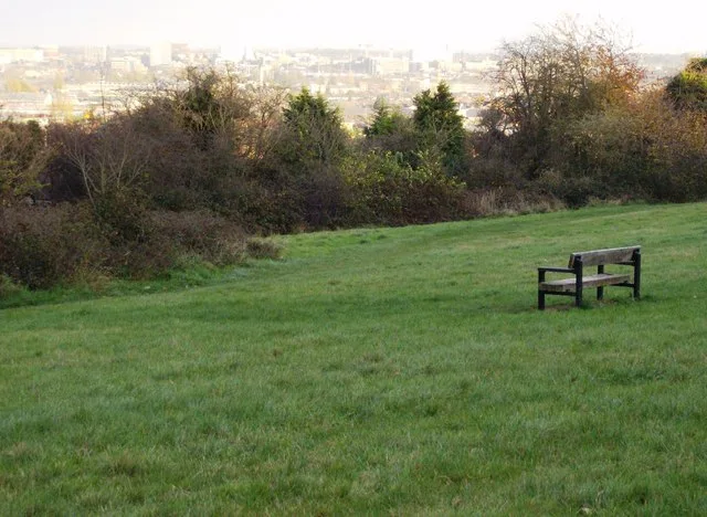
McIlroy Park in Reading is a park. McIlroy Park is near Norcot Road. Ⓦ.
- Leisure
- park
Image
Pharmacy
DIY stores
Hairdresser's
Fireworks shops
Bus stops
Convenience stores
Community centre
Supermarkets
Restaurants
Roads nearby
Norcot RoadCod 'n' Chips, Heat and Eat, Kebab Corner, Indian Corner, Grab&Go, Church End Lane, Blundells Road, The Victoria, Vesuvio, Lawrence Road, Norcot, Romany Lane
100 m
Glenrosa Road100 m
Birch Avenue150 m
Tylers Place150 m
Broomfield Road200 m
Fairsted Close200 m
Delaney Close250 m
Lawrence Road250 m
Staffordshire Close250 m
Dartington Close250 m
Riley Road250 m
Links Drive300 m
Dresden Way300 m
Wealden Way300 m
Holkham Close300 m
Lousehill Copse Path350 m
Rodway Road350 m
Romany Close350 m
Test Close350 m
Church End Lane350 m
Chelsea Close350 m
Stanham Road350 m
Atherton Close400 m
Stour Close400 m
Wedgewood Way400 m
Delft Close400 m
Tay RoadTay Road
400 m
Macarthur Close400 m
Iona Avenue400 m
Thirlmere Avenue400 m
Savernake Close450 m
Logan Close450 m
Portmeirion Gardens450 m
Minton Close450 m
Pottery RoadPottery Road Pharmacy
450 m
Calder Close450 m
Sanctuary Close450 m
Carron Close450 m
Denby Way500 m
Spode Close500 m
Chichester Road500 m
Royston Close500 m
Gipsy Lane500 m
Coalport Way550 m
Hardwick Road550 m
Warnford Road550 m
Doctor's practice nearby
Tilehurst Surgery200 m
Forests nearby
Lousehill Copse300 m
Pubs nearby
Tylers Rest150 m
| Heritage designation | local nature reserve |
|---|---|
| Located in | Reading |
| Country | United Kingdom |
| Part of | McIlroy Park and Round Copse |
 Public transport map Reading Legend
 | Railway | |
| Bus | |
| Tram |
 Cycling map Reading Legend
 | Cycle path | |
| Cycle lane on road | |
| Cycling on bus lane | |
| Bicycle street | |
| Cyclists allowed | |
| Cyclists allowed, good surface | |
| No cycling | |
| Cobblestones |
| Long-distance cycle route | (depending on scale) | |
| Long-distance cycle route |
 Walking map Reading Legend
 | Path |
| Long-distance hiking trail | (depending on scale) | |
| Long-distance hiking trail | ||
| No pedestrians |