
Reading International Business Park in Reading, Berkshire
Reading International Business Park in Reading is a commercial area.
- Land Use
- commercial area
- Website
- https://readinginternationalbusinesspark.co.uk/
Image
Cafés
Kitchen showrooms
Pet shops
Bicycle shops
Florist's
Bus stops
Fast food restaurants
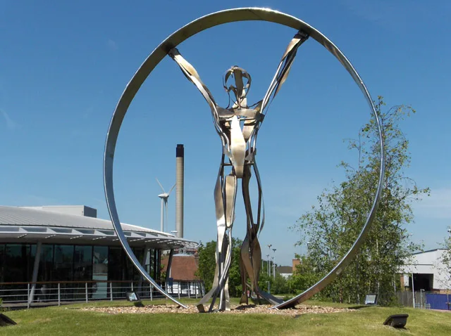
Artwork
Door shops
Pet groomings
Veterinary clinic
Clinic
Community centre
Roads nearby
Basingstoke RoadLong Barn Lane, Elgar Road, Pizza GoGo, 7 Day Supermarket, Best & Less Supermarket, Buckland Road Junction, Ken's, Harmony Nails, Ladbrokes, We Buy Any Car, Reading Gateway, Alper Kebab, Launderette & Dry Cleaners, Whitley Park School, Callington Road, The World Upside Down, Bennet Road, Hartland Road, Holiday Inn, Christchurch Gardens, Alamin Tandoori, Belle Hair, Basingstoke Road Pharmacy, 3 Chairs & A Barber, Reading Café, Signarama
150 m
Whitley Wood RoadEngineer's Court, Shapla Tandoori, Holberton Road, Wentworth Avenue, Woodside Way, Tamarisk Avenue, Bargain Tyres, Whitley Wood, South Reading Surgery, Co-op Food, PMK Supermarket, Betfred, Champions Barner Lounge, Engineers Court
250 m
Three Mile Cross Interchange250 m
Kingsley Close350 m
The Maying400 m
Vernon Crescent400 m
Sentinal Road400 m
Harness Close450 m
Mereoak Busway450 m
Village Close450 m
Wrenswood Close450 m
Heroes Walk500 m
Imperial WayTodd Doors, Popeyes, Jollyes, Wren Kitchens, Jolly Groomer, Community Pet Clinic, Worton Grange
500 m
Woodman Close500 m
Farmers Close550 m
Spencer Road550 m
Creswell Close550 m
St. Elizabeth Close550 m
Worton DriveHSS Hire, BSS Industrial, Synexus Thames Valley Clinic, Rygor Reading
550 m
Ruston Close600 m
Dovecote Road600 m
Woodside600 m
Hartley Court Road600 m
Great Lea600 m
Tidman Road600 m
Ashby Court650 m
Silchester Place650 m
Poldark Place650 m
Hayes Drive700 m
Woodcock LaneGreggs, Britalba
750 m
Mereoak LaneMereoak Park, Mereoak Park & Ride
750 m
Guernsey Place750 m
Cafés nearby
dot200 m
Car dealerships nearby
Waylands450 m
Motorline500 m
Reading Audi700 m
Commercial buildings nearby
Campus300 m
Redcentric700 m
Convenience stores nearby
D&D Convenience700 m
Fast food restaurants nearby
Burger King400 m
Hotels nearby
Premier Inn350 m
Industrial areas nearby
Trade City Reading400 m
Office buildings nearby
Imperium550 m
Pacific House600 m
Atlantic House600 m
Recreation grounds nearby
South Whitley Park400 m
Restaurants nearby
Nando's450 m
Retail areas nearby
Reading Gateway500 m
Supermarkets nearby
ALDI300 m
| Located in | Reading |
|---|---|
| Country | United Kingdom |
| Location | Whitley |
 Public transport map Reading Legend
| Railway | |
| Bus | |
| Tram |
 Cycling map Reading Legend
| Cycle path | |
| Cycle lane on road | |
| Cycling on bus lane | |
| Bicycle street | |
| Cyclists allowed | |
| Cyclists allowed, good surface | |
| No cycling | |
| Cobblestones |
| Long-distance cycle route | (depending on scale) | |
| Long-distance cycle route |
 Walking map Reading Legend
| Path |
| Long-distance hiking trail | (depending on scale) | |
| Long-distance hiking trail | ||
| No pedestrians |