
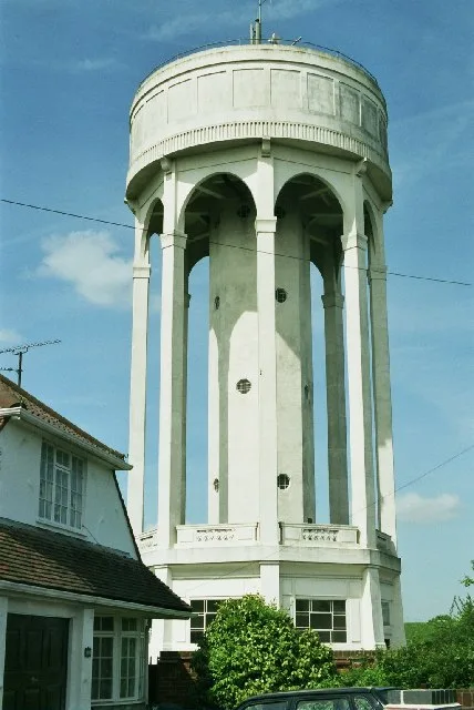
Tilehurst Water Tower in Reading, Berkshire
Tilehurst Water Tower in Reading is a water tower (built in 1932). Tilehurst Water Tower is near Langley Hill Close. Ⓦ.
- Building Type
- building
Image
Post boxes
Fast food restaurants
Art galleries
Dry cleaner's
Bus stops
Convenience stores
Bookmakers
DIY stores
Beauty salons
Restaurants
Dentist
Roads nearby
Boundary Close150 m
Manor Park Close150 m
Park LaneSanders, Water Tower, City Road, Q-Tech (Electrical Supplies), Park Lane Off Licence, Coral, UPS Service Point, Park Lane Unisex Salon, Angles Of Art, Zyka, Today's Local, Chapels, Mayfair
200 m
Firs Road200 m
Glenwood Drive200 m
Swallow Close250 m
Portland Gardens250 m
Alder Drive250 m
Halls RoadElysien, Top Cut, Aurora
250 m
Ayrton Senna Road250 m
Partridge Drive250 m
City RoadSaint Paul's School, City Road
300 m
Langley Hill Close300 m
Burlington Road350 m
Hugh Fraser Drive350 m
Greenfinch Close350 m
Maiwand Gardens350 m
Claire Court400 m
Lansdowne Road400 m
Foxcombe Drive400 m
Robin Way400 m
Grafton Road400 m
Holland Road400 m
Voller Drive400 m
Pegasus Court400 m
Goldcrest Way400 m
Lapwing Close450 m
Curlew Drive450 m
Wellfield Close450 m
Fairway Avenue450 m
Hildens DriveWellfield Close, Warborough Avenue, Local Xpress, Jay's News and Convenience Store, Greenacre Services, Taste of Tandoori, Ocean Garden, Spice Master, SumoSam, Herbies Pizza, Salon 16, Peking Chef, Hildens Drive Post Office, The Kurl Salon
450 m
Blagrave Cottages450 m
Blagrave Rise500 m
Heathfield Avenue500 m
Nabbs Hill Close500 m
Withy Close550 m
Langley HillYew Tree Rise
600 m
Bay Tree Rise600 m
Broom Close600 m
Fern Close700 m
Fuchsia Close700 m
Yew Tree Rise700 m
Fern Walk750 m
Forests nearby
Withy Copse500 m
Curtis's Wood500 m
Industrial areas nearby
Blagrave Radio Site450 m
Playgrounds nearby
Ayrton Senna Play Area250 m
Pubs nearby
The Water Tower150 m
Recreation grounds nearby
Hildens Drive Play Area450 m
| Located in | Tilehurst |
|---|---|
| Country | United Kingdom |
 Public transport map Reading Legend
 | Railway | |
| Bus | |
| Tram |
 Cycling map Reading Legend
 | Cycle path | |
| Cycle lane on road | |
| Cycling on bus lane | |
| Bicycle street | |
| Cyclists allowed | |
| Cyclists allowed, good surface | |
| No cycling | |
| Cobblestones |
| Long-distance cycle route | (depending on scale) | |
| Long-distance cycle route |
 Walking map Reading Legend
 | Path |
| Long-distance hiking trail | (depending on scale) | |
| Long-distance hiking trail | ||
| No pedestrians |