
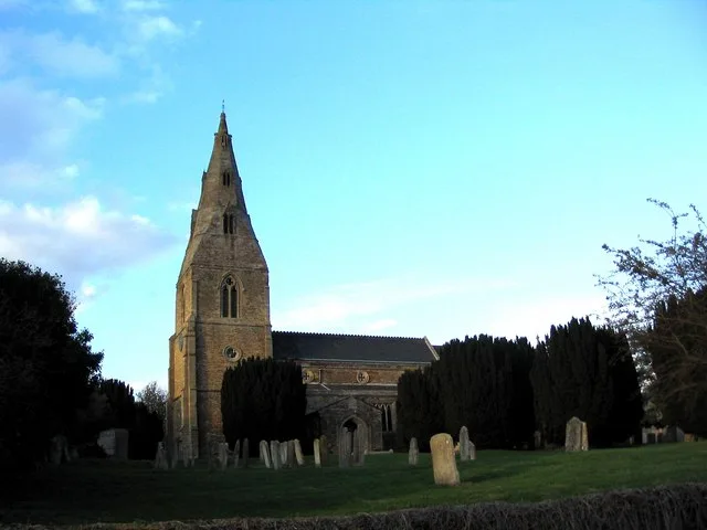
All Hallows in Seaton, Rutland
All Hallows in Rutland, Seaton is a Anglicana church. It is near Thompsons Lane and is also known as All Hallows Church, Seaton. The church belongs to the Diocese of Peterborough and is dedicated to All Saints' Day. It is a listed building. All Hallows also exists in Telford and Wrekin, City of Milton Keynes, Hampshire and North Northamptonshire. Ⓦ.
- Amenity
- place of worship
- Building Type
- church
Image
Roads nearby
Baines Lane150 m
Thompsons Lane200 m
Drurys Lane200 m
Moles Lane300 m
West Lane350 m
Grange Lane700 m
Seaton Road1,0 km
Morcott Road1,2 km
Gretton Road1,5 km
Wakerley RoadHarringworth, The White Swan
1,6 km
Deene Road1,6 km
Coach Bridge1,6 km
Church LaneManor Farm, Village Farm
2,2 km
Peters Way2,3 km
Main RoadLonsdale Farm, The Old Pheasant Inn
2,3 km
Glaston Park2,3 km
Walnut Close2,3 km
Main StreetBisbrooke
2,3 km
Denfield Close2,4 km
Spring Lane2,4 km
Manor Lane2,4 km
Bottom Lane2,4 km
Top Lane2,4 km
The Inhams2,5 km
Baulk Road2,5 km
Baulk Hill2,7 km
Morcott ServicesRedwings Lodge
2,7 km
Thorpe Road2,7 km
Uppingham Road2,7 km
Glaston RoadJET
2,8 km
Wing RoadFydell Row
3,1 km
Abandoned railways nearby
Rugby to Stamford Line1,3 km
Seaton to Uppingham Branch1,4 km
Seaton to Wansford Branch2,6 km
Buildings nearby
The Gate2,4 km
Community centres nearby
Harringworth Village Hall1,5 km
Convenience stores nearby
Londis2,7 km
Farmyards nearby
Glaston Lodge2,2 km
Grasslands nearby
Seaton Meadows1,3 km
Petrol stations nearby
Esso2,6 km
Places of worship nearby
St John the Baptist1,4 km
Bisbrooke: St John the Baptist2,2 km
St Andrew2,4 km
Pubs nearby
george and dragon100 m
Railway lines nearby
Kettering North Junction and Melton Mowbray Line1000 m
Restaurants nearby
Rutland Point2,7 km
Rivers nearby
River Welland1,8 km
Streams nearby
Seaton Brook500 m
Uppingham Brook1,8 km
| Dedicated to | All Saints' Day |
|---|---|
| Diocese | Diocese of Peterborough |
| Heritage designation | Grade II listed building |
| Located in | Seaton |
| Country | United Kingdom |
 Public transport map Seaton Legend
| Railway | |
| Bus | |
| Tram |
 Cycling map Seaton Legend
| Cycle path | |
| Cycle lane on road | |
| Cycling on bus lane | |
| Bicycle street | |
| Cyclists allowed | |
| Cyclists allowed, good surface | |
| No cycling | |
| Cobblestones |
| Long-distance cycle route | (depending on scale) | |
| Long-distance cycle route |
 Walking map Seaton Legend
| Path |
| Long-distance hiking trail | (depending on scale) | |
| Long-distance hiking trail | ||
| No pedestrians |