
St.Michael in Child's Ercall
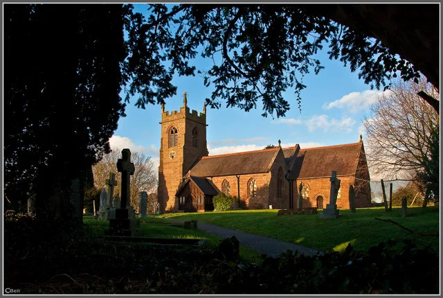
St.Michael in Shropshire, Child's Ercall is a Anglicana church. It is near Village Barns and is also known as St. Michael and All Angels. The church belongs to the Anglican Diocese of Lichfield and is dedicated to Michael.
- Alternative Name
- St. Michael and All Angels
- Amenity
- place of worship
- Building Type
- church
Image
Hofläden
Roads nearby
Village Road50 m
The FoldChild's Ercall
200 m
Village Barns200 m
Manor Green200 m
Kenfields Close200 m
Narrow Lane250 m
The Arboretum250 m
Steppes Way250 m
Crow Lane250 m
Benbows Close250 m
St. Michaels Way300 m
Eaton Road950 m
Ollerton LaneThe Firs Farm
1,4 km
Pixley LanePixley
2,0 km
Whitley Field2,2 km
Eaton Grange Barns2,2 km
Mill Lane2,3 km
Hatton Road2,3 km
Eastern Bridge2,5 km
Western Bridge2,6 km
Hooks Lane2,6 km
Bog Hall LaneBog Hall
2,9 km
The Chestnuts3,0 km
Chester RoadThe Falcon Inn
3,1 km
Body of waters nearby
The Sytchpits2,8 km
The Pool3,1 km
Buildings nearby
The Lea Gates1,5 km
Firs Farmhouse1,6 km
Peplow Mill2,4 km
Stoke Park Farmhouse2,4 km
Peplow Hall2,7 km
Woodhouse Farmhouse2,8 km
Commercial areas nearby
Ollerton Business Park1,2 km
Community centres nearby
Childs Ercall Village Club250 m
Jubilee Hall400 m
Forests nearby
Conyburg Wood2,6 km
Quarry Wood3,0 km
Horse ridings nearby
S&G Equine Limted1,6 km
Places of worship nearby
Chapel of the Epiphany2,9 km
Recreation grounds nearby
Childs Ercall Park450 m
Sports pitches nearby
Childs Ercall Bowls Club250 m
Streams nearby
Alford Brook1000 m
Aldford Brook2,8 km
Woodlands nearby
The Locks2,2 km
The Common2,2 km
Willow Coppice2,5 km
Primrose Dell2,7 km
Oak Coppice2,8 km
Other nearby
Peplow2,3 km
| Dedicated to | Michael |
|---|---|
| Diocese | Anglican Diocese of Lichfield |
| Located in | Child's Ercall |
| Country | United Kingdom |
 Public transport map Child's Ercall Legend
 | Railway | |
| Bus | |
| Tram |
 Cycling map Child's Ercall Legend
 | Cycle path | |
| Cycle lane on road | |
| Cycling on bus lane | |
| Bicycle street | |
| Cyclists allowed | |
| Cyclists allowed, good surface | |
| No cycling | |
| Cobblestones |
| Long-distance cycle route | (depending on scale) | |
| Long-distance cycle route |
 Walking map Child's Ercall Legend
 | Path |
| Long-distance hiking trail | (depending on scale) | |
| Long-distance hiking trail | ||
| No pedestrians |