
Rivelin Quarries in Bradfield, South Yorkshire
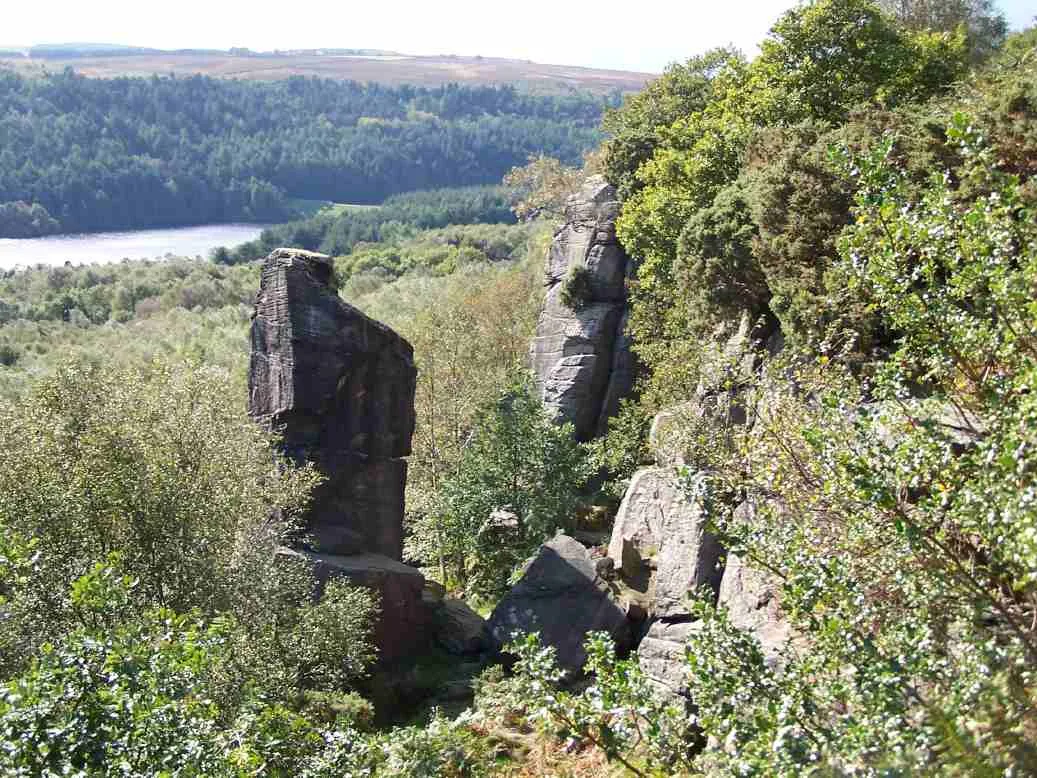
Rivelin Quarries in Bradfield in Sheffield is a cliff. Ⓦ.
- Nature
- cliff
Image
Bus stops
Roads nearby
Onksley Lane400 m
Ronksley Lane450 m
Wyming Brook Drive600 m
Moorwood Lane750 m
Long LaneOnesacre
900 m
Dobb Lane950 m
Manchester RoadManchester Road/Pump House, Manchester Road/Lydgate Hall Crescent, Manchester Road/Benty Lane, Manchester Road/Rivelin Valley Road, Manchester Road/Tapton House Road, Manchester Road/Vernon Terrace, Manchester Road/Lawson Road, Manchester Road, Manchester Road/Rails Road, Manchester Road/Blackbrook Bridge, Manchester Road/Den Bank Drive, Manchester Road/Coldwell Lane, Manchester Road/Hagg Lane, Manchester Road/Den Bank, Manchester Road/Barnfield Road, Manchester Road/The Bell Hagg
1,0 km
Rod Side1,0 km
Redmires Lane1,1 km
Flash Lane1,2 km
Long CausewayRedmires Reservoirs and The Long Causeway
1,3 km
Soughley LaneBlue Moo Cafe
1,3 km
Redmires RoadSandygate Road/Coldwell Lane, Sandygate Road/Sandygate Park Road, Sandygate Road/Pitchford Lane, Redmires Road/Pitchford Lane, Sandygate Road/Claremont Hospital, Redmires Lodge, Redmires Road/Lodge Lane, Redmires Road/Worcester Road, Redmires Road/Crimicar Lane, Redmires Road/Blackbrook Road, Redmires Road/Lodge Moor Housing Estate, Redmires Road/Hallam Grange Road, Redmires Road/Golf Course, The Barncliffe Stoop and The Ancient Road, Lodge Moor Terminus, Redmires Road/Hallam Primary School, Redmires Road/The Ridge
1,4 km
Body of waters nearby
Rivelin Lower Reservoir500 m
Rivelin Upper Reservoir600 m
Buildings nearby
Old Dam House350 m
Ronksley Hall Farm450 m
Norfolk Lodge600 m
Rivelin House600 m
Fox Holes Lodge650 m
The Flash1,1 km
Flash Farm1,1 km
Wadefield1,2 km
Yorkshire Water Rivelin WTW1,2 km
Reservoir Cottages1,6 km
Campsite nearby
Wyming Brook Farm Certificated Site1,5 km
Cliffs nearby
Rivelin Edge450 m
Drains nearby
Redmires Conduit1,4 km
Farmyards nearby
Moorwood Equine Club at Moorwood Farm850 m
Townfield Head Farm950 m
Beeton Rod1,0 km
Beacon Farm1,2 km
Allen Sike Farm1,3 km
Wyming Brook Farm1,4 km
Heaths nearby
Ash Cabin Flat1,2 km
Head Stone Bank1,3 km
Nursing homes nearby
The White House Care Home200 m
Pubs nearby
The Three Merry Lads1,1 km
The Sportsman1,3 km
Recreation grounds nearby
Redmires Playing Field1,3 km
Rivers nearby
River Rivelin850 m
Streams nearby
Reddicar Clough1,0 km
Rivelin Brook1,1 km
Allen Sike1,2 km
Wyming Brook1,5 km
Woodlands nearby
Rivelin Rough800 m
Fearney Hill Plantation800 m
Fox Holes Plantation1,3 km
Fox Hagg1,4 km
| Country | United Kingdom |
|---|
 Public transport map Bradfield Legend
| Railway | |
| Bus | |
| Tram |
 Cycling map Bradfield Legend
| Cycle path | |
| Cycle lane on road | |
| Cycling on bus lane | |
| Bicycle street | |
| Cyclists allowed | |
| Cyclists allowed, good surface | |
| No cycling | |
| Cobblestones |
| Long-distance cycle route | (depending on scale) | |
| Long-distance cycle route |
 Walking map Bradfield Legend
| Path |
| Long-distance hiking trail | (depending on scale) | |
| Long-distance hiking trail | ||
| No pedestrians |