
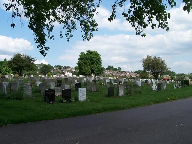
Wisewood Cemetery in Bradfield, South Yorkshire
Wisewood Cemetery in Bradfield in Sheffield is a cemetery. Wisewood Cemetery is also known as Sheffield (Wisewood) Cemetery.
- Land Use
- cemetery
Bus stops
Roads nearby
The Chase250 m
Hanson Road300 m
Dunkerley Road350 m
Black Lane350 m
Leaton Close350 m
France Road450 m
Chase RoadChase Road/France Road, Chase Road/Hanson Road, Chase Road/Phillips Road
450 m
Occupation Lane500 m
The Grove500 m
Lee Road500 m
Archer Gate500 m
Philips Road500 m
Normandale Avenue550 m
Hunters Gardens550 m
Phillips RoadDog Leg Bench
550 m
Rodney HillRodney Hill/Chase Road, Rodney Hill/Normandale Avenue, Rodney Hill/Loxley Road, Rodney Hill/South View Rise, Rodney Hill/Woodstock Road
600 m
Alders Green600 m
Loxley RoadLoxley Road/Low Matlock Lane, Loxley Road/Studfield Hill, Loxley Road/Wisewood Inn, Loxley Road/The Grove, Loxley Road/Black Lane/Cemetery, Loxley/Loxley Road, Loxley Road/Long Lane, Loxley, Loxley Road/Rodney Hill, Loxley Road/Rowell Lane, Loxley Road/West Lane, Loxley New Road/Storrs Bridge Lane, Loxley Road/Storrs Bridge Lane, Loxley Road/Stacy Bank Farm, Loxley Road/Barnfield House, Stacey Bank, High Bradfield, Loxley Road/Woodfall Lane, Loxley Road/New Road, Loxley Road/Damflask, Low Holdworth
650 m
Auckland Avenue650 m
South View Close650 m
Robin Wood Nature Trail650 m
South View Rise700 m
Austin Close700 m
Oak Apple Walk700 m
Robin Hood Chase750 m
Low Matlock LaneLow Matlock
750 m
Furness Close750 m
High Matlock RoadHigh Matlock Road - Hail&Ride (62/267)
800 m
Friar Close800 m
Riber Close800 m
Greaves LaneGreaves Lane/Greaves Close, High Matlock, The Robin Hood Inn
850 m
Clark Grove850 m
Darley Grove850 m
Durmast Grove850 m
Leawood Place850 m
High Matlock AvenueHigh Matlock Avenue/Riber Close
850 m
Little Matlock Way900 m
Webbs Avenue950 m
Little Matlock Gardens950 m
Apartment buildings nearby
Robin Hood House750 m
Buildings nearby
Loxley Village200 m
Olive Cottage350 m
Cliffs nearby
Stannington Ruffs700 m
Fishings nearby
Mill Dam Fishing450 m
Pavilions nearby
Pavilion350 m
Pubs nearby
Admiral Rodney200 m
The Wisewood Inn550 m
Recreation grounds nearby
Loxley Recreation Ground250 m
Wisewood Juniors Sports Ground500 m
| Located in | Sheffield |
|---|---|
| Postal code | S6 4TD |
| Country | United Kingdom |
 Public transport map Bradfield Legend
| Railway | |
| Bus | |
| Tram |
 Cycling map Bradfield Legend
| Cycle path | |
| Cycle lane on road | |
| Cycling on bus lane | |
| Bicycle street | |
| Cyclists allowed | |
| Cyclists allowed, good surface | |
| No cycling | |
| Cobblestones |
| Long-distance cycle route | (depending on scale) | |
| Long-distance cycle route |
 Walking map Bradfield Legend
| Path |
| Long-distance hiking trail | (depending on scale) | |
| Long-distance hiking trail | ||
| No pedestrians |