
St James in Tamworth
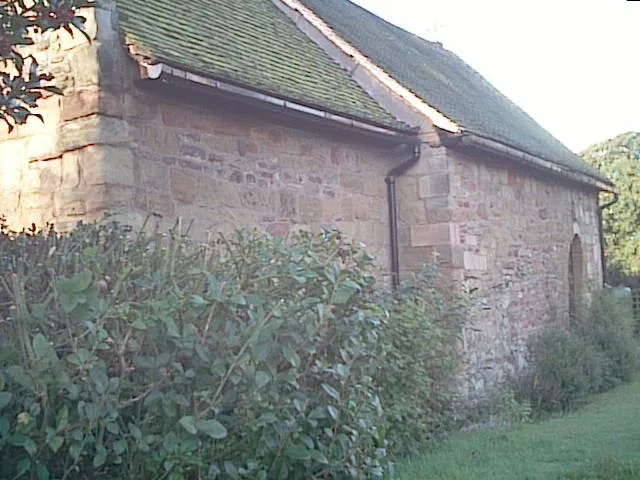
St James in Tamworth is a Anglicana church (B79 8AU). It is near Iris Close and is also known as Wigginton S.James. The church belongs to the Anglican Diocese of Lichfield and is a listed building. St James also exists in Greater Manchester, Greater London, West Midlands, Cambridgeshire and Peterborough and Liverpool City Region.
- Postal Code
- B79 8AU
- Amenity
- place of worship
- Building Type
- church
Image
Convenience stores
Bus stops
Roads nearby
Comberford RoadHillcroft Close, The Riftswood Inn, Clifton Avenue, Chestnut Avenue, Coton Lane, The Riftswood
150 m
Hillcrest Close200 m
Highgrove Close200 m
Balmoral Close250 m
Sandringham Court250 m
Windsor Close250 m
Wigginton RoadKensington Drive, Ambulance Station, Hill Top Avenue, Tennis Courts, Chestnut Avenue
250 m
Kensington Drive300 m
Wigginton Gardens300 m
Iris Close300 m
Steere Avenue350 m
Adonis Close350 m
Flora Close350 m
Perry Close350 m
Croft Avenue400 m
School Walk400 m
Burton Close400 m
Willington RoadBorough Park Stores
400 m
Hampton Close400 m
Croft Street400 m
Henley Close450 m
Borough Road450 m
Ashby RoadBrowns Lane, Perrycrofts Crescent, Queen Elizabeth School
450 m
Kingston Close500 m
Farm Close500 m
LakenheathKangs
500 m
Perrycrofts CrescentFarm Close, Ashlands Close, Henley Close, Belvedere Close
500 m
Norton Close550 m
Harwell Close600 m
Pimpernel Drive600 m
Ashlands Close600 m
Tavistock Close600 m
Offa DriveTamworth Railway Station, Morrisons Store, Aethelflaeda Monument
600 m
Orchid Close650 m
Oleander Close650 m
Meadow Way650 m
Poppy Court650 m
Belvedere Close650 m
Abandoned railways nearby
Tamworth Curve650 m
Colleges nearby
Landau Forte Academy Tamworth Sixth Form250 m
Technology Block450 m
George Crook Building500 m
Jubilee Building550 m
Doctor's practice nearby
Aldergate Medical Practice450 m
Railway lines nearby
Trent Valley Line550 m
Trent Valley Down Fast600 m
Derby to Birmingham (Proof House Junction) Line600 m
Recreation grounds nearby
Spital Bownling & Tennis Club150 m
Sports pitches nearby
Spital Crown Green Bowling Club150 m
| Diocese | Anglican Diocese of Lichfield |
|---|---|
| Heritage designation | Grade II* listed building |
| Located in | Tamworth |
| Country | United Kingdom |
 Public transport map Tamworth Legend
| Railway | |
| Bus | |
| Tram |
 Cycling map Tamworth Legend
| Cycle path | |
| Cycle lane on road | |
| Cycling on bus lane | |
| Bicycle street | |
| Cyclists allowed | |
| Cyclists allowed, good surface | |
| No cycling | |
| Cobblestones |
| Long-distance cycle route | (depending on scale) | |
| Long-distance cycle route |
 Walking map Tamworth Legend
| Path |
| Long-distance hiking trail | (depending on scale) | |
| Long-distance hiking trail | ||
| No pedestrians |